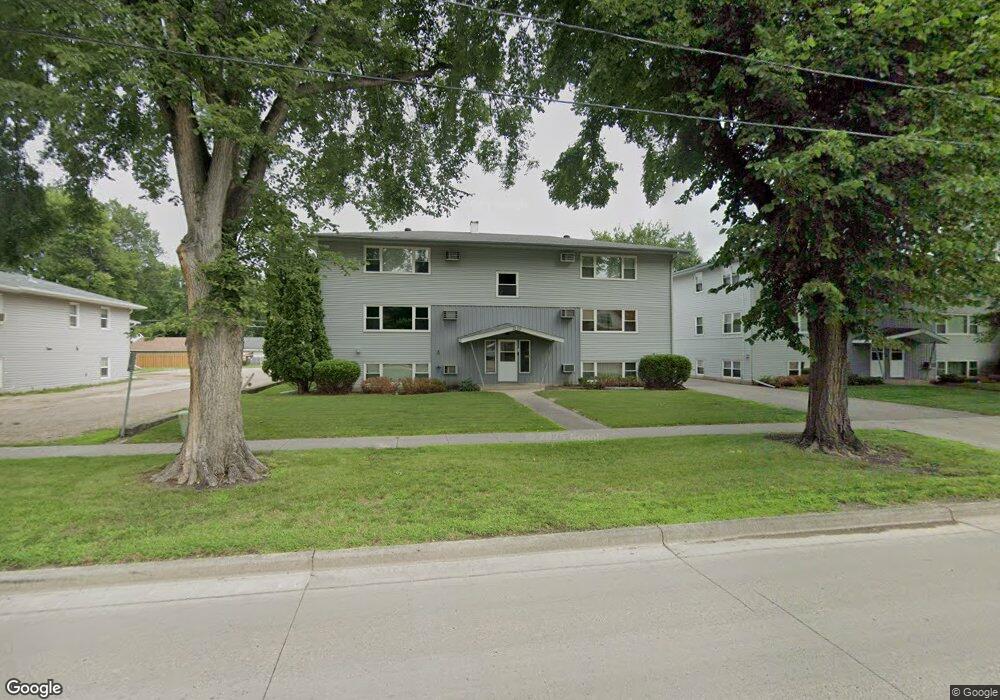
1225 10th St N Unit 4 Fargo, ND 58102
Roosevelt NeighborhoodEstimated Value: $82,000 - $98,000
2
Beds
1
Bath
808
Sq Ft
$110/Sq Ft
Est. Value
About This Home
This home is located at 1225 10th St N Unit 4, Fargo, ND 58102 and is currently estimated at $88,616, approximately $109 per square foot. 1225 10th St N Unit 4 is a home located in Cass County with nearby schools including Horace Mann Roosevelt Elementary School, Ben Franklin Middle School, and North High School.
Ownership History
Date
Name
Owned For
Owner Type
Purchase Details
Closed on
May 28, 2021
Sold by
Skogen Jody and Skogen Tammy L
Bought by
Hischer Mason
Current Estimated Value
Home Financials for this Owner
Home Financials are based on the most recent Mortgage that was taken out on this home.
Original Mortgage
$64,800
Outstanding Balance
$53,983
Interest Rate
2.9%
Mortgage Type
New Conventional
Estimated Equity
$34,633
Purchase Details
Closed on
Jun 30, 2014
Sold by
Peters Matilda P
Bought by
Skogen Jody and Skogen Tammy L
Create a Home Valuation Report for This Property
The Home Valuation Report is an in-depth analysis detailing your home's value as well as a comparison with similar homes in the area
Home Values in the Area
Average Home Value in this Area
Purchase History
| Date | Buyer | Sale Price | Title Company |
|---|---|---|---|
| Hischer Mason | $72,000 | Fm Title | |
| Skogen Jody | $68,000 | Trn Abstract & Title |
Source: Public Records
Mortgage History
| Date | Status | Borrower | Loan Amount |
|---|---|---|---|
| Open | Hischer Mason | $64,800 |
Source: Public Records
Tax History Compared to Growth
Tax History
| Year | Tax Paid | Tax Assessment Tax Assessment Total Assessment is a certain percentage of the fair market value that is determined by local assessors to be the total taxable value of land and additions on the property. | Land | Improvement |
|---|---|---|---|---|
| 2024 | $1,114 | $40,600 | $5,300 | $35,300 |
| 2023 | $1,067 | $39,050 | $5,300 | $33,750 |
| 2022 | $995 | $35,500 | $5,300 | $30,200 |
| 2021 | $977 | $35,500 | $5,300 | $30,200 |
| 2020 | $965 | $35,500 | $5,300 | $30,200 |
| 2019 | $1,054 | $38,850 | $2,850 | $36,000 |
| 2018 | $1,041 | $38,850 | $2,850 | $36,000 |
| 2017 | $982 | $37,000 | $2,850 | $34,150 |
| 2016 | $810 | $33,650 | $2,850 | $30,800 |
| 2015 | $796 | $31,000 | $1,950 | $29,050 |
| 2014 | $662 | $25,050 | $1,950 | $23,100 |
| 2013 | $650 | $25,050 | $1,950 | $23,100 |
Source: Public Records
Map
Nearby Homes
- 1261 10th St N
- 1316 8th St N
- 1109 10th St N
- 1119 9th St N
- 1346 9th St N
- 1115 9th St N
- 1329 12th St N
- 917 14th Ave N
- 802 11th Ave N
- 1357 12th St N
- 1111 7th St N
- 722 11th Ave N
- 1036 12th St N
- 1119 Broadway N
- 1015 12th St N
- 1012 12th St N
- 703 & 705 10th Ave N
- 1026 University Dr N
- 1125 5th St N
- 911 8th St N
- 1225 10th St N Unit 5
- 1225 10th St N Unit 3
- 1225 10th St N Unit 1
- 1225 10th St N Unit 6
- 1225 10th St N Unit 2
- 1225 10th St N
- 1221 10th St N Unit 6
- 1221 10th St N Unit 2
- 1221 10th St N Unit 5
- 1221 10th St N Unit 4
- 1221 10th St N Unit 3
- 1221 10th St N Unit 1
- 1221 10th St N Unit 102
- 1221 10th St N Unit 22
- 1221 10th St N
- 1231 10th St N
- 1231 10th St N
- 1238 9th St N
- 1240 9th St N
- 1253 10th St N