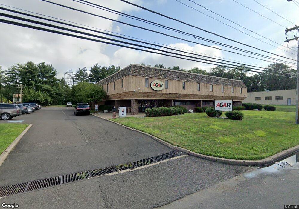
1225 Industrial Blvd Southampton, PA 18966
--
Bed
--
Bath
18,684
Sq Ft
1
Acres
About This Home
This home is located at 1225 Industrial Blvd, Southampton, PA 18966. 1225 Industrial Blvd is a home located in Bucks County with nearby schools including Davis Elementary School, Klinger Middle School, and William Tennent High School.
Ownership History
Date
Name
Owned For
Owner Type
Purchase Details
Closed on
Dec 16, 2011
Sold by
First Landing Inc
Bought by
Agar Investments Llc
Purchase Details
Closed on
Jul 1, 2011
Sold by
Landing Strip Properties Lp
Bought by
First Landing Inc
Purchase Details
Closed on
Apr 30, 2007
Sold by
Fox Chase Fsb
Bought by
Landing Strip Properties Lp
Home Financials for this Owner
Home Financials are based on the most recent Mortgage that was taken out on this home.
Original Mortgage
$1,500,000
Interest Rate
6.39%
Mortgage Type
Commercial
Purchase Details
Closed on
Aug 31, 1999
Sold by
Land Olakes Inc
Bought by
Fox Chase Fsb
Create a Home Valuation Report for This Property
The Home Valuation Report is an in-depth analysis detailing your home's value as well as a comparison with similar homes in the area
Home Values in the Area
Average Home Value in this Area
Purchase History
| Date | Buyer | Sale Price | Title Company |
|---|---|---|---|
| Agar Investments Llc | $440,000 | None Available | |
| First Landing Inc | $991 | None Available | |
| Landing Strip Properties Lp | $1,820,000 | The Talon Group | |
| Fox Chase Fsb | $662,650 | Commonwealth Land Title Ins |
Source: Public Records
Mortgage History
| Date | Status | Borrower | Loan Amount |
|---|---|---|---|
| Previous Owner | Landing Strip Properties Lp | $1,500,000 |
Source: Public Records
Tax History Compared to Growth
Tax History
| Year | Tax Paid | Tax Assessment Tax Assessment Total Assessment is a certain percentage of the fair market value that is determined by local assessors to be the total taxable value of land and additions on the property. | Land | Improvement |
|---|---|---|---|---|
| 2025 | $46,199 | $216,000 | $23,480 | $192,520 |
| 2024 | $46,199 | $216,000 | $23,480 | $192,520 |
| 2023 | $44,796 | $216,000 | $23,480 | $192,520 |
| 2022 | $43,852 | $216,000 | $23,480 | $192,520 |
| 2021 | $43,060 | $216,000 | $23,480 | $192,520 |
| 2020 | $42,466 | $216,000 | $23,480 | $192,520 |
| 2019 | $40,901 | $216,000 | $23,480 | $192,520 |
| 2018 | $39,958 | $216,000 | $23,480 | $192,520 |
| 2017 | $38,830 | $216,000 | $23,480 | $192,520 |
| 2016 | $38,830 | $216,000 | $23,480 | $192,520 |
| 2015 | -- | $216,000 | $23,480 | $192,520 |
| 2014 | -- | $216,000 | $23,480 | $192,520 |
Source: Public Records
Map
Nearby Homes
- 685 Provident Rd
- 693 Provident Rd
- 681 Provident Rd
- 247 Gravel Hill Rd
- 215 Gravel Hill Rd
- 967 Jeffrey Dr
- 603 Steamboat Station Unit 603
- 604 Cushmore Rd
- 1307 Steamboat Station Unit 1307
- 1632 Mcnelis Dr
- 643 Croft Dr
- 1581 Heather Rd
- 1535 Fieldwood Rd
- 1555 Fieldwood Rd
- 756 Churchville Rd
- 736 Plum St
- 1745 Brandywine Dr
- 721 Grantham Ct
- 905 Pebble Ln
- 634 Nicole Dr
- 1228 Cushmore Rd
- 1236 Cushmore Rd
- 1244 Cushmore Rd
- 1220 Cushmore Rd
- 1252 Cushmore Rd
- 1212 Cushmore Rd
- 1260 Cushmore Rd
- 1204 Cushmore Rd
- 1268 Cushmore Rd
- 1182 Cushmore Rd
- 1265 Industrial Blvd
- 1237 Cushmore Rd
- 1245 Cushmore Rd
- 1253 Cushmore Rd
- 1276 Cushmore Rd
- 0 Industrial Blvd Unit 5679566
- 1174 Cushmore Rd
- 1263 Cushmore Rd
- 1284 Cushmore Rd
- 1166 Cushmore Rd