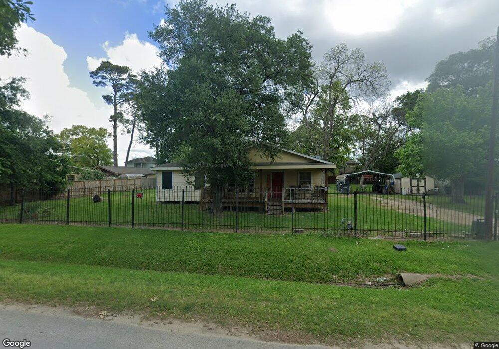
1225 Norham St Houston, TX 77022
Northside-Northline NeighborhoodEstimated Value: $296,000 - $376,822
2
Beds
1
Bath
1,800
Sq Ft
$195/Sq Ft
Est. Value
About This Home
This home is located at 1225 Norham St, Houston, TX 77022 and is currently estimated at $350,206, approximately $194 per square foot. 1225 Norham St is a home located in Harris County with nearby schools including Janowski Elementary School, Burbank Middle School, and Sam Houston Math, Science & Technology Center.
Ownership History
Date
Name
Owned For
Owner Type
Purchase Details
Closed on
Jul 1, 2011
Sold by
Bernal Adolf
Bought by
Bernal Veronica V
Current Estimated Value
Purchase Details
Closed on
Nov 17, 1999
Sold by
Clark Russell Ray
Bought by
Coley Linda Sue and Harris Linda Sue
Purchase Details
Closed on
Mar 12, 1995
Sold by
Clark Smyth Grace L
Bought by
Harris Linda Sue
Create a Home Valuation Report for This Property
The Home Valuation Report is an in-depth analysis detailing your home's value as well as a comparison with similar homes in the area
Home Values in the Area
Average Home Value in this Area
Purchase History
| Date | Buyer | Sale Price | Title Company |
|---|---|---|---|
| Bernal Veronica V | -- | None Available | |
| Coley Linda Sue | -- | -- | |
| Harris Linda Sue | -- | -- |
Source: Public Records
Mortgage History
| Date | Status | Borrower | Loan Amount |
|---|---|---|---|
| Closed | Bernal Veronica V | $0 |
Source: Public Records
Tax History Compared to Growth
Tax History
| Year | Tax Paid | Tax Assessment Tax Assessment Total Assessment is a certain percentage of the fair market value that is determined by local assessors to be the total taxable value of land and additions on the property. | Land | Improvement |
|---|---|---|---|---|
| 2025 | $4,074 | $384,903 | $319,200 | $65,703 |
| 2024 | $4,074 | $367,044 | $292,950 | $74,094 |
| 2023 | $4,074 | $278,655 | $178,500 | $100,155 |
| 2022 | $5,364 | $257,029 | $178,500 | $78,529 |
| 2021 | $5,161 | $236,364 | $178,500 | $57,864 |
| 2020 | $4,875 | $229,889 | $178,500 | $51,389 |
| 2019 | $4,631 | $201,714 | $147,000 | $54,714 |
| 2018 | $3,083 | $166,375 | $122,850 | $43,525 |
| 2017 | $4,207 | $166,375 | $122,850 | $43,525 |
| 2016 | $3,660 | $144,733 | $115,500 | $29,233 |
| 2015 | $2,419 | $94,094 | $64,000 | $30,094 |
| 2014 | $2,419 | $94,094 | $64,000 | $30,094 |
Source: Public Records
Map
Nearby Homes
- 1104 Charnwood St
- 8109 W Hardy Rd
- 1016 Apache St
- 743 Apache St
- 714 Apache St
- 741 Mcdaniel St
- 631 Apache St
- 8411 Berry Brush Ln
- 8402 Berry Green Ln
- 726 Mcdaniel St
- 802 Berry Sage Ln
- 729 Caperton St
- 1207 Firnat St
- 723 Doverside St
- 1817 Mcdaniel St
- 0 Appleton St
- 807 Firnat St
- 88 Berry Rd
- 8205 Appleton St
- 2017 Sadler St
- 1217 Norham St
- 1233 Norham St
- 1236 Charnwood St
- 1211 Norham St
- 1237 Norham St
- 1235 Norham St
- 1224 Charnwood St
- 1302 Charnwood St
- 1232 Norham St
- 1228 Charnwood St
- 1220 Charnwood St
- 1209 Norham St
- 1301 Norham St
- 1210 Charnwood St Unit B
- 1220 Norham St
- 1304 Charnwood St
- 1218 Norham St
- 1303 Norham St
- 1208 Charnwood St
- 1212 Norham St