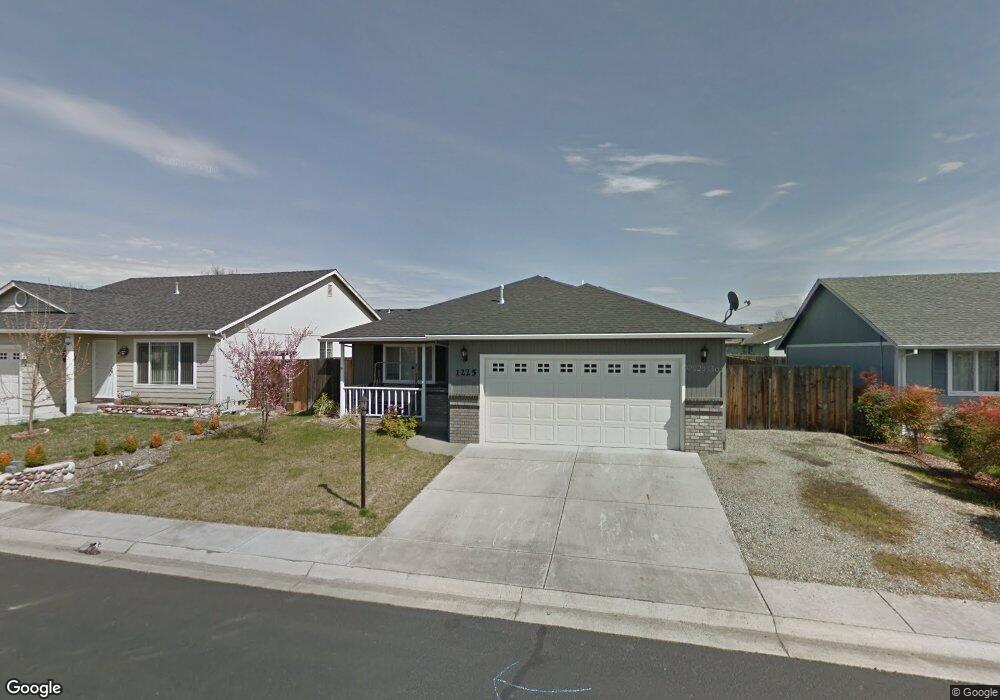
1225 Pheasant Way Central Point, OR 97502
Estimated Value: $335,000 - $374,000
3
Beds
2
Baths
1,439
Sq Ft
$250/Sq Ft
Est. Value
About This Home
This home is located at 1225 Pheasant Way, Central Point, OR 97502 and is currently estimated at $359,730, approximately $249 per square foot. 1225 Pheasant Way is a home located in Jackson County with nearby schools including Jewett Elementary School, Scenic Middle School, and Crater High School.
Ownership History
Date
Name
Owned For
Owner Type
Purchase Details
Closed on
Jun 10, 2021
Sold by
Jeffs Allyson and Morris Allyson
Bought by
Jeffs Allyson
Current Estimated Value
Home Financials for this Owner
Home Financials are based on the most recent Mortgage that was taken out on this home.
Original Mortgage
$165,500
Outstanding Balance
$148,857
Interest Rate
2.9%
Mortgage Type
New Conventional
Estimated Equity
$210,873
Purchase Details
Closed on
Sep 24, 2019
Sold by
Morris Allyson and Jeffs Allyson
Bought by
Morris Allyson
Home Financials for this Owner
Home Financials are based on the most recent Mortgage that was taken out on this home.
Original Mortgage
$162,800
Interest Rate
4.12%
Mortgage Type
FHA
Purchase Details
Closed on
Dec 21, 2010
Sold by
Azevedo Rusty J and Azevedo Leanne
Bought by
Jeffs Allyson
Home Financials for this Owner
Home Financials are based on the most recent Mortgage that was taken out on this home.
Original Mortgage
$121,831
Interest Rate
4.17%
Mortgage Type
FHA
Purchase Details
Closed on
Sep 21, 2005
Sold by
Whiteley Charles E and Whiteley Sunnie L
Bought by
Azevedo Rusty J and Azevedo Leanne
Home Financials for this Owner
Home Financials are based on the most recent Mortgage that was taken out on this home.
Original Mortgage
$201,600
Interest Rate
5.81%
Mortgage Type
Fannie Mae Freddie Mac
Purchase Details
Closed on
Aug 7, 2003
Sold by
Barber Mark E and Barber Laura A
Bought by
Whiteley Charles E and Whiteley Sunnie L
Home Financials for this Owner
Home Financials are based on the most recent Mortgage that was taken out on this home.
Original Mortgage
$154,562
Interest Rate
5.17%
Mortgage Type
FHA
Purchase Details
Closed on
Feb 26, 2003
Sold by
Duncan Development Llc
Bought by
Barber Mark E and Barber Laura A
Home Financials for this Owner
Home Financials are based on the most recent Mortgage that was taken out on this home.
Original Mortgage
$32,925
Interest Rate
5.93%
Create a Home Valuation Report for This Property
The Home Valuation Report is an in-depth analysis detailing your home's value as well as a comparison with similar homes in the area
Purchase History
| Date | Buyer | Sale Price | Title Company |
|---|---|---|---|
| Jeffs Allyson | -- | Accommodation | |
| Morris Allyson | -- | Amerititle | |
| Jeffs Allyson | $125,000 | Ticor Title Company Oregon | |
| Azevedo Rusty J | $252,000 | Lawyers Title Insurance Corp | |
| Whiteley Charles E | $156,746 | Amerititle | |
| Barber Mark E | $43,900 | Amerititle |
Source: Public Records
Mortgage History
| Date | Status | Borrower | Loan Amount |
|---|---|---|---|
| Open | Jeffs Allyson | $165,500 | |
| Closed | Morris Allyson | $162,800 | |
| Closed | Jeffs Allyson | $121,831 | |
| Previous Owner | Azevedo Rusty J | $201,600 | |
| Previous Owner | Whiteley Charles E | $154,562 | |
| Previous Owner | Barber Mark E | $32,925 |
Source: Public Records
Tax History
| Year | Tax Paid | Tax Assessment Tax Assessment Total Assessment is a certain percentage of the fair market value that is determined by local assessors to be the total taxable value of land and additions on the property. | Land | Improvement |
|---|---|---|---|---|
| 2026 | $3,618 | $218,620 | -- | -- |
| 2025 | $3,529 | $212,260 | $78,050 | $134,210 |
| 2024 | $3,529 | $206,080 | $75,780 | $130,300 |
| 2023 | $3,415 | $200,080 | $73,570 | $126,510 |
| 2022 | $3,336 | $200,080 | $73,570 | $126,510 |
| 2021 | $3,241 | $194,260 | $71,420 | $122,840 |
| 2020 | $3,146 | $188,610 | $69,340 | $119,270 |
| 2019 | $3,069 | $177,790 | $65,360 | $112,430 |
| 2018 | $2,975 | $172,620 | $63,450 | $109,170 |
| 2017 | $2,900 | $172,620 | $63,450 | $109,170 |
| 2016 | $2,816 | $162,720 | $59,810 | $102,910 |
| 2015 | $2,698 | $162,720 | $59,810 | $102,910 |
| 2014 | -- | $153,390 | $56,370 | $97,020 |
Source: Public Records
Map
Nearby Homes
- 2311 Lara Ln
- 2335 New Haven Dr
- 1617 Tennessee Ln
- 1153 Annalise St
- 1121 Annalise St
- 4722 Gebhard Rd
- 1113 Annalise St
- 1109 Annalise St
- 1653 Kentucky Ct
- 2460 Jeremy St
- 875 N Mountain Ave
- 446 Beebe Rd
- 549 Wilson Rd
- 368 Live Oak Loop
- 4595 Table Rock Rd
- 225 Wilson Rd
- 4286 Hamrick Rd
- 1600 E Pine St
- 1840 E Pine St
- 4399 Table Rock Rd
- 1107 Pheasant Way
- 1229 Pheasant Way
- 1238 Hawk Dr
- 1142 Hawk Dr
- 1233 Pheasant Way
- 1108 Pheasant Way
- 1218 Pheasant Way
- 1222 Pheasant Way
- 1246 Hawk Dr
- 1226 Pheasant Way
- 2102 Lara Ln
- 2020 Lara Ln
- 1250 Hawk Dr
- 2106 Lara Ln
- 2016 Lara Ln
- 1230 Pheasant Way
- 1245 Hawk Dr
- 1205 Twin Rocks Dr
- 1103 Twin Rocks Dr
- 1249 Hawk Dr
Your Personal Tour Guide
Ask me questions while you tour the home.