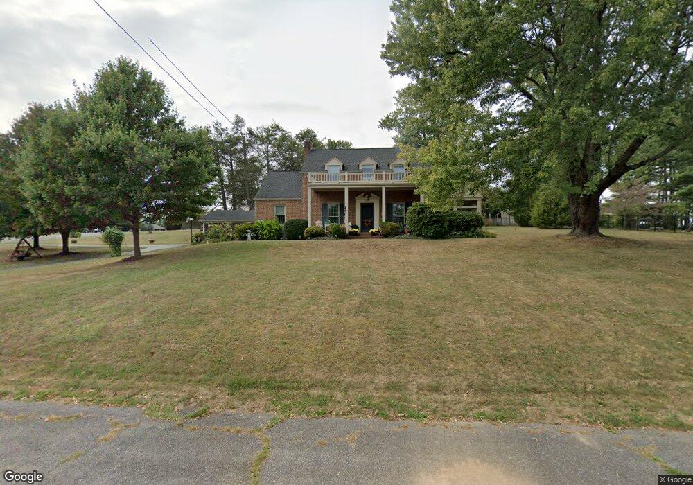
1225 Shamrock Ln Waynesboro, VA 22980
Estimated Value: $407,000 - $591,000
4
Beds
4
Baths
2,272
Sq Ft
$209/Sq Ft
Est. Value
About This Home
This home is located at 1225 Shamrock Ln, Waynesboro, VA 22980 and is currently estimated at $475,070, approximately $209 per square foot. 1225 Shamrock Ln is a home located in Waynesboro City with nearby schools including Berkeley Glenn Elementary School, Kate Collins Middle School, and Waynesboro High School.
Ownership History
Date
Name
Owned For
Owner Type
Purchase Details
Closed on
Jul 11, 2018
Sold by
Schurz Helen Fell
Bought by
Wilson Robert E and Wilson Carolyn S
Current Estimated Value
Home Financials for this Owner
Home Financials are based on the most recent Mortgage that was taken out on this home.
Original Mortgage
$197,000
Outstanding Balance
$171,107
Interest Rate
4.6%
Mortgage Type
New Conventional
Estimated Equity
$303,963
Create a Home Valuation Report for This Property
The Home Valuation Report is an in-depth analysis detailing your home's value as well as a comparison with similar homes in the area
Home Values in the Area
Average Home Value in this Area
Purchase History
| Date | Buyer | Sale Price | Title Company |
|---|---|---|---|
| Wilson Robert E | $317,000 | Attorney |
Source: Public Records
Mortgage History
| Date | Status | Borrower | Loan Amount |
|---|---|---|---|
| Open | Wilson Robert E | $197,000 |
Source: Public Records
Tax History Compared to Growth
Tax History
| Year | Tax Paid | Tax Assessment Tax Assessment Total Assessment is a certain percentage of the fair market value that is determined by local assessors to be the total taxable value of land and additions on the property. | Land | Improvement |
|---|---|---|---|---|
| 2025 | $3,303 | $402,800 | $75,000 | $327,800 |
| 2024 | $2,772 | $360,000 | $70,000 | $290,000 |
| 2023 | $2,772 | $360,000 | $70,000 | $290,000 |
| 2022 | $2,521 | $280,100 | $65,000 | $215,100 |
| 2021 | $2,521 | $280,100 | $65,000 | $215,100 |
| 2020 | $2,197 | $244,200 | $65,000 | $179,200 |
| 2019 | $2,198 | $244,200 | $65,000 | $179,200 |
| 2018 | $1,982 | $220,200 | $65,000 | $155,200 |
| 2017 | $1,916 | $220,200 | $65,000 | $155,200 |
| 2016 | $1,739 | $217,400 | $65,000 | $152,400 |
| 2015 | $1,739 | $217,400 | $65,000 | $152,400 |
| 2014 | -- | $208,700 | $65,000 | $143,700 |
| 2013 | -- | $0 | $0 | $0 |
Source: Public Records
Map
Nearby Homes
- 1358 Keesling Ave
- 1220 Chatham Rd
- 842 Maple Ave
- 705 Oak Ave
- 833 Jefferson Ave
- 701 Western Rd
- 2495 N Lyndhurst Rd
- 636 Rosser Ave
- 645 Maple Ave
- 1305 13th St
- 373 S Magnolia Ave
- 840 Hawthorne Ln
- 1215 W 12th St
- 112 Country Lodge Rd
- 477 Chestnut Ave
- 1229 Rosser Ave
- PENWELL Plan at Kira Heights
- SALEM Plan at Kira Heights
- NEUVILLE Plan at Kira Heights
- 314 13th St
- 1501 Tuckahoe Rd
- 1224 Shamrock Ln
- 1500 Brunswick Rd
- 1400 Tuckahoe Rd
- 1513 Tuckahoe Rd
- 1216 Shamrock Ln
- 1500 Tuckahoe Rd
- 1200 Boxwood Cir
- 1208 Shamrock Ln
- 1512 Tuckahoe Rd
- 1219 Boxwood Cir
- 1311 Orchard Ave
- 1516 Brunswick Rd
- 1225 Meadowbrook Rd
- 1217 Meadowbrook Rd
- 1310 York Dr
- 1235 Meadowbrook Rd
- 1319 Orchard Ave
- 1216 Boxwood Cir
- 1225 Boxwood Cir