Estimated Value: $265,000 - $322,000
3
Beds
2
Baths
1,857
Sq Ft
$156/Sq Ft
Est. Value
About This Home
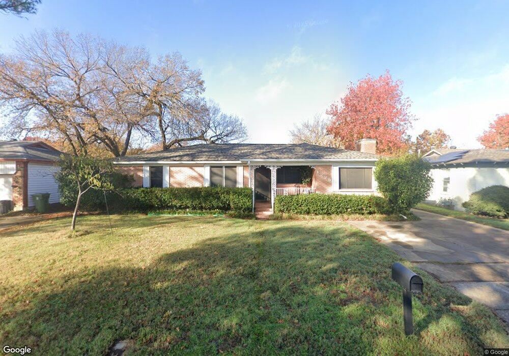
This home is located at 1225 Simpson Dr, Hurst, TX 76053 and is currently estimated at $289,600, approximately $155 per square foot. 1225 Simpson Dr is a home located in Tarrant County with nearby schools including Harrison Lane Elementary School, Hurst J High School, and L.D. Bell High School.
Ownership History
Date
Name
Owned For
Owner Type
Purchase Details
Closed on
Oct 16, 2019
Sold by
House Thomas Christopher
Bought by
Parsons Christopher A and Hediger Thomas B
Current Estimated Value
Home Financials for this Owner
Home Financials are based on the most recent Mortgage that was taken out on this home.
Original Mortgage
$174,900
Outstanding Balance
$152,906
Interest Rate
3.4%
Mortgage Type
New Conventional
Estimated Equity
$136,694
Purchase Details
Closed on
Nov 11, 2009
Sold by
Resentreter Dorothy
Bought by
House Thomas Christopher
Home Financials for this Owner
Home Financials are based on the most recent Mortgage that was taken out on this home.
Original Mortgage
$107,516
Interest Rate
4.9%
Mortgage Type
FHA
Purchase Details
Closed on
Dec 10, 2001
Sold by
Rosentreter Dorthy
Bought by
Rosentreter Dorthy
Create a Home Valuation Report for This Property
The Home Valuation Report is an in-depth analysis detailing your home's value as well as a comparison with similar homes in the area
Home Values in the Area
Average Home Value in this Area
Purchase History
| Date | Buyer | Sale Price | Title Company |
|---|---|---|---|
| Parsons Christopher A | -- | Fnt | |
| House Thomas Christopher | -- | Hftc | |
| Rosentreter Dorthy | -- | -- |
Source: Public Records
Mortgage History
| Date | Status | Borrower | Loan Amount |
|---|---|---|---|
| Open | Parsons Christopher A | $174,900 | |
| Previous Owner | House Thomas Christopher | $107,516 |
Source: Public Records
Tax History
| Year | Tax Paid | Tax Assessment Tax Assessment Total Assessment is a certain percentage of the fair market value that is determined by local assessors to be the total taxable value of land and additions on the property. | Land | Improvement |
|---|---|---|---|---|
| 2025 | $3,302 | $235,000 | $55,000 | $180,000 |
| 2024 | $3,302 | $255,729 | $55,000 | $200,729 |
| 2023 | $4,258 | $236,931 | $35,000 | $201,931 |
| 2022 | $4,448 | $204,791 | $35,000 | $169,791 |
| 2021 | $4,236 | $199,076 | $35,000 | $164,076 |
| 2020 | $3,841 | $159,669 | $35,000 | $124,669 |
| 2019 | $3,752 | $173,783 | $35,000 | $138,783 |
| 2018 | $2,867 | $139,356 | $16,000 | $123,356 |
| 2017 | $3,206 | $159,083 | $16,000 | $143,083 |
| 2016 | $2,914 | $132,099 | $16,000 | $116,099 |
| 2015 | $2,344 | $104,700 | $15,000 | $89,700 |
| 2014 | $2,344 | $104,700 | $15,000 | $89,700 |
Source: Public Records
Map
Nearby Homes
- 1160 Harrison Ln
- 1236 Harrison Ln
- 1148 Simpson Dr
- 1113 Norwood Dr
- 1348 Norwood Dr
- 1352 Simpson Dr
- 905 Brown Trail
- 1213 Glenda Dr
- 1016 Keith Dr
- 344 Bedford Ct E
- 341 Hurst Dr
- 153 Sheri Ln
- 224 Plainview Dr
- 1112 Karla Dr
- 802 Brown Trail
- 1428 Pamela St
- 1236 King Dr
- 33 Somerset Terrace
- 936 Barbara Ann Dr
- 209 W Cedar St
- 1229 Simpson Dr
- 1224 Harrison Ln
- 1233 Simpson Dr
- 1217 Simpson Dr
- 1228 Harrison Ln
- 1220 Harrison Ln
- 1220 Simpson Dr
- 1228 Simpson Dr
- 1232 Harrison Ln
- 1216 Harrison Ln
- 1213 Simpson Dr
- 1216 Simpson Dr
- 1232 Simpson Dr
- 1212 Harrison Ln
- 1212 Simpson Dr
- 1209 Simpson Dr
- 1225 Norwood Dr
- 1221 Norwood Dr
- 1229 Norwood Dr
- 1208 Harrison Ln
Your Personal Tour Guide
Ask me questions while you tour the home.