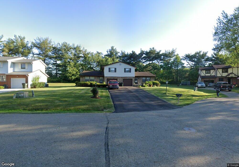
1225 Suffield Cir NW Canton, OH 44708
Estimated Value: $207,000 - $259,262
4
Beds
4
Baths
2,024
Sq Ft
$120/Sq Ft
Est. Value
About This Home
This home is located at 1225 Suffield Cir NW, Canton, OH 44708 and is currently estimated at $243,066, approximately $120 per square foot. 1225 Suffield Cir NW is a home located in Stark County with nearby schools including Pfeiffer Intermediate School, Edison Middle School, and Perry High School.
Ownership History
Date
Name
Owned For
Owner Type
Purchase Details
Closed on
Nov 14, 2024
Sold by
Rowlands Shayne E and Rowlands Cheryle J
Bought by
Rowlands Property Three Llc
Current Estimated Value
Purchase Details
Closed on
May 27, 1999
Sold by
Williams Bradley J and Williams Molly Jo
Bought by
Rowlands Shayne E and Rowlands Cheryle J
Home Financials for this Owner
Home Financials are based on the most recent Mortgage that was taken out on this home.
Original Mortgage
$80,000
Interest Rate
6.62%
Mortgage Type
Purchase Money Mortgage
Create a Home Valuation Report for This Property
The Home Valuation Report is an in-depth analysis detailing your home's value as well as a comparison with similar homes in the area
Home Values in the Area
Average Home Value in this Area
Purchase History
| Date | Buyer | Sale Price | Title Company |
|---|---|---|---|
| Rowlands Property Three Llc | -- | None Listed On Document | |
| Rowlands Property Three Llc | -- | None Listed On Document | |
| Rowlands Shayne E | $130,000 | -- |
Source: Public Records
Mortgage History
| Date | Status | Borrower | Loan Amount |
|---|---|---|---|
| Previous Owner | Rowlands Shayne E | $80,000 |
Source: Public Records
Tax History Compared to Growth
Tax History
| Year | Tax Paid | Tax Assessment Tax Assessment Total Assessment is a certain percentage of the fair market value that is determined by local assessors to be the total taxable value of land and additions on the property. | Land | Improvement |
|---|---|---|---|---|
| 2025 | -- | $67,140 | $20,900 | $46,240 |
| 2024 | -- | $67,140 | $20,900 | $46,240 |
| 2023 | $3,460 | $67,520 | $21,280 | $46,240 |
| 2022 | $3,477 | $67,520 | $21,280 | $46,240 |
| 2021 | $3,698 | $67,520 | $21,280 | $46,240 |
| 2020 | $3,180 | $55,660 | $17,890 | $37,770 |
| 2019 | $2,870 | $55,660 | $17,890 | $37,770 |
| 2018 | $2,844 | $55,660 | $17,890 | $37,770 |
| 2017 | $2,871 | $52,050 | $14,770 | $37,280 |
| 2016 | $2,886 | $52,050 | $14,770 | $37,280 |
| 2015 | $2,912 | $52,050 | $14,770 | $37,280 |
| 2014 | $640 | $46,420 | $13,760 | $32,660 |
| 2013 | $1,260 | $46,420 | $13,760 | $32,660 |
Source: Public Records
Map
Nearby Homes
- 5364 Burlawn St NW
- 5058 Monticello Ave NW Unit C1
- 702 Netherwood Ave NW
- 2777 Duxbury NW
- 0 Birkdale St NW Unit 5122150
- 515 Oneida Ave NW
- 5117 4th St NW
- VL Woodlawn Ave NW
- 805 Woodlawn Ave NW
- 4719 15th St NW
- 5040 2nd St NW
- 4560 7th St NW
- 4558 17th St NW
- 503 Manor Ave NW
- 1702 Thornridge Rd NW
- 4513 11th St NW
- 2421 Brentwood Rd NW
- 4505 11th St NW
- 1039 Prescot Ave NW
- 2450 Larchmoor Pkwy NW
- 1217 Suffield Cir NW
- 1233 Suffield Cir NW
- 1241 Suffield Cir NW
- 1207 Suffield Cir NW
- 1252 Suffield Cir NW
- 1253 Suffield Cir NW
- 5160 12th St NW
- 1201 Suffield Cir NW
- 5118 Dresden Dr NW
- 5224 Trent Rd NW
- 5210 Trent Rd NW
- 1130 Perry Dr NW
- 5156 Dresden Dr NW
- 5156 12th St NW
- 5141 Dresden Dr NW
- 1126 Perry Dr NW
- 5148 12th St NW
- 5108 Dresden Dr NW
- 1125 Perry Dr NW
- 5135 12th St NW