Estimated Value: $387,531 - $437,000
4
Beds
2
Baths
2,150
Sq Ft
$190/Sq Ft
Est. Value
About This Home
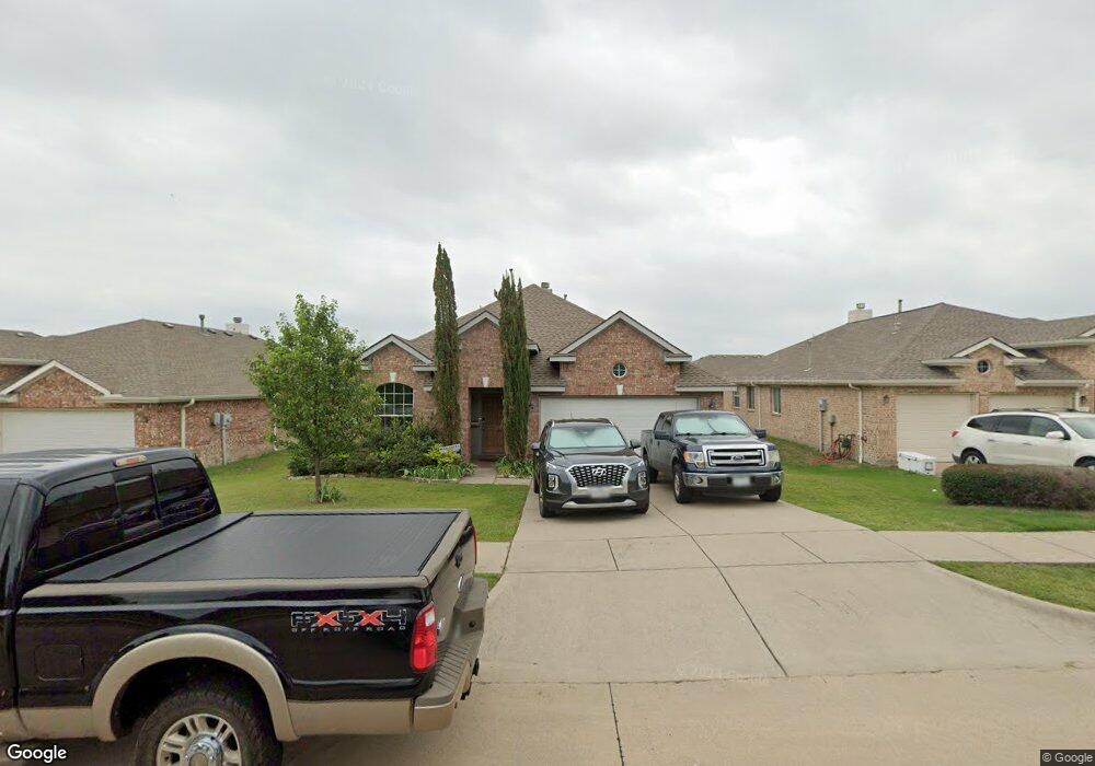
This home is located at 1226 Cedar Branch Dr, Wylie, TX 75098 and is currently estimated at $409,133, approximately $190 per square foot. 1226 Cedar Branch Dr is a home located in Collin County with nearby schools including Wally Watkins Elementary School, AB Harrison Intermediate School, and Grady Burnett J High School.
Ownership History
Date
Name
Owned For
Owner Type
Purchase Details
Closed on
Jul 20, 2017
Sold by
Stahler Robert and Stahler Kay Marie
Bought by
Petzel Robert G and Petzel Lois E
Current Estimated Value
Home Financials for this Owner
Home Financials are based on the most recent Mortgage that was taken out on this home.
Original Mortgage
$70,000
Outstanding Balance
$47,753
Interest Rate
3.89%
Mortgage Type
New Conventional
Estimated Equity
$361,380
Purchase Details
Closed on
Jan 25, 2006
Sold by
Rh Of Texas Lp
Bought by
White Albert R
Home Financials for this Owner
Home Financials are based on the most recent Mortgage that was taken out on this home.
Original Mortgage
$166,175
Interest Rate
6.24%
Mortgage Type
FHA
Create a Home Valuation Report for This Property
The Home Valuation Report is an in-depth analysis detailing your home's value as well as a comparison with similar homes in the area
Home Values in the Area
Average Home Value in this Area
Purchase History
| Date | Buyer | Sale Price | Title Company |
|---|---|---|---|
| Petzel Robert G | -- | None Available | |
| White Albert R | -- | None Available |
Source: Public Records
Mortgage History
| Date | Status | Borrower | Loan Amount |
|---|---|---|---|
| Open | Petzel Robert G | $70,000 | |
| Previous Owner | White Albert R | $166,175 |
Source: Public Records
Tax History Compared to Growth
Tax History
| Year | Tax Paid | Tax Assessment Tax Assessment Total Assessment is a certain percentage of the fair market value that is determined by local assessors to be the total taxable value of land and additions on the property. | Land | Improvement |
|---|---|---|---|---|
| 2025 | $5,771 | $394,137 | $105,000 | $303,397 |
| 2024 | $5,771 | $358,306 | $105,000 | $298,867 |
| 2023 | $5,771 | $325,733 | $95,000 | $300,620 |
| 2022 | $6,497 | $296,121 | $80,000 | $267,105 |
| 2021 | $6,334 | $269,201 | $70,000 | $199,201 |
| 2020 | $6,379 | $256,892 | $60,000 | $196,892 |
| 2019 | $6,619 | $251,863 | $60,000 | $191,863 |
| 2018 | $6,453 | $239,623 | $55,000 | $184,623 |
| 2017 | $5,901 | $223,559 | $45,000 | $178,559 |
| 2016 | $5,535 | $206,845 | $40,000 | $166,845 |
| 2015 | $4,403 | $187,034 | $40,000 | $147,034 |
Source: Public Records
Map
Nearby Homes
- 1318 Chestnut Hill Dr
- 1320 Cedar Branch Dr
- 1321 Iron Horse St
- 1210 Iron Horse St
- 1201 E Stone Rd
- 1323 Canyon Creek Rd
- 1316 Taren Trail
- 1318 Taren Trail
- 407 Sparrow Dr
- 1330 Canyon Creek Rd
- 306 Foxwood Ct
- 312 Maltese Cir
- 1503 E Collins Blvd
- 1210 Troy Rd
- 1115 Nighthawk Dr
- 1209 Surrey Cir
- 1613 Saddle Ridge Dr
- 825 Forest Edge Ln
- 1605 Roberts Ravine Rd
- 409 Cedar Ridge Dr
- 1228 Cedar Branch Dr
- 1224 Cedar Branch Dr
- 1300 Cedar Branch Dr
- 1303 Chestnut Hill Dr
- 1305 Chestnut Hill Dr
- 1222 Cedar Branch Dr
- 1307 Chestnut Hill Dr
- 1301 Chestnut Hill Dr
- 1231 Cedar Branch Dr
- 1302 Cedar Branch Dr
- 1309 Chestnut Hill Dr
- 1219 Chestnut Hill Dr
- 1220 Cedar Branch Dr
- 1303 Clear Creek Dr
- 1229 Cedar Branch Dr
- 1304 Cedar Branch Dr
- 1300 Clear Creek Dr
- 1311 Chestnut Hill Dr
- 1217 Chestnut Hill Dr
- 1305 Clear Creek Dr