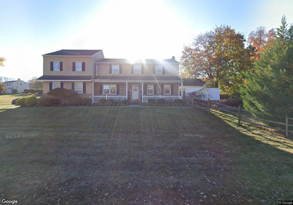
1226 Clearbrook Rd West Chester, PA 19380
Estimated Value: $774,000 - $871,000
5
Beds
3
Baths
3,246
Sq Ft
$247/Sq Ft
Est. Value
About This Home
This home is located at 1226 Clearbrook Rd, West Chester, PA 19380 and is currently estimated at $802,980, approximately $247 per square foot. 1226 Clearbrook Rd is a home located in Chester County with nearby schools including Exton Elementary School, J.R. Fugett Middle School, and West Chester East High School.
Ownership History
Date
Name
Owned For
Owner Type
Purchase Details
Closed on
Jul 11, 1997
Sold by
Algeo William D and Algeo James J
Bought by
Tomlin Matthew R and Tomlin Rachel A
Current Estimated Value
Home Financials for this Owner
Home Financials are based on the most recent Mortgage that was taken out on this home.
Original Mortgage
$142,900
Outstanding Balance
$20,478
Interest Rate
7.5%
Estimated Equity
$782,502
Create a Home Valuation Report for This Property
The Home Valuation Report is an in-depth analysis detailing your home's value as well as a comparison with similar homes in the area
Home Values in the Area
Average Home Value in this Area
Purchase History
| Date | Buyer | Sale Price | Title Company |
|---|---|---|---|
| Tomlin Matthew R | $181,000 | -- |
Source: Public Records
Mortgage History
| Date | Status | Borrower | Loan Amount |
|---|---|---|---|
| Open | Tomlin Matthew R | $142,900 |
Source: Public Records
Tax History Compared to Growth
Tax History
| Year | Tax Paid | Tax Assessment Tax Assessment Total Assessment is a certain percentage of the fair market value that is determined by local assessors to be the total taxable value of land and additions on the property. | Land | Improvement |
|---|---|---|---|---|
| 2025 | $6,743 | $232,610 | $43,880 | $188,730 |
| 2024 | $6,743 | $232,610 | $43,880 | $188,730 |
| 2023 | $6,743 | $232,610 | $43,880 | $188,730 |
| 2022 | $6,655 | $232,610 | $43,880 | $188,730 |
| 2021 | $6,563 | $232,610 | $43,880 | $188,730 |
| 2020 | $6,520 | $232,610 | $43,880 | $188,730 |
| 2019 | $6,430 | $232,610 | $43,880 | $188,730 |
| 2018 | $5,936 | $219,420 | $43,880 | $175,540 |
| 2017 | $5,807 | $219,420 | $43,880 | $175,540 |
| 2016 | $4,037 | $219,420 | $43,880 | $175,540 |
| 2015 | $4,037 | $219,420 | $43,880 | $175,540 |
| 2014 | $4,037 | $219,420 | $43,880 | $175,540 |
Source: Public Records
Map
Nearby Homes
- 1205 Killington Cir
- Kipling Plan at The Woodlands at Brandywine
- Nottingham Plan at The Woodlands at Brandywine
- Hawthorne Plan at The Woodlands at Brandywine
- Savannah Plan at The Woodlands at Brandywine
- Magnolia Plan at The Woodlands at Brandywine
- Woodford Plan at The Woodlands at Brandywine
- Augusta Plan at The Woodlands at Brandywine
- Devonshire Plan at The Woodlands at Brandywine
- Ethan Plan at The Woodlands at Brandywine
- Covington Plan at The Woodlands at Brandywine
- 300 Kirkland Ave Unit DEVONSHIRE
- 300 Kirkland Ave Unit HAWTHORNE
- 300 Kirkland Ave Unit SAVANNAH
- 300 Kirkland Ave Unit AUGUSTA
- 1322 Ashbridge Rd
- 1302 Ashbridge Rd
- 1206 Longford Rd Unit 51
- 1203 Karen Ln
- 116 Windridge Dr
- 563 Patrice Ln
- 561 Patrice Ln
- 1281 Country Ln
- 1224 Clearbrook Rd
- 1279 Country Ln
- 1241 Clearbrook Rd
- 1239 Clearbrook Rd
- 1283 Country Ln
- 1237 Clearbrook Rd
- 556 Patrice Ln
- 1277 Country Ln
- 1285 Country Ln
- 1222 Clearbrook Rd
- 1235 Clearbrook Rd
- 1275 Country Ln
- 558 Patrice Ln
- 1287 Country Ln
- 1233 Clearbrook Rd
- 557 Patrice Ln
- 1284 Clearbrook Rd