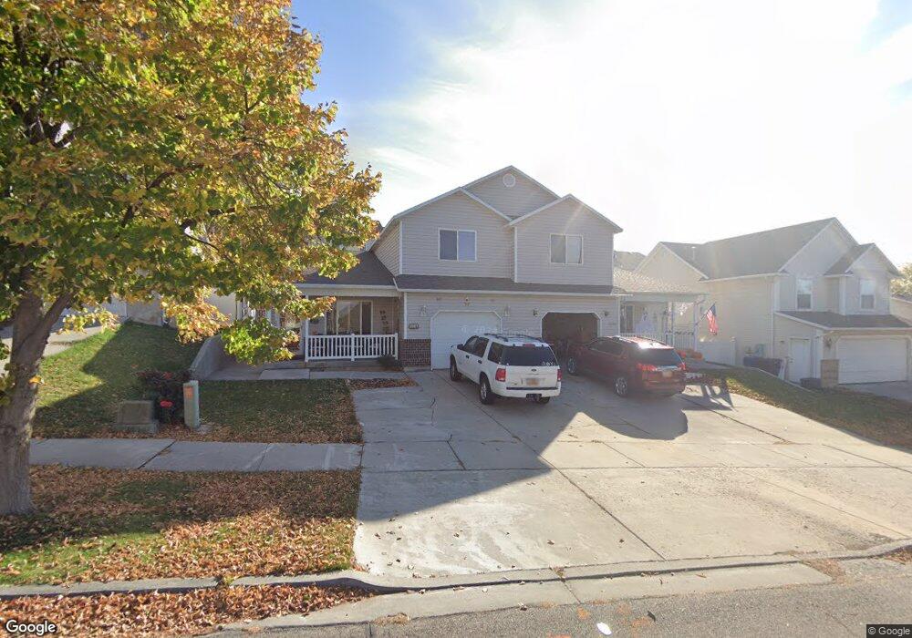
1226 E 570 N Spanish Fork, UT 84660
Estimated Value: $350,188 - $375,000
3
Beds
2
Baths
1,470
Sq Ft
$244/Sq Ft
Est. Value
About This Home
This home is located at 1226 E 570 N, Spanish Fork, UT 84660 and is currently estimated at $359,297, approximately $244 per square foot. 1226 E 570 N is a home located in Utah County with nearby schools including Rees Elementary School, Diamond Fork Junior High School, and Mapleton Junior High School.
Ownership History
Date
Name
Owned For
Owner Type
Purchase Details
Closed on
Jun 21, 2019
Sold by
Correa Gabriel D and Correa Lorena
Bought by
Montoya Gabriel Correa and Correa Lorena
Current Estimated Value
Home Financials for this Owner
Home Financials are based on the most recent Mortgage that was taken out on this home.
Original Mortgage
$186,480
Outstanding Balance
$163,629
Interest Rate
4%
Mortgage Type
New Conventional
Estimated Equity
$195,668
Purchase Details
Closed on
Apr 4, 2000
Sold by
West Wing Contractors
Bought by
Correa Gabriel D and Correa Lorena
Home Financials for this Owner
Home Financials are based on the most recent Mortgage that was taken out on this home.
Original Mortgage
$131,416
Interest Rate
8.3%
Mortgage Type
FHA
Create a Home Valuation Report for This Property
The Home Valuation Report is an in-depth analysis detailing your home's value as well as a comparison with similar homes in the area
Home Values in the Area
Average Home Value in this Area
Purchase History
| Date | Buyer | Sale Price | Title Company |
|---|---|---|---|
| Montoya Gabriel Correa | -- | Highland Title | |
| Correa Gabriel D | -- | Pro Title & Escrow Inc |
Source: Public Records
Mortgage History
| Date | Status | Borrower | Loan Amount |
|---|---|---|---|
| Open | Montoya Gabriel Correa | $186,480 | |
| Closed | Correa Gabriel D | $131,416 |
Source: Public Records
Tax History Compared to Growth
Tax History
| Year | Tax Paid | Tax Assessment Tax Assessment Total Assessment is a certain percentage of the fair market value that is determined by local assessors to be the total taxable value of land and additions on the property. | Land | Improvement |
|---|---|---|---|---|
| 2025 | $1,899 | $185,295 | $70,600 | $266,300 |
| 2024 | $1,899 | $195,745 | $0 | $0 |
| 2023 | $1,840 | $189,915 | $0 | $0 |
| 2022 | $1,857 | $187,935 | $0 | $0 |
| 2021 | $1,642 | $265,900 | $59,700 | $206,200 |
| 2020 | $1,550 | $243,900 | $59,700 | $184,200 |
| 2019 | $1,419 | $235,000 | $59,700 | $175,300 |
| 2018 | $1,143 | $182,900 | $59,700 | $123,200 |
| 2017 | $1,097 | $94,380 | $0 | $0 |
| 2016 | $915 | $77,660 | $0 | $0 |
| 2015 | $865 | $72,600 | $0 | $0 |
| 2014 | $784 | $66,000 | $0 | $0 |
Source: Public Records
Map
Nearby Homes
- 1228 E 680 N
- 1261 E 680 N
- 1213 E 540 N
- 453 N 1210 E
- 1025 E 360 N Unit 5
- 1001 E 360 N Unit 7
- 1022 E 360 N Unit 27
- 991 E 360 N Unit 8
- 1004 E 360 N Unit 28
- 1050 E 800 N Unit 13
- 1083 E 400 N
- 2597 E 360 N Unit 16
- 822 N 1120 E
- 969 E 550 N
- 1495 E 400 N
- 1113 E 870 N
- 314 N 1070 E
- 902 N 1120 E
- 1024 E 260 N Unit 18
- 1006 E 260 N Unit 17
- 1224 E 570 N
- 1242 E 570 N
- 1219 E 540 N
- 1219 E 540 N Unit 24
- 1244 E 570 N
- 1218 E 570 N
- 1229 E 540 N
- 1229 E 540 N Unit 23
- 1201 E 540 N
- 1201 E 540 N Unit 27
- 1213 E 540 N Unit 25
- 1207 E 540 N
- 1207 E 540 N Unit 26
- 1231 E 540 N
- 1231 E 540 N Unit 22
- 1197 E 540 N
- 1197 E 540 N Unit 28
- 1237 E 540 N
- 1237 E 540 N Unit 21
- 1258 E 570 N