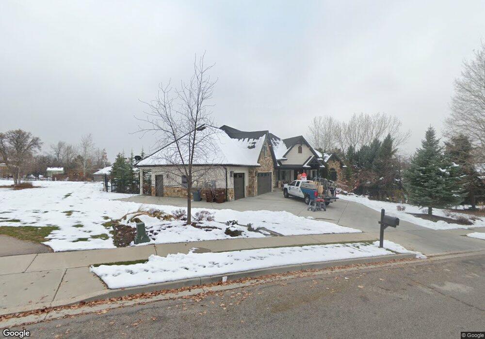
1226 E Lone Peak Dr Unit 7 Alpine, UT 84004
Estimated Value: $1,570,000 - $1,995,362
3
Beds
3
Baths
3,145
Sq Ft
$538/Sq Ft
Est. Value
About This Home
This home is located at 1226 E Lone Peak Dr Unit 7, Alpine, UT 84004 and is currently estimated at $1,691,091, approximately $537 per square foot. 1226 E Lone Peak Dr Unit 7 is a home located in Utah County with nearby schools including Alpine School, Timberline Middle School, and Lone Peak High School.
Ownership History
Date
Name
Owned For
Owner Type
Purchase Details
Closed on
Oct 28, 2010
Sold by
Goeckeritz Troy
Bought by
Goeckeritz Troy G and Goeckeritz Jodi Clark
Current Estimated Value
Home Financials for this Owner
Home Financials are based on the most recent Mortgage that was taken out on this home.
Original Mortgage
$417,000
Outstanding Balance
$275,971
Interest Rate
4.33%
Mortgage Type
New Conventional
Estimated Equity
$1,415,120
Purchase Details
Closed on
Mar 19, 2010
Sold by
Neuenschwander Rhett P and Neuenschwander Brooke H
Bought by
Goeckeritz Troy
Home Financials for this Owner
Home Financials are based on the most recent Mortgage that was taken out on this home.
Original Mortgage
$350,000
Interest Rate
5.5%
Mortgage Type
Construction
Purchase Details
Closed on
Mar 12, 2009
Sold by
Neuenschwander Rhett and Neuenschwander Brooke H
Bought by
Neuenschwander Rhett and Neuenschwander Brooke
Purchase Details
Closed on
Jan 4, 2005
Sold by
Neuenschwander Rhett T and Neuenschwander Brooke H
Bought by
Neuenschwander Rhett P and Neuenschwander Brooke H
Home Financials for this Owner
Home Financials are based on the most recent Mortgage that was taken out on this home.
Original Mortgage
$45,000
Interest Rate
5.67%
Mortgage Type
New Conventional
Purchase Details
Closed on
Sep 2, 2004
Sold by
Neuenschwander Rhett
Bought by
Neuenschwander Rhett T and Neuenschwander Brooke H
Purchase Details
Closed on
Aug 17, 2004
Sold by
Neuenschwander Brooke
Bought by
Neuenschwander Rhett
Purchase Details
Closed on
Jun 23, 2004
Sold by
England Charlotte
Bought by
Neuenschwander Brooke
Purchase Details
Closed on
Jun 17, 2004
Sold by
Anderson Nadeene
Bought by
Neuenschwander Brooke
Purchase Details
Closed on
Mar 15, 2004
Sold by
England Kathryn
Bought by
Neuenschwander Brooke
Purchase Details
Closed on
Mar 9, 2004
Sold by
England Jane
Bought by
Neuenschwander Brooke
Create a Home Valuation Report for This Property
The Home Valuation Report is an in-depth analysis detailing your home's value as well as a comparison with similar homes in the area
Home Values in the Area
Average Home Value in this Area
Purchase History
| Date | Buyer | Sale Price | Title Company |
|---|---|---|---|
| Goeckeritz Troy G | -- | Eagle Pointe Title Insuranc | |
| Goeckeritz Troy | -- | Signature Title Insurance A | |
| Neuenschwander Rhett | -- | None Available | |
| Neuenschwander Rhett P | -- | Signature Title Insurance A | |
| Neuenschwander Rhett T | -- | Signature Title Insurance Ag | |
| Neuenschwander Rhett | -- | -- | |
| Neuenschwander Brooke | -- | Signature Title Insurance A | |
| Neuenschwander Brooke | -- | Signature Title Insurance A | |
| Neuenschwander Brooke | -- | Signature Title Insurance A | |
| Neuenschwander Brooke | -- | Signature Title Insurance A | |
| Neuenschwander Brooke | -- | Signature Title Insurance A |
Source: Public Records
Mortgage History
| Date | Status | Borrower | Loan Amount |
|---|---|---|---|
| Open | Goeckeritz Troy G | $417,000 | |
| Closed | Goeckeritz Troy | $350,000 | |
| Previous Owner | Neuenschwander Rhett P | $45,000 |
Source: Public Records
Tax History Compared to Growth
Tax History
| Year | Tax Paid | Tax Assessment Tax Assessment Total Assessment is a certain percentage of the fair market value that is determined by local assessors to be the total taxable value of land and additions on the property. | Land | Improvement |
|---|---|---|---|---|
| 2025 | $7,125 | $941,710 | $599,400 | $1,112,800 |
| 2024 | $7,125 | $830,390 | $0 | $0 |
| 2023 | $6,749 | $844,470 | $0 | $0 |
| 2022 | $6,201 | $753,555 | $0 | $0 |
| 2021 | $5,768 | $1,088,700 | $388,600 | $700,100 |
| 2020 | $5,545 | $1,024,300 | $337,900 | $686,400 |
| 2019 | $5,128 | $988,900 | $337,900 | $651,000 |
| 2018 | $4,723 | $900,000 | $304,100 | $595,900 |
| 2017 | $4,713 | $477,895 | $0 | $0 |
| 2016 | $4,614 | $436,150 | $0 | $0 |
| 2015 | $4,814 | $430,485 | $0 | $0 |
| 2014 | $4,333 | $383,350 | $0 | $0 |
Source: Public Records
Map
Nearby Homes
- 19 N Lone Peak Dr
- 76 N Bald Mountain Dr
- 1063 E Alpine Dr
- 196 Holly Dr
- 1450 E Golden Eagle Cir Unit 10
- 1131 E Fox Meadow Ln Unit 5
- 870 Quail Hollow Cir
- 546 River Meadow Dr
- 653 Hampton Ct
- 1292 E 810 S
- 1263 E Chapman Ct
- 667 E 770 N
- 475 Grove Dr
- 909 Ridge Ln
- 201 E Red Pine Dr Unit 17
- 629 S Pheasant Ridge Cir
- 48 N 100 E
- 682 Healey Blvd
- 1116 Birch Cir
- 659 E Pioneer Rd
- 1226 E Lone Peak Dr
- 1226 E Lone Peak Dr Unit 7
- 12 N Country Manor Ln
- 1197 Mountain Oaks Cir
- 1215 Mountain Oaks Cir
- 10 S Wild Flower Dr
- 36 S Wild Flower Dr
- 1177 Mountain Oaks Cir
- 1223 E Lone Peak Dr
- 1255 E Lone Peak Dr
- 56 S Wild Flower Dr
- 94 N Country Manor Ln
- 94 N Country Manor Ln Unit 8
- 1279 E Lone Peak Dr
- 1216 Mountain Oaks Cir
- 76 S Wild Flower Dr
- 16 S Country Manor Ln
- 13 S Wild Flower Dr
- 1310 E Lone Peak Dr
- 31 S Wild Flower Dr