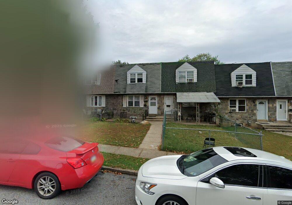
1226 Harshaw Rd Brookhaven, PA 19015
Estimated Value: $180,310 - $232,000
3
Beds
1
Bath
1,260
Sq Ft
$163/Sq Ft
Est. Value
About This Home
This home is located at 1226 Harshaw Rd, Brookhaven, PA 19015 and is currently estimated at $205,578, approximately $163 per square foot. 1226 Harshaw Rd is a home located in Delaware County with nearby schools including The Christian Academy and Institute of Islamic Studies.
Ownership History
Date
Name
Owned For
Owner Type
Purchase Details
Closed on
Mar 28, 2024
Sold by
Dike Stanley Ifeanyi and Dike Hope
Bought by
Dike Stanley Ifeanyi
Current Estimated Value
Purchase Details
Closed on
Apr 3, 2002
Sold by
Dike Alexander C
Bought by
Dike Stanley Ifeanyi
Purchase Details
Closed on
Feb 26, 1998
Sold by
Downey Michael R and Downey Christine
Bought by
Dike Alexander C
Home Financials for this Owner
Home Financials are based on the most recent Mortgage that was taken out on this home.
Original Mortgage
$58,947
Interest Rate
6.93%
Mortgage Type
FHA
Create a Home Valuation Report for This Property
The Home Valuation Report is an in-depth analysis detailing your home's value as well as a comparison with similar homes in the area
Home Values in the Area
Average Home Value in this Area
Purchase History
| Date | Buyer | Sale Price | Title Company |
|---|---|---|---|
| Dike Stanley Ifeanyi | -- | None Listed On Document | |
| Dike Stanley Ifeanyi | $59,000 | -- | |
| Dike Alexander C | $59,000 | T A Title Insurance Company |
Source: Public Records
Mortgage History
| Date | Status | Borrower | Loan Amount |
|---|---|---|---|
| Previous Owner | Dike Alexander C | $58,947 |
Source: Public Records
Tax History Compared to Growth
Tax History
| Year | Tax Paid | Tax Assessment Tax Assessment Total Assessment is a certain percentage of the fair market value that is determined by local assessors to be the total taxable value of land and additions on the property. | Land | Improvement |
|---|---|---|---|---|
| 2025 | $1,673 | $72,410 | $17,960 | $54,450 |
| 2024 | $1,673 | $72,410 | $17,960 | $54,450 |
| 2023 | $1,732 | $72,410 | $17,960 | $54,450 |
| 2022 | $1,769 | $72,410 | $17,960 | $54,450 |
| 2021 | $2,575 | $72,410 | $17,960 | $54,450 |
| 2020 | $2,346 | $54,150 | $13,450 | $40,700 |
| 2019 | $2,351 | $54,150 | $13,450 | $40,700 |
| 2018 | $2,323 | $54,150 | $0 | $0 |
| 2017 | $2,229 | $54,150 | $0 | $0 |
| 2016 | $303 | $54,150 | $0 | $0 |
| 2015 | $303 | $54,150 | $0 | $0 |
| 2014 | $297 | $54,150 | $0 | $0 |
Source: Public Records
Map
Nearby Homes
- 1228 Elson Rd
- 4010 Powell Rd
- 1356 Adair Rd
- 1300 Rainer Rd
- 3811 Powell Rd
- 3809 Powell Rd
- 1349 Elson Rd
- 3710 Sophia Ln
- Turner (Second Floor) Plan at Bridgewater Run
- Johnson (First Floor) Plan at Bridgewater Run
- Juniper Plan at Bridgewater Run
- 1403 Rainer Rd
- 3901 Elson Rd
- 3920 Elson Rd
- 1607 Powell Rd
- 00 S Springhouse Ln
- 2 Church St
- 107 Romaine Way
- 4 3rd St
- 0 Brookhaven & Creek Rd Unit PADE2084418
- 1224 Harshaw Rd
- 1228 Harshaw Rd
- 1222 Harshaw Rd
- 1220 Harshaw Rd
- 1232 Harshaw Rd
- 1234 Harshaw Rd
- 1216 Harshaw Rd
- 1236 Harshaw Rd
- 1313 Adair Rd
- 1315 Adair Rd
- 1311 Adair Rd
- 1309 Adair Rd
- 1317 Adair Rd
- 1238 Harshaw Rd
- 1307 Adair Rd
- 1321 Adair Rd
- 1214 Hawshaw Rd
- 1240 Harshaw Rd
- 1214 Harshaw Rd
- 1305 Adair Rd