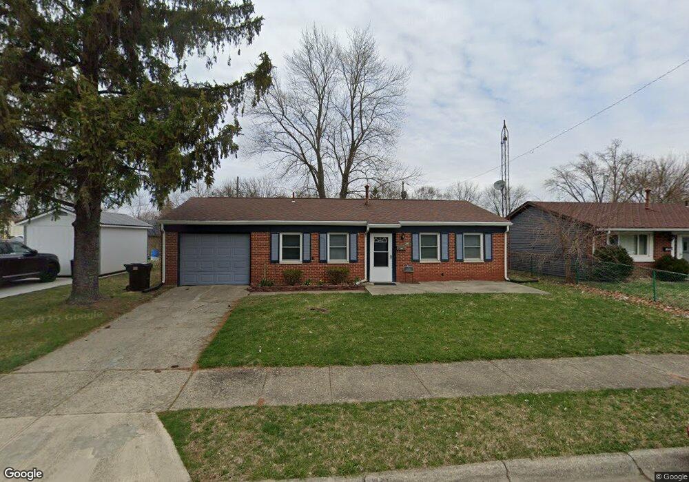
1226 Liberty Ave Springfield, OH 45506
Estimated Value: $83,000 - $126,000
3
Beds
1
Bath
891
Sq Ft
$119/Sq Ft
Est. Value
About This Home
This home is located at 1226 Liberty Ave, Springfield, OH 45506 and is currently estimated at $105,716, approximately $118 per square foot. 1226 Liberty Ave is a home located in Clark County with nearby schools including Fulton Elementary School, Hayward Middle School, and Springfield High School.
Ownership History
Date
Name
Owned For
Owner Type
Purchase Details
Closed on
May 13, 2016
Sold by
Roe Dwight C and Roe Cheryl L
Bought by
Roe Roe Rentals Llc
Current Estimated Value
Purchase Details
Closed on
Mar 27, 2013
Sold by
Victoria Anita M
Bought by
Roe Dwight C
Purchase Details
Closed on
Sep 5, 2001
Sold by
Jenkins Robert J and Jenkins Shareen L
Bought by
Garrett Mattie M
Home Financials for this Owner
Home Financials are based on the most recent Mortgage that was taken out on this home.
Original Mortgage
$54,000
Interest Rate
7.03%
Mortgage Type
Purchase Money Mortgage
Create a Home Valuation Report for This Property
The Home Valuation Report is an in-depth analysis detailing your home's value as well as a comparison with similar homes in the area
Home Values in the Area
Average Home Value in this Area
Purchase History
| Date | Buyer | Sale Price | Title Company |
|---|---|---|---|
| Roe Roe Rentals Llc | -- | None Available | |
| Roe Dwight C | $32,800 | None Available | |
| Garrett Mattie M | $54,000 | Evans Title Agency Inc |
Source: Public Records
Mortgage History
| Date | Status | Borrower | Loan Amount |
|---|---|---|---|
| Previous Owner | Garrett Mattie M | $54,000 |
Source: Public Records
Tax History Compared to Growth
Tax History
| Year | Tax Paid | Tax Assessment Tax Assessment Total Assessment is a certain percentage of the fair market value that is determined by local assessors to be the total taxable value of land and additions on the property. | Land | Improvement |
|---|---|---|---|---|
| 2024 | $965 | $19,530 | $2,890 | $16,640 |
| 2023 | $965 | $19,530 | $2,890 | $16,640 |
| 2022 | $988 | $19,530 | $2,890 | $16,640 |
| 2021 | $865 | $15,750 | $2,330 | $13,420 |
| 2020 | $867 | $15,750 | $2,330 | $13,420 |
| 2019 | $870 | $15,750 | $2,330 | $13,420 |
| 2018 | $850 | $14,780 | $2,680 | $12,100 |
| 2017 | $850 | $14,785 | $2,685 | $12,100 |
| 2016 | $827 | $14,785 | $2,685 | $12,100 |
| 2015 | $843 | $14,785 | $2,685 | $12,100 |
| 2014 | $840 | $14,785 | $2,685 | $12,100 |
| 2013 | $1,288 | $14,785 | $2,685 | $12,100 |
Source: Public Records
Map
Nearby Homes
- 1216 Innisfallen Ave
- 1201 Dibert Ave
- 929 S Western Ave
- 0 Montgomery Ave
- 1109 Montgomery Ave
- 830 Dibert Ave
- 1220 W Pleasant St
- 1515 W Perrin Ave
- 924 W State St
- 642 W Euclid Ave
- 833 W Mulberry St
- 1010 Heard Ave
- 711 W Mulberry St
- 506 W Southern Ave
- 1205 W High St
- 516 W Clark St
- 1009 W High St
- 424 W State St
- 416 W Southern Ave
- 409 W Southern Ave
- 1220 Liberty Ave
- 844 Farnam St
- 1236 Liberty Ave
- 1225 Cobb Ave
- 1214 Liberty Ave
- 1219 Cobb Ave
- 1213 Cobb Ave
- 1237 Cobb Ave
- 1227 Liberty Ave
- 1221 Liberty Ave
- 920 Farnam St
- 1208 Liberty Ave
- 1215 Liberty Ave
- 1209 Cobb Ave
- 1209 Liberty Ave
- 1204 Liberty Ave
- 1224 Cobb Ave
- 1205 Cobb Ave
- 1238 Cobb Ave
- 905 Farnam St