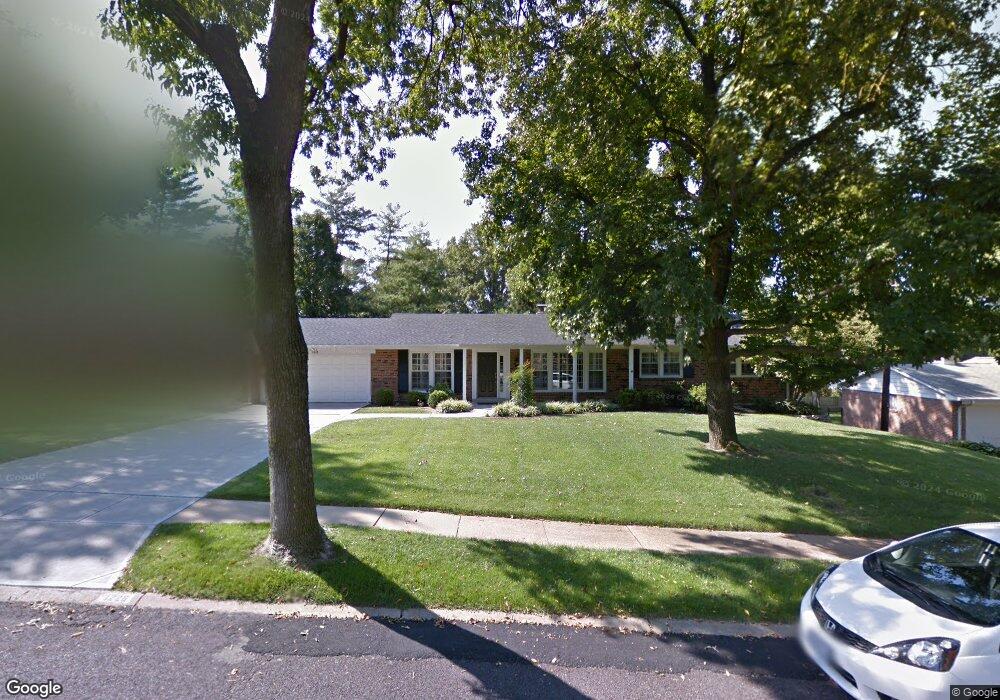
1226 Lindgate Dr Saint Louis, MO 63122
Estimated Value: $518,000 - $686,000
3
Beds
3
Baths
2,004
Sq Ft
$300/Sq Ft
Est. Value
About This Home
This home is located at 1226 Lindgate Dr, Saint Louis, MO 63122 and is currently estimated at $601,829, approximately $300 per square foot. 1226 Lindgate Dr is a home located in St. Louis County with nearby schools including Westchester Elementary School, North Kirkwood Middle School, and Kirkwood Senior High School.
Ownership History
Date
Name
Owned For
Owner Type
Purchase Details
Closed on
Aug 19, 2014
Sold by
Haywood Michael S and Haywood Sueleen
Bought by
Albart Steve and Albart Anne B
Current Estimated Value
Home Financials for this Owner
Home Financials are based on the most recent Mortgage that was taken out on this home.
Original Mortgage
$344,000
Outstanding Balance
$253,613
Interest Rate
3.25%
Mortgage Type
Adjustable Rate Mortgage/ARM
Estimated Equity
$348,216
Create a Home Valuation Report for This Property
The Home Valuation Report is an in-depth analysis detailing your home's value as well as a comparison with similar homes in the area
Home Values in the Area
Average Home Value in this Area
Purchase History
| Date | Buyer | Sale Price | Title Company |
|---|---|---|---|
| Albart Steve | $430,000 | Title Partners Agency Llc |
Source: Public Records
Mortgage History
| Date | Status | Borrower | Loan Amount |
|---|---|---|---|
| Open | Albart Steve | $344,000 |
Source: Public Records
Tax History Compared to Growth
Tax History
| Year | Tax Paid | Tax Assessment Tax Assessment Total Assessment is a certain percentage of the fair market value that is determined by local assessors to be the total taxable value of land and additions on the property. | Land | Improvement |
|---|---|---|---|---|
| 2025 | $6,014 | $109,480 | $57,950 | $51,530 |
| 2024 | $6,014 | $96,180 | $39,840 | $56,340 |
| 2023 | $5,920 | $96,180 | $39,840 | $56,340 |
| 2022 | $5,352 | $81,090 | $39,840 | $41,250 |
| 2021 | $5,282 | $81,090 | $39,840 | $41,250 |
| 2020 | $5,315 | $78,470 | $32,190 | $46,280 |
| 2019 | $5,333 | $78,470 | $32,190 | $46,280 |
| 2018 | $5,329 | $69,250 | $26,730 | $42,520 |
| 2017 | $5,322 | $69,250 | $26,730 | $42,520 |
| 2016 | $3,818 | $49,970 | $22,930 | $27,040 |
| 2015 | $3,799 | $49,970 | $22,930 | $27,040 |
| 2014 | $3,776 | $48,580 | $15,350 | $33,230 |
Source: Public Records
Map
Nearby Homes
- 1422 Northlin Dr
- 919 Nana Ln
- 11909 Lillian Ave
- 11913 Lillian Ave
- 12006 Montour Dr
- 1001 Dovergate Dr
- 1710 Lynkirk Ln
- 946 Rochdale Dr
- 1312 W Essex Ave
- 896 Twin Pine Dr
- 1090 Kinstern Dr
- 1126 Bopp Rd
- 11358 Manchester Rd
- 12224 TBB Roger Ln
- 811 Cherry St
- 1003 Ormond Dr
- 546 Dougherty Ferry Rd
- 550 Bedford Oaks Dr
- 425 Gabriel Dr
- 2005 Woodland Knoll
- 1220 Lindgate Dr
- 1304 Lindgate Dr
- 858 Sherilin Dr
- 854 Sherilin Dr
- 907 Lisa Ln
- 908 Mindy Ln
- 860 Sherilin Dr
- 1212 Lindgate Dr
- 1312 Lindgate Dr
- 850 Sherilin Dr
- 908 Lisa Ln
- 864 Sherilin Dr
- 839 Lockett Rd
- 1318 Lindgate Dr
- 917 Lisa Ln
- 859 Sherilin Dr
- 907 Mindy Ln
- 918 Mindy Ln
- 1206 Lindgate Dr
- 844 Sherilin Dr