Estimated Value: $1,061,000 - $1,458,000
3
Beds
4
Baths
2,669
Sq Ft
$443/Sq Ft
Est. Value
About This Home
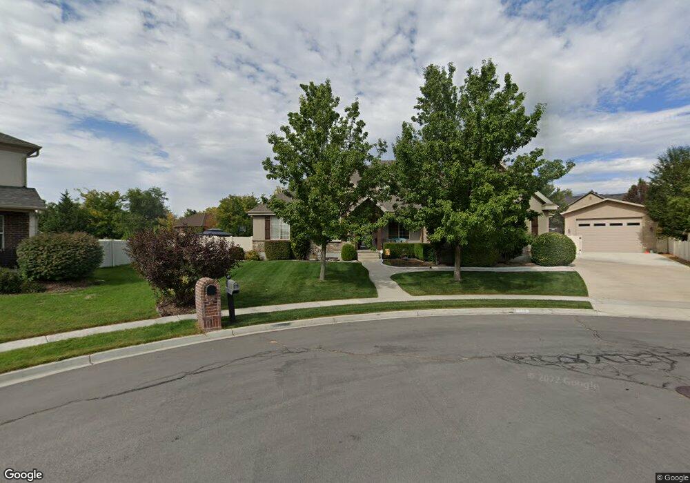
This home is located at 1226 N 1000 E Unit 29, Lehi, UT 84043 and is currently estimated at $1,182,733, approximately $443 per square foot. 1226 N 1000 E Unit 29 is a home located in Utah County with nearby schools including Sego Lily Elementary School, Lehi Junior High School, and Skyridge High School.
Ownership History
Date
Name
Owned For
Owner Type
Purchase Details
Closed on
Feb 5, 2025
Sold by
Woffinden Scott H and Woffinden Michele
Bought by
Scott And Michele Woffinden Irrevocable Trust and Woffinden
Current Estimated Value
Purchase Details
Closed on
Apr 16, 2015
Sold by
Dunford John J and Dunford Heather R
Bought by
Woffinden Scott H and Woffinden Michele
Home Financials for this Owner
Home Financials are based on the most recent Mortgage that was taken out on this home.
Original Mortgage
$417,000
Interest Rate
3.7%
Mortgage Type
New Conventional
Purchase Details
Closed on
Oct 14, 2005
Sold by
Steve Harris Construction Inc
Bought by
Dunford John J and Dunford Heather R
Purchase Details
Closed on
Apr 12, 2004
Sold by
Butterfield Cindy Clark and Butterfield Richard Chad
Bought by
Butterfield Richard Chad and Butterfield Cindy C
Create a Home Valuation Report for This Property
The Home Valuation Report is an in-depth analysis detailing your home's value as well as a comparison with similar homes in the area
Home Values in the Area
Average Home Value in this Area
Purchase History
| Date | Buyer | Sale Price | Title Company |
|---|---|---|---|
| Scott And Michele Woffinden Irrevocable Trust | -- | None Listed On Document | |
| Woffinden Scott H | -- | Meridian Title Co | |
| Dunford John J | -- | First American Title Agency | |
| Butterfield Richard Chad | -- | Affiliated First Title Comp |
Source: Public Records
Mortgage History
| Date | Status | Borrower | Loan Amount |
|---|---|---|---|
| Previous Owner | Woffinden Scott H | $417,000 |
Source: Public Records
Tax History Compared to Growth
Tax History
| Year | Tax Paid | Tax Assessment Tax Assessment Total Assessment is a certain percentage of the fair market value that is determined by local assessors to be the total taxable value of land and additions on the property. | Land | Improvement |
|---|---|---|---|---|
| 2025 | $4,417 | $593,450 | $345,800 | $733,200 |
| 2024 | $4,417 | $516,945 | $0 | $0 |
| 2023 | $4,035 | $512,655 | $0 | $0 |
| 2022 | $3,915 | $482,295 | $0 | $0 |
| 2021 | $3,511 | $653,800 | $200,100 | $453,700 |
| 2020 | $3,310 | $609,300 | $185,300 | $424,000 |
| 2019 | $3,184 | $609,300 | $185,300 | $424,000 |
| 2018 | $3,093 | $559,600 | $150,000 | $409,600 |
| 2017 | $2,869 | $275,990 | $0 | $0 |
| 2016 | $2,916 | $260,205 | $0 | $0 |
| 2015 | $3,072 | $260,205 | $0 | $0 |
| 2014 | $2,823 | $237,765 | $0 | $0 |
Source: Public Records
Map
Nearby Homes
- 1175 E 900 N
- 832 N Somerset Alley
- 735 N 1000 E
- 893 N 1580 E
- 595 N 1200 E
- 458 N 1100 E Unit 3
- 9435 N Aspen Hollow Cir
- 418 N 1322 E
- 705 N 400 E
- 1295 N 190 E
- 901 N Lakota Rd
- 1036 E 310 N Unit K1
- 975 E 2125 N
- 859 E 2125 N
- 328 N 1270 E
- 1329 N 100 E Unit 21
- 428 E 500 N
- 3935 W 1000 N Unit 438
- 3983 W 1000 N Unit 442
- 4007 W 1000 N
- 1226 N 1000 E
- 1223 N 1000 E
- 1224 N 1000 E
- 1325 N Cedarhollow Blvd
- 1274 N 940 E
- 1274 N 940 E Unit 19
- 1297 N Cedar Hollow Blvd
- 1297 N Cedar Hollow Blvd Unit 41
- 1290 N 940 E
- 1248 N 940 E
- 1248 N 940 E Unit 18
- 1267 N Cedar Hollow Blvd
- 1267 N Cedar Hollow Blvd
- 1344 Cedar Hollow Blvd
- 1197 N 1000 E
- 1231 N Cedar Hollow Blvd
- 1232 Cedar Hollow Blvd
- 1196 N 1000 E
- 1220 N 940 E
- 1345 N Cedar Hollow Blvd