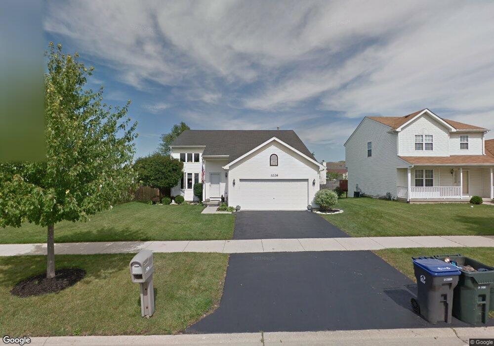
1226 Pheasant Run Zion, IL 60099
West Zion NeighborhoodEstimated Value: $289,107 - $332,000
3
Beds
2
Baths
1,616
Sq Ft
$190/Sq Ft
Est. Value
About This Home
This home is located at 1226 Pheasant Run, Zion, IL 60099 and is currently estimated at $307,527, approximately $190 per square foot. 1226 Pheasant Run is a home located in Lake County with nearby schools including Newport Elementary School, Beach Park Middle School, and Zion-Benton Township High School.
Ownership History
Date
Name
Owned For
Owner Type
Purchase Details
Closed on
Feb 24, 2003
Sold by
Bank Of Waukegan
Bought by
Vazquez Gerardo and Vazquez Mildred
Current Estimated Value
Home Financials for this Owner
Home Financials are based on the most recent Mortgage that was taken out on this home.
Original Mortgage
$140,400
Interest Rate
5.71%
Purchase Details
Closed on
Jul 24, 2002
Sold by
Fifth Third Bank Chicago
Bought by
Bank Of Waukegan
Home Financials for this Owner
Home Financials are based on the most recent Mortgage that was taken out on this home.
Original Mortgage
$124,504
Interest Rate
4.75%
Mortgage Type
Construction
Create a Home Valuation Report for This Property
The Home Valuation Report is an in-depth analysis detailing your home's value as well as a comparison with similar homes in the area
Home Values in the Area
Average Home Value in this Area
Purchase History
| Date | Buyer | Sale Price | Title Company |
|---|---|---|---|
| Vazquez Gerardo | $175,500 | -- | |
| Bank Of Waukegan | -- | -- |
Source: Public Records
Mortgage History
| Date | Status | Borrower | Loan Amount |
|---|---|---|---|
| Previous Owner | Vazquez Gerardo | $140,400 | |
| Previous Owner | Bank Of Waukegan | $124,504 |
Source: Public Records
Tax History Compared to Growth
Tax History
| Year | Tax Paid | Tax Assessment Tax Assessment Total Assessment is a certain percentage of the fair market value that is determined by local assessors to be the total taxable value of land and additions on the property. | Land | Improvement |
|---|---|---|---|---|
| 2024 | $8,313 | $72,981 | $9,919 | $63,062 |
| 2023 | $8,344 | $65,069 | $8,844 | $56,225 |
| 2022 | $8,344 | $63,954 | $7,261 | $56,693 |
| 2021 | $8,271 | $59,994 | $6,811 | $53,183 |
| 2020 | $8,228 | $57,864 | $6,406 | $51,458 |
| 2019 | $8,049 | $53,902 | $5,967 | $47,935 |
| 2018 | $7,449 | $48,612 | $5,420 | $43,192 |
| 2017 | $7,338 | $45,095 | $5,028 | $40,067 |
| 2016 | $6,889 | $40,936 | $4,564 | $36,372 |
| 2015 | $6,705 | $37,143 | $4,141 | $33,002 |
| 2014 | $6,378 | $36,635 | $3,915 | $32,720 |
| 2012 | $6,709 | $39,015 | $4,169 | $34,846 |
Source: Public Records
Map
Nearby Homes
- 1305 Reed Rd
- 1210 Lorelei Dr
- 4004 Gregory Dr
- 4014 Ridge Rd
- 4013 Ridge Rd
- 1524 Anderson Trail
- 4108 Douglas Dr
- 1712 Dusk Dr
- 3903 9th St
- 4539 Illinois 173
- 4533 Illinois 173
- 11778 W 12th St
- 1907 Dawn Ln
- 1521 Southport Ct
- 1405 Lewis Ave
- 12434 W Van Ct
- 42908 N Lewis Ave
- 4109 Sarah Dr
- 41616 N Delany Rd
- 2407 Phillip Dr
- 1224 Pheasant Run
- 1228 Pheasant Run
- 4209 Quail St
- 4207 Quail St
- 1222 Pheasant Run
- 1230 Pheasant Run
- 4211 Quail St
- 4205 Quail St
- 1215 Butterfield Ln
- 1227 Pheasant Run
- 1232 Pheasant Run
- 4213 Quail St
- 1220 Pheasant Run
- 1225 Pheasant Run
- 4203 Quail St
- 1234 Pheasant Run
- 1214 Butterfield Ln
- 4215 Quail St
- 1223 Pheasant Run
- 4210 Highland Rd