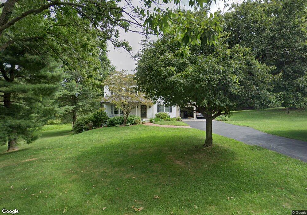
1226 Upton Cir West Chester, PA 19380
Estimated Value: $699,000 - $793,845
4
Beds
3
Baths
2,344
Sq Ft
$322/Sq Ft
Est. Value
About This Home
This home is located at 1226 Upton Cir, West Chester, PA 19380 and is currently estimated at $755,461, approximately $322 per square foot. 1226 Upton Cir is a home located in Chester County with nearby schools including East Goshen Elementary School, J.R. Fugett Middle School, and West Chester East High School.
Ownership History
Date
Name
Owned For
Owner Type
Purchase Details
Closed on
Jul 3, 2003
Sold by
Dodds Edward and Dodds Lisa A
Bought by
Dodds Edward and Dodds Lisa A
Current Estimated Value
Home Financials for this Owner
Home Financials are based on the most recent Mortgage that was taken out on this home.
Original Mortgage
$192,600
Outstanding Balance
$32,314
Interest Rate
5.88%
Mortgage Type
New Conventional
Estimated Equity
$723,147
Purchase Details
Closed on
Feb 1, 1983
Bought by
Lynch Michael P and Lynch Catherine P
Create a Home Valuation Report for This Property
The Home Valuation Report is an in-depth analysis detailing your home's value as well as a comparison with similar homes in the area
Home Values in the Area
Average Home Value in this Area
Purchase History
| Date | Buyer | Sale Price | Title Company |
|---|---|---|---|
| Dodds Edward | -- | First American Title Ins Co | |
| Lynch Michael P | $91,500 | -- |
Source: Public Records
Mortgage History
| Date | Status | Borrower | Loan Amount |
|---|---|---|---|
| Open | Dodds Edward | $192,600 |
Source: Public Records
Tax History Compared to Growth
Tax History
| Year | Tax Paid | Tax Assessment Tax Assessment Total Assessment is a certain percentage of the fair market value that is determined by local assessors to be the total taxable value of land and additions on the property. | Land | Improvement |
|---|---|---|---|---|
| 2025 | $6,785 | $236,110 | $54,620 | $181,490 |
| 2024 | $6,785 | $236,110 | $54,620 | $181,490 |
| 2023 | $6,785 | $236,110 | $54,620 | $181,490 |
| 2022 | $6,578 | $236,110 | $54,620 | $181,490 |
| 2021 | $6,484 | $236,110 | $54,620 | $181,490 |
| 2020 | $6,441 | $236,110 | $54,620 | $181,490 |
| 2019 | $6,349 | $236,110 | $54,620 | $181,490 |
| 2018 | $6,210 | $236,110 | $54,620 | $181,490 |
| 2017 | $6,072 | $236,110 | $54,620 | $181,490 |
| 2016 | $5,272 | $236,110 | $54,620 | $181,490 |
| 2015 | $5,272 | $236,110 | $54,620 | $181,490 |
| 2014 | $5,272 | $236,110 | $54,620 | $181,490 |
Source: Public Records
Map
Nearby Homes
- THE WARREN - Millstone Cir
- THE GREENBRIAR - Millstone Cir
- THE PRESCOTT - Millstone Cir
- THE DELCHESTER
- 1203 Upton Cir
- 629 Glenwood Ln
- 1414 Morstein Rd
- 13 Anthony Dr
- 1243 Princeton Ln
- 2 Hersheys Dr
- 600 Franklin Way
- 1200 Waterford Rd
- 1577 Vassar Ct
- 516 Eaton Way
- 505 Eaton Way
- 975 Kennett Way
- 1237 W King Rd
- 856 Jefferson Way
- 141 Chandler Dr
- 1653 Yardley Ct
- 1330 Jackson Ln
- 1224 Upton Cir
- 1223 Upton Cir
- 1221 Upton Cir
- THE WARREN - Millstone Circle -Gps 1010 Hershey Mill Rd
- THE GREENBRIAR - Rd
- 1334 Jackson Ln
- THE PRESCOTT - Millstone Circle- Gps 1010 Hershey Mill Rd
- 1222 Upton Cir
- 1020 Hershey Mill Rd
- The Delchester - Rd
- The Delchester - Millstone Cir
- 1227 Upton Cir
- 1331 Jackson Ln
- 1217 Upton Cir
- 1220 Upton Cir
- 1336 Jackson Ln
- 1213 Hadleigh Dr
- 1333 Jackson Ln
- THE PRESCOTT - Millstone Circle ( Gps 1010 Hershey Mill Road)