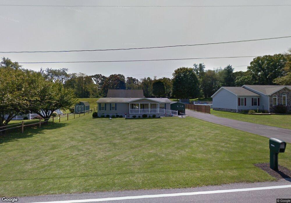
12264 Polktown Rd Waynesboro, PA 17268
Estimated Value: $147,438 - $303,000
--
Bed
--
Bath
1,404
Sq Ft
$171/Sq Ft
Est. Value
About This Home
This home is located at 12264 Polktown Rd, Waynesboro, PA 17268 and is currently estimated at $240,110, approximately $171 per square foot. 12264 Polktown Rd is a home located in Franklin County with nearby schools including Waynesboro Area Senior High School, St. Andrew Catholic School, and Noah's Ark Christian Child Care Center.
Ownership History
Date
Name
Owned For
Owner Type
Purchase Details
Closed on
Dec 2, 2014
Sold by
Stevens James H and Stevens Carol J
Bought by
Stevens Carol J
Current Estimated Value
Home Financials for this Owner
Home Financials are based on the most recent Mortgage that was taken out on this home.
Original Mortgage
$68,200
Interest Rate
4.02%
Mortgage Type
New Conventional
Create a Home Valuation Report for This Property
The Home Valuation Report is an in-depth analysis detailing your home's value as well as a comparison with similar homes in the area
Home Values in the Area
Average Home Value in this Area
Purchase History
| Date | Buyer | Sale Price | Title Company |
|---|---|---|---|
| Stevens Carol J | -- | None Available |
Source: Public Records
Mortgage History
| Date | Status | Borrower | Loan Amount |
|---|---|---|---|
| Closed | Stevens Carol J | $68,200 |
Source: Public Records
Tax History Compared to Growth
Tax History
| Year | Tax Paid | Tax Assessment Tax Assessment Total Assessment is a certain percentage of the fair market value that is determined by local assessors to be the total taxable value of land and additions on the property. | Land | Improvement |
|---|---|---|---|---|
| 2025 | $3,157 | $20,550 | $1,400 | $19,150 |
| 2024 | $3,064 | $20,550 | $1,400 | $19,150 |
| 2023 | $2,974 | $20,550 | $1,400 | $19,150 |
| 2022 | $2,886 | $20,550 | $1,400 | $19,150 |
| 2021 | $2,803 | $20,550 | $1,400 | $19,150 |
| 2020 | $2,760 | $20,550 | $1,400 | $19,150 |
| 2019 | $2,699 | $20,550 | $1,400 | $19,150 |
| 2018 | $2,611 | $20,550 | $1,400 | $19,150 |
| 2017 | $2,539 | $20,420 | $1,400 | $19,020 |
| 2016 | $585 | $20,420 | $1,400 | $19,020 |
| 2015 | $545 | $20,420 | $1,400 | $19,020 |
| 2014 | $545 | $20,420 | $1,400 | $19,020 |
Source: Public Records
Map
Nearby Homes
- 12222 Polktown Rd Unit 37
- 12222 Polktown Rd Unit 80
- 11890 Village Heights Dr
- 12041 Koons Rd
- 5377 Harrier Way
- 5385 Harrier Way
- TBD Whippet Trail
- 12708 Cold Springs Rd
- 6668 Marsh Rd
- 158 Bradford Spring Ct
- 504 Cleveland Ave
- 422 Cleveland Ave
- 435 Scott Ave
- 217 Fairview Ave
- 418 W 6th St
- 101 Fairview Ave
- 0 Westview Ave
- 25 Fairview Ave
- 208 Hamilton Ave
- 228 Hamilton Ave
- 12246 Polktown Rd
- 12280 Polktown Rd
- 12228 Polktown Rd
- 12296 Polktown Rd
- 12222 Polktown Rd Lot Unit 67
- 12222 Polktown Rd
- 12181 Polktown Rd
- 4840 Gray Hawk Dr
- 12224 Polktown Rd
- 12197 Polktown Rd
- 4828 Gray Hawk Dr
- 12222 Polktown Rd Unit LOT 34
- 12222 Polktown Rd Unit 113
- 12222 Polktown Rd Unit 54
- 12222 Polktown Rd Unit 111
- 12222 Polktown Rd Unit 33
- 12222 Polktown Rd Unit 103
- 12222 Polktown Rd Unit 92
- 12222 Polktown Rd Unit 43
- 12222 Polktown Rd Unit 30