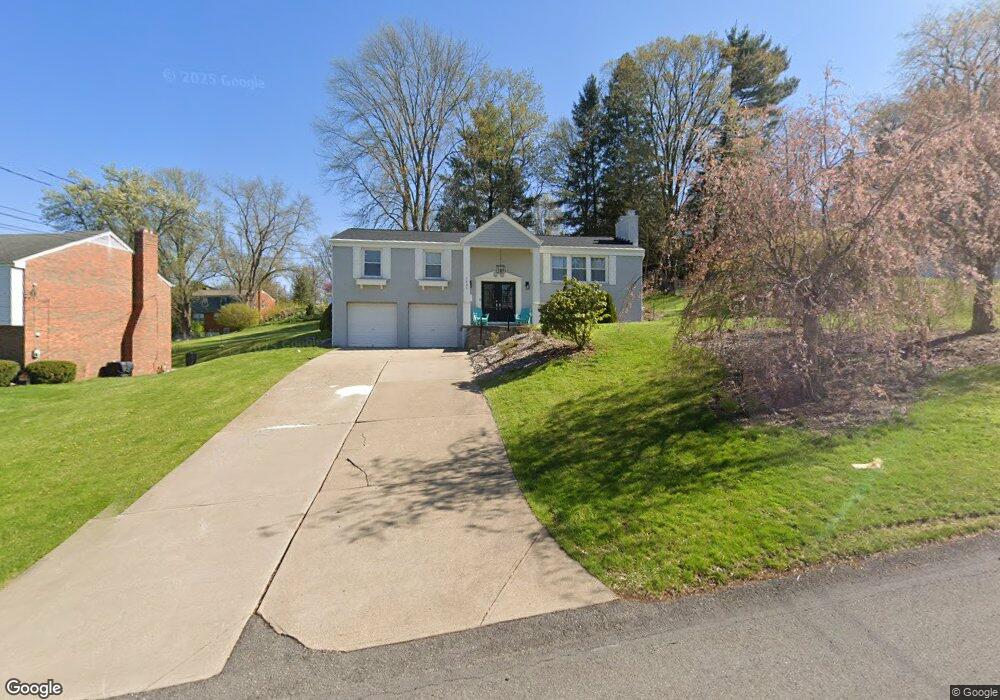
1227 Fernridge Dr Upper St. Clair, PA 15241
Estimated Value: $425,000 - $544,213
4
Beds
3
Baths
2,150
Sq Ft
$236/Sq Ft
Est. Value
About This Home
This home is located at 1227 Fernridge Dr, Upper St. Clair, PA 15241 and is currently estimated at $507,053, approximately $235 per square foot. 1227 Fernridge Dr is a home located in Allegheny County with nearby schools including Upper St. Clair High School and St. Louise De Marillac School.
Ownership History
Date
Name
Owned For
Owner Type
Purchase Details
Closed on
May 1, 2019
Sold by
Lahaye Maxwell Joseph and Blanchard Taryn Beth
Bought by
Meyer Aaron C and Meyer Emily
Current Estimated Value
Home Financials for this Owner
Home Financials are based on the most recent Mortgage that was taken out on this home.
Original Mortgage
$306,000
Outstanding Balance
$269,036
Interest Rate
4.2%
Mortgage Type
New Conventional
Estimated Equity
$238,017
Purchase Details
Closed on
Jan 23, 2018
Sold by
Lin Yu Sen and Shang Mei Ying
Bought by
Lahaye Maxwell Joseph and Shang Mei Ying
Purchase Details
Closed on
Aug 19, 2013
Sold by
Richetti Joseph
Bought by
Lin Yu Sen and Shang Mei Ying
Purchase Details
Closed on
Aug 25, 1978
Bought by
Richetti Joseph and Richetti Rafelina
Create a Home Valuation Report for This Property
The Home Valuation Report is an in-depth analysis detailing your home's value as well as a comparison with similar homes in the area
Home Values in the Area
Average Home Value in this Area
Purchase History
| Date | Buyer | Sale Price | Title Company |
|---|---|---|---|
| Meyer Aaron C | $360,000 | Blue Sky Closing Svcs Inc | |
| Lahaye Maxwell Joseph | $210,000 | Keystone Closing Svcs Llc | |
| Lin Yu Sen | $235,000 | -- | |
| Richetti Joseph | $77,000 | -- |
Source: Public Records
Mortgage History
| Date | Status | Borrower | Loan Amount |
|---|---|---|---|
| Open | Meyer Aaron C | $306,000 |
Source: Public Records
Tax History Compared to Growth
Tax History
| Year | Tax Paid | Tax Assessment Tax Assessment Total Assessment is a certain percentage of the fair market value that is determined by local assessors to be the total taxable value of land and additions on the property. | Land | Improvement |
|---|---|---|---|---|
| 2025 | $11,164 | $292,300 | $80,000 | $212,300 |
| 2024 | $11,164 | $292,300 | $80,000 | $212,300 |
| 2023 | $10,851 | $292,300 | $80,000 | $212,300 |
| 2022 | $10,592 | $292,300 | $80,000 | $212,300 |
| 2021 | $1,383 | $292,300 | $80,000 | $212,300 |
| 2020 | $6,988 | $292,300 | $80,000 | $212,300 |
| 2019 | $6,884 | $200,000 | $80,000 | $120,000 |
| 2018 | $1,712 | $200,000 | $80,000 | $120,000 |
| 2017 | $6,579 | $200,000 | $80,000 | $120,000 |
| 2016 | $946 | $200,000 | $80,000 | $120,000 |
| 2015 | $946 | $217,000 | $80,000 | $137,000 |
| 2014 | $6,675 | $217,000 | $80,000 | $137,000 |
Source: Public Records
Map
Nearby Homes
- 1315 Old Meadow Rd
- 1216 Rolling Meadow Rd
- 1251 Greystone Dr
- 1331 Morrow Rd
- 1051 Grandview Ave
- 2370 Morrow Rd
- 1005 Tall Trees Dr
- 1435 Morrow Rd
- 2350 Morrow Rd
- 921 McLaughlin Run Rd
- 909 McLaughlin Run Rd
- 2301 Southampton Dr
- 1586 Pinehurst Dr Unit 2
- 839 McLaughlin Run Rd
- [Lot 135] 1464 Dominion Heights
- 654 Gregg Ave
- 808 Mill St
- 626 Baldwin St
- 652 Bower Hill Rd
- [Lot 414] 1501 Bedner Ct
- 1227 Fernridge Dr
- 1221 Fernridge Dr
- 1231 Fernridge Dr
- 1230 Firston Cir
- 1318 Old Meadow Rd
- 1228 Firston Cir
- 1228 Fernridge Dr
- 1235 Fernridge Dr
- 1222 Fernridge Dr
- 1234 Fernridge Dr
- 1110 Firston Cir
- 1236 Firston Cir
- 1216 Fernridge Dr
- 1314 Old Meadow Rd
- 1237 Fernridge Dr
- 1238 Fernridge Dr
- 1223 Rolling Meadow Rd
- 1227 Rolling Meadow Rd
- 1231 Rolling Meadow Rd
- 1319 Old Meadow Rd