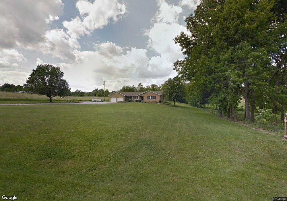
1227 Hoover Rd Mansfield, OH 44903
Estimated Value: $353,000 - $370,000
3
Beds
3
Baths
2,250
Sq Ft
$161/Sq Ft
Est. Value
About This Home
This home is located at 1227 Hoover Rd, Mansfield, OH 44903 and is currently estimated at $362,398, approximately $161 per square foot. 1227 Hoover Rd is a home located in Richland County with nearby schools including Madison High School, Temple-Christian School, and St. Mary Catholic School.
Ownership History
Date
Name
Owned For
Owner Type
Purchase Details
Closed on
Dec 15, 2021
Sold by
Anderkin E Irene E and Anderkin Ethel Irene
Bought by
Garcia Donna J and Garcia Donna J
Current Estimated Value
Home Financials for this Owner
Home Financials are based on the most recent Mortgage that was taken out on this home.
Original Mortgage
$247,600
Outstanding Balance
$227,328
Interest Rate
2.98%
Mortgage Type
VA
Estimated Equity
$135,070
Purchase Details
Closed on
Jun 18, 1990
Create a Home Valuation Report for This Property
The Home Valuation Report is an in-depth analysis detailing your home's value as well as a comparison with similar homes in the area
Home Values in the Area
Average Home Value in this Area
Purchase History
| Date | Buyer | Sale Price | Title Company |
|---|---|---|---|
| Garcia Donna J | $280,000 | None Available | |
| -- | $13,000 | -- |
Source: Public Records
Mortgage History
| Date | Status | Borrower | Loan Amount |
|---|---|---|---|
| Open | Garcia Donna J | $247,600 |
Source: Public Records
Tax History Compared to Growth
Tax History
| Year | Tax Paid | Tax Assessment Tax Assessment Total Assessment is a certain percentage of the fair market value that is determined by local assessors to be the total taxable value of land and additions on the property. | Land | Improvement |
|---|---|---|---|---|
| 2024 | $4,694 | $96,780 | $12,150 | $84,630 |
| 2023 | $4,694 | $96,780 | $12,150 | $84,630 |
| 2022 | $3,817 | $69,910 | $10,860 | $59,050 |
| 2021 | $3,339 | $69,910 | $10,860 | $59,050 |
| 2020 | $3,364 | $69,910 | $10,860 | $59,050 |
| 2019 | $3,125 | $59,250 | $9,210 | $50,040 |
| 2018 | $2,921 | $59,250 | $9,210 | $50,040 |
| 2017 | $2,948 | $59,250 | $9,210 | $50,040 |
| 2016 | $3,035 | $60,540 | $8,750 | $51,790 |
| 2015 | $3,035 | $60,540 | $8,750 | $51,790 |
| 2014 | $2,884 | $60,540 | $8,750 | $51,790 |
| 2012 | $1,445 | $63,730 | $9,210 | $54,520 |
Source: Public Records
Map
Nearby Homes
- 1791 Beal Rd
- 1171 Hoover Rd
- 0 Hoover Rd
- 1585 Beal Rd
- 1292 Wolford Rd
- 920 Piper Rd
- 1245 N Stewart Rd
- 1151 Beal Rd
- 1158 Delwood Rd
- 1150 Delwood Dr
- 1106 Keller Dr Unit 1108
- 1806 Richard Dr
- 1951 Woodmont Rd
- 1140 5th Ave
- 903 Mayflower Ave
- 2202 Lakewood Dr
- 1997 Hout Rd
- 0 Wesley
- 1910 Crider Rd
- 735 Pennsylvania Ave
- 1761 Beal Rd
- 1192 Hoover Rd
- 1745 Beal Rd
- 1817 Beal Rd
- 1271 Bentwood Ct
- 1735 Beal Rd
- 1281 Bentwood Ct
- 1760 Beal Rd
- 1240 Bentwood Ct
- 1725 Beal Rd
- 1821 Beal Rd
- 1145 Hoover Rd
- 1286 Bentwood Ct
- 1703 Beal Rd Unit 1705
- 1703 1705 Beal Rd
- 1705 Beal Rd
- 1133 Hoover Rd
- 1710 Beal Rd
- 1311 Bentwood Ct
- 1144 Hoover Rd