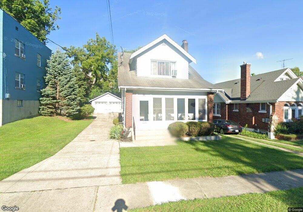
1227 McKeone Ave Cincinnati, OH 45205
West Price Hill NeighborhoodEstimated Value: $134,000 - $178,000
2
Beds
1
Bath
1,256
Sq Ft
$118/Sq Ft
Est. Value
About This Home
This home is located at 1227 McKeone Ave, Cincinnati, OH 45205 and is currently estimated at $148,320, approximately $118 per square foot. 1227 McKeone Ave is a home located in Hamilton County with nearby schools including Carson School, Gilbert A. Dater High School, and Western Hills High School.
Ownership History
Date
Name
Owned For
Owner Type
Purchase Details
Closed on
Aug 31, 2006
Sold by
Colley Jeanne Lillis
Bought by
Jackson Kenneth M and Jackson Priscilla J
Current Estimated Value
Home Financials for this Owner
Home Financials are based on the most recent Mortgage that was taken out on this home.
Original Mortgage
$70,650
Outstanding Balance
$50,565
Interest Rate
10.55%
Mortgage Type
Unknown
Estimated Equity
$97,755
Purchase Details
Closed on
Nov 13, 1996
Sold by
Muething Jo Ann E
Bought by
C D M Inc
Create a Home Valuation Report for This Property
The Home Valuation Report is an in-depth analysis detailing your home's value as well as a comparison with similar homes in the area
Home Values in the Area
Average Home Value in this Area
Purchase History
| Date | Buyer | Sale Price | Title Company |
|---|---|---|---|
| Jackson Kenneth M | $79,000 | Federated Land Title Agency | |
| C D M Inc | $1,000 | -- |
Source: Public Records
Mortgage History
| Date | Status | Borrower | Loan Amount |
|---|---|---|---|
| Open | Jackson Kenneth M | $70,650 |
Source: Public Records
Tax History Compared to Growth
Tax History
| Year | Tax Paid | Tax Assessment Tax Assessment Total Assessment is a certain percentage of the fair market value that is determined by local assessors to be the total taxable value of land and additions on the property. | Land | Improvement |
|---|---|---|---|---|
| 2024 | $2,109 | $35,007 | $5,208 | $29,799 |
| 2023 | $2,154 | $35,007 | $5,208 | $29,799 |
| 2022 | $1,278 | $18,519 | $5,173 | $13,346 |
| 2021 | $1,229 | $18,519 | $5,173 | $13,346 |
| 2020 | $1,261 | $18,519 | $5,173 | $13,346 |
| 2019 | $1,254 | $16,835 | $4,704 | $12,131 |
| 2018 | $1,256 | $16,835 | $4,704 | $12,131 |
| 2017 | $1,194 | $16,835 | $4,704 | $12,131 |
| 2016 | $1,426 | $19,877 | $5,026 | $14,851 |
| 2015 | $1,286 | $19,877 | $5,026 | $14,851 |
| 2014 | $1,295 | $19,877 | $5,026 | $14,851 |
| 2013 | $1,495 | $22,589 | $5,712 | $16,877 |
Source: Public Records
Map
Nearby Homes
- 1226 Rutledge Ave
- 1213 Texas Ave
- 1227 Texas Ave
- 1205 Amanda Place
- 1225 Amanda Place
- 4136 Saint Lawrence Ave
- 1026 Schiff Ave
- 1006 Kreis Ln
- 1239 Sliker Ave
- 1113 Gilsey Ave
- 1002 Winfield Ave
- 1057 Gilsey Ave
- 4638 Glenway Ave
- 900 Kreis Ln
- 4526 Clearview Ave
- 2403 Glenway Ave
- 4549 Clearview Ave
- 4553 Clearview Ave
- 904 Rosemont Ave
- 1617 Dewey Ave
- 1231 McKeone Ave
- 1223 McKeone Ave
- 1221 McKeone Ave
- 1235 McKeone Ave
- 1239 McKeone Ave
- 1238 Rutledge Ave
- 1217 McKeone Ave
- 1218 McKeone Ave
- 1242 Rutledge Ave
- 1216 McKeone Ave
- 1241 McKeone Ave
- 1214 McKeone Ave
- 1234 McKeone Ave
- 1211 McKeone Ave
- 1210 Rutledge Ave
- 1248 Rutledge Ave
- 1243 McKeone Ave
- 1238 McKeone Ave
- 1250 Rutledge Ave
- 1242 McKeone Ave