Estimated Value: $78,000 - $93,000
2
Beds
1
Bath
891
Sq Ft
$96/Sq Ft
Est. Value
About This Home
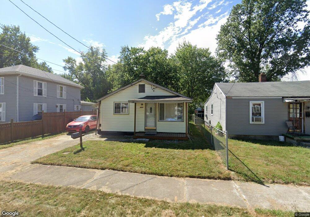
This home is located at 1227 N Union St, Lima, OH 45801 and is currently estimated at $85,939, approximately $96 per square foot. 1227 N Union St is a home located in Allen County with nearby schools including Independence Elementary School, Lima North Middle School, and Lima West Middle School.
Ownership History
Date
Name
Owned For
Owner Type
Purchase Details
Closed on
Oct 6, 2024
Sold by
Potts Patricia and Potts Thomas
Bought by
Davis Catherine Potts
Current Estimated Value
Purchase Details
Closed on
Jul 8, 2014
Sold by
Potts Mary Sue
Bought by
Potts Robert W
Purchase Details
Closed on
Aug 4, 1994
Sold by
Hahn Tim
Bought by
Lawrence Margaret
Home Financials for this Owner
Home Financials are based on the most recent Mortgage that was taken out on this home.
Original Mortgage
$33,800
Interest Rate
8.53%
Mortgage Type
FHA
Purchase Details
Closed on
Mar 13, 1987
Bought by
Hahn Tim
Create a Home Valuation Report for This Property
The Home Valuation Report is an in-depth analysis detailing your home's value as well as a comparison with similar homes in the area
Home Values in the Area
Average Home Value in this Area
Purchase History
| Date | Buyer | Sale Price | Title Company |
|---|---|---|---|
| Davis Catherine Potts | $28,500 | None Listed On Document | |
| Potts Robert W | -- | None Available | |
| Lawrence Margaret | $33,500 | -- | |
| Hahn Tim | $18,200 | -- |
Source: Public Records
Mortgage History
| Date | Status | Borrower | Loan Amount |
|---|---|---|---|
| Previous Owner | Lawrence Margaret | $33,800 |
Source: Public Records
Tax History Compared to Growth
Tax History
| Year | Tax Paid | Tax Assessment Tax Assessment Total Assessment is a certain percentage of the fair market value that is determined by local assessors to be the total taxable value of land and additions on the property. | Land | Improvement |
|---|---|---|---|---|
| 2024 | $724 | $19,010 | $3,570 | $15,440 |
| 2023 | $667 | $14,950 | $2,800 | $12,150 |
| 2022 | $662 | $14,950 | $2,800 | $12,150 |
| 2021 | $700 | $14,950 | $2,800 | $12,150 |
| 2020 | $707 | $13,440 | $2,730 | $10,710 |
| 2019 | $707 | $13,440 | $2,730 | $10,710 |
| 2018 | $718 | $13,440 | $2,730 | $10,710 |
| 2017 | $710 | $13,440 | $2,730 | $10,710 |
| 2016 | $717 | $13,440 | $2,730 | $10,710 |
| 2015 | $712 | $13,440 | $2,730 | $10,710 |
| 2014 | $712 | $13,270 | $2,660 | $10,610 |
| 2013 | $693 | $13,270 | $2,660 | $10,610 |
Source: Public Records
Map
Nearby Homes
- 1200 N Main St
- 340 W Robb Ave
- 939 N West St
- 123 Flanders Ave
- 128 E Lane Ave
- 820 N Main St
- 222 W Grand Ave
- 711 Taylor Ave
- 608 W O'Connor Ave
- 610 W Robb Ave
- 400 W Northern Ave
- 616 N Elizabeth St
- 410 W Northern Ave
- 105 Watt Ave
- 606 N West St
- 416 Hazel Ave
- 622 N Jefferson St
- 765 W O'Connor Ave
- 1116 Belvidere Ave
- 14 House Package
- 1225 N Union St
- 1231 N Union St
- 1233 N Union St
- 1217 N Union St
- 1226 N Union St
- 1228 N Union St
- 1230 N Union St
- 1237 N Union St
- 1213 N Union St
- 1232 N Union St
- 1234 N Union St
- 1239 N Union St
- 118 E Robb Ave
- 1229 N Central Ave
- 116 E Robb Ave
- 1236 N Union St
- 112 E Robb Ave
- 141 E Oconnor Ave
- 131 E Oconnor Ave