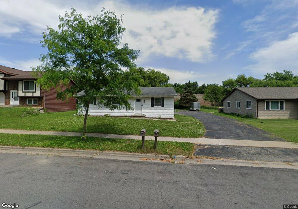
1227 S Thompson Dr Madison, WI 53716
Elvehjem NeighborhoodEstimated Value: $421,000 - $476,081
6
Beds
2
Baths
2,125
Sq Ft
$213/Sq Ft
Est. Value
About This Home
This home is located at 1227 S Thompson Dr, Madison, WI 53716 and is currently estimated at $453,270, approximately $213 per square foot. 1227 S Thompson Dr is a home located in Dane County with nearby schools including Elvehjem Elementary School, Sennett Middle School, and La Follette High School.
Ownership History
Date
Name
Owned For
Owner Type
Purchase Details
Closed on
May 15, 2025
Sold by
Miller Peter J and Miller Rachel
Bought by
Miller Property Group Llc
Current Estimated Value
Purchase Details
Closed on
Apr 29, 2015
Sold by
Sorenson Keith A and Sorenson Carole A
Bought by
Miller Peter and Miller Rachel
Home Financials for this Owner
Home Financials are based on the most recent Mortgage that was taken out on this home.
Original Mortgage
$138,750
Interest Rate
3.68%
Mortgage Type
New Conventional
Create a Home Valuation Report for This Property
The Home Valuation Report is an in-depth analysis detailing your home's value as well as a comparison with similar homes in the area
Home Values in the Area
Average Home Value in this Area
Purchase History
| Date | Buyer | Sale Price | Title Company |
|---|---|---|---|
| Miller Property Group Llc | -- | None Listed On Document | |
| Miller Peter | $185,000 | None Available |
Source: Public Records
Mortgage History
| Date | Status | Borrower | Loan Amount |
|---|---|---|---|
| Previous Owner | Miller Peter | $138,750 |
Source: Public Records
Tax History Compared to Growth
Tax History
| Year | Tax Paid | Tax Assessment Tax Assessment Total Assessment is a certain percentage of the fair market value that is determined by local assessors to be the total taxable value of land and additions on the property. | Land | Improvement |
|---|---|---|---|---|
| 2024 | $14,958 | $427,200 | $92,800 | $334,400 |
| 2023 | $7,011 | $388,400 | $87,400 | $301,000 |
| 2021 | $5,971 | $281,700 | $77,200 | $204,500 |
| 2020 | $5,675 | $256,100 | $70,200 | $185,900 |
| 2019 | $5,780 | $243,900 | $66,900 | $177,000 |
| 2018 | $5,111 | $227,900 | $66,900 | $161,000 |
| 2017 | $5,455 | $203,500 | $60,800 | $142,700 |
| 2016 | $4,355 | $185,000 | $60,800 | $124,200 |
| 2015 | $4,772 | $196,400 | $60,800 | $135,600 |
| 2014 | $4,680 | $196,400 | $60,800 | $135,600 |
| 2013 | $5,474 | $196,400 | $60,800 | $135,600 |
Source: Public Records
Map
Nearby Homes
- 1214 Bay Ridge Rd
- 6 Eldon Ct
- 15 Eastridge Ct
- 1510 Ellen Ave
- 1409 Lynchburg Trail
- 10 Vienna Cir
- 1621 Droster Rd
- 5827 Gemini Dr Unit 5827
- 1634 Kings Mill Way Unit 308
- 1609 Ellen Ave
- 1625 Kings Mill Way Unit 104
- 1625 Kings Mill Way Unit 311
- 1629 Kings Mill Way Unit 312
- 1629 Kings Mill Way Unit 209
- 1617 National Ave
- 6132 Culpepper Ln
- 6147 Dell Dr Unit 1
- 6155 Dell Dr Unit 3
- 702 Copernicus Way
- 540 Apollo Way
- 1225 S Thompson Dr
- 1229 S Thompson Dr
- 1221 S Thompson Dr
- 1231 S Thompson Dr
- 1223 S Thompson Dr
- 1303 S Thompson Dr
- 1219 S Thompson Dr
- 1228 S Thompson Dr
- 1232 S Thompson Dr
- 1224 S Thompson Dr
- 1226 S Thompson Dr
- 1307 S Thompson Dr
- 1215 S Thompson Dr
- 1222 S Thompson Dr
- 1230 S Thompson Dr
- 1305 S Thompson Dr
- 1218 S Thompson Dr
- 1302 S Thompson Dr
- 1304 S Thompson Dr
- 1216 S Thompson Dr Unit 7