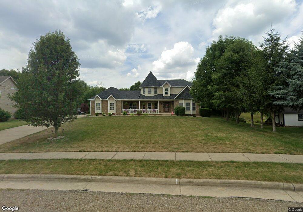
1227 W Chester Dr Louisville, OH 44641
Estimated Value: $369,000 - $460,935
3
Beds
3
Baths
2,520
Sq Ft
$165/Sq Ft
Est. Value
About This Home
This home is located at 1227 W Chester Dr, Louisville, OH 44641 and is currently estimated at $416,234, approximately $165 per square foot. 1227 W Chester Dr is a home located in Stark County with nearby schools including Louisville High School and St. Thomas Aquinas High School & Middle School.
Ownership History
Date
Name
Owned For
Owner Type
Purchase Details
Closed on
Jul 22, 2022
Sold by
Millard David L
Bought by
Dunn Scott A and Dunn Rachel M
Current Estimated Value
Home Financials for this Owner
Home Financials are based on the most recent Mortgage that was taken out on this home.
Original Mortgage
$356,200
Outstanding Balance
$339,291
Interest Rate
5.23%
Mortgage Type
New Conventional
Estimated Equity
$76,943
Purchase Details
Closed on
Dec 31, 2018
Sold by
Millard Kristin M
Bought by
Millard David L
Purchase Details
Closed on
Jan 17, 2005
Sold by
Jencar Developers Inc
Bought by
Millard David L and Millard Kristin M
Home Financials for this Owner
Home Financials are based on the most recent Mortgage that was taken out on this home.
Original Mortgage
$220,000
Interest Rate
6.5%
Mortgage Type
Construction
Create a Home Valuation Report for This Property
The Home Valuation Report is an in-depth analysis detailing your home's value as well as a comparison with similar homes in the area
Home Values in the Area
Average Home Value in this Area
Purchase History
| Date | Buyer | Sale Price | Title Company |
|---|---|---|---|
| Dunn Scott A | $375,000 | None Listed On Document | |
| Millard David L | -- | None Available | |
| Millard David L | $48,000 | -- |
Source: Public Records
Mortgage History
| Date | Status | Borrower | Loan Amount |
|---|---|---|---|
| Open | Dunn Scott A | $356,200 | |
| Previous Owner | Millard David L | $220,000 |
Source: Public Records
Tax History Compared to Growth
Tax History
| Year | Tax Paid | Tax Assessment Tax Assessment Total Assessment is a certain percentage of the fair market value that is determined by local assessors to be the total taxable value of land and additions on the property. | Land | Improvement |
|---|---|---|---|---|
| 2025 | -- | $150,430 | $39,130 | $111,300 |
| 2024 | -- | $155,330 | $44,030 | $111,300 |
| 2023 | $4,710 | $109,350 | $31,120 | $78,230 |
| 2022 | $4,718 | $109,350 | $31,120 | $78,230 |
| 2021 | $4,731 | $109,350 | $31,120 | $78,230 |
| 2020 | $3,890 | $97,620 | $28,040 | $69,580 |
| 2019 | $4,005 | $100,870 | $31,150 | $69,720 |
| 2018 | $4,122 | $100,870 | $31,150 | $69,720 |
| 2017 | $3,838 | $90,620 | $29,440 | $61,180 |
| 2016 | $3,916 | $90,620 | $29,440 | $61,180 |
| 2015 | $3,928 | $90,620 | $29,440 | $61,180 |
| 2014 | $1,970 | $85,160 | $27,650 | $57,510 |
| 2013 | $1,989 | $85,160 | $27,650 | $57,510 |
Source: Public Records
Map
Nearby Homes
- 1175 Sturbridge Dr
- 1149 Sturbridge Dr
- 0 Brookridge Ave
- 0 Glenbar St
- 3580 Brookridge Ave Lot 15
- 524 Glenbar St
- 300 Kennedy St
- 248 Menegay Rd
- 1561 Noel St
- 201 Indiana Ave
- 428 Honeycrisp Dr NE
- 3047 Mcintosh Dr NE
- 432 Honeycrisp Dr NE
- 2962 Mcintosh Dr NE
- 2963 Mcintosh Dr NE
- 430 Honeycrisp Dr NE
- 2957 Mcintosh Dr NE
- 5474 Ravenna Ave
- 6083 Apple St
- 316 E Reno Dr
- 1221 W Chester Dr
- 1205 W Chester Dr
- 1245 Filomena Cir
- 1255 Filomena Cir
- 1267 Filomena Cir
- 1225 Filomena Cir
- 1213 W Chester Dr
- 1216 W Chester Dr
- 1279 Filomena Cir
- 56 V/L W Chester Dr
- 0 W Chester Dr
- 1215 Filomena Cir
- 1204 W Chester Dr
- 1224 Filomena Cir
- 1285 Filomena Cir
- 1244 Filomena Cir
- 1256 Filomena Cir
- 1288 Filomena Cir
- 1268 Filomena Cir
- 1205 Filomena Cir