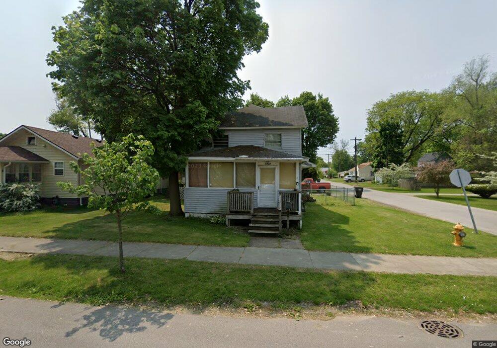
1227 W Hubbard Ave Elkhart, IN 46516
Impact NeighborhoodEstimated Value: $112,101 - $127,000
3
Beds
1
Bath
1,283
Sq Ft
$91/Sq Ft
Est. Value
About This Home
This home is located at 1227 W Hubbard Ave, Elkhart, IN 46516 and is currently estimated at $117,275, approximately $91 per square foot. 1227 W Hubbard Ave is a home located in Elkhart County with nearby schools including Hawthorne Elementary School, Roosevelt STEAM Academy, and West Side Middle School.
Ownership History
Date
Name
Owned For
Owner Type
Purchase Details
Closed on
Feb 8, 2023
Sold by
Miller Kevin Nelson
Bought by
Miller Kevin Nelson and Miller Diana Carol
Current Estimated Value
Purchase Details
Closed on
Jul 11, 2008
Sold by
Fannie Mae
Bought by
Miller Kevin N
Home Financials for this Owner
Home Financials are based on the most recent Mortgage that was taken out on this home.
Original Mortgage
$27,111
Interest Rate
6.36%
Mortgage Type
FHA
Purchase Details
Closed on
Jan 30, 2008
Sold by
Shoufler David W
Bought by
Federal National Mortgage Association
Create a Home Valuation Report for This Property
The Home Valuation Report is an in-depth analysis detailing your home's value as well as a comparison with similar homes in the area
Home Values in the Area
Average Home Value in this Area
Purchase History
| Date | Buyer | Sale Price | Title Company |
|---|---|---|---|
| Miller Kevin Nelson | -- | -- | |
| Miller Kevin N | -- | Title One | |
| Federal National Mortgage Association | $39,922 | None Available |
Source: Public Records
Mortgage History
| Date | Status | Borrower | Loan Amount |
|---|---|---|---|
| Previous Owner | Miller Kevin N | $27,111 |
Source: Public Records
Tax History Compared to Growth
Tax History
| Year | Tax Paid | Tax Assessment Tax Assessment Total Assessment is a certain percentage of the fair market value that is determined by local assessors to be the total taxable value of land and additions on the property. | Land | Improvement |
|---|---|---|---|---|
| 2024 | $62 | $61,700 | $8,700 | $53,000 |
| 2022 | $62 | $53,800 | $8,700 | $45,100 |
| 2021 | $26 | $49,300 | $8,700 | $40,600 |
| 2020 | $15 | $47,200 | $8,700 | $38,500 |
| 2019 | $15 | $43,400 | $8,700 | $34,700 |
| 2018 | $15 | $40,300 | $8,700 | $31,600 |
| 2017 | $15 | $38,400 | $8,700 | $29,700 |
| 2016 | $15 | $37,000 | $8,700 | $28,300 |
| 2014 | $262 | $37,600 | $8,700 | $28,900 |
| 2013 | $262 | $38,200 | $8,700 | $29,500 |
Source: Public Records
Map
Nearby Homes
- 919 W Wolf Ave
- 714 W Blaine Ave
- 1803 W Indiana Ave
- 1007 Mason St
- 1523 Navajo St
- 1301 Harrison St
- 1309 Harrison St
- 409 W Wolf Ave
- 421 W Garfield Ave
- 1529 Okema St
- 721 Harrison St
- 711 W Marion St
- 607 W Marion St
- 2301 Aurora Ave
- 1011 Benham Ct
- 1202 S Shore Dr
- Lot 34 Auburn Estates
- VL El Paco Manor
- Lot 13 Parkway Ave
- Lot 12 Parkway Ave
- 1225 W Hubbard Ave
- 2020 13th St
- 1307 W Hubbard Ave
- 1215 W Hubbard Ave
- 2015 13th St
- 1220 Concord Ave
- 1309 W Hubbard Ave
- 1300 Concord Ave
- 1226 W Hubbard Ave
- 1911 13th St
- 1216 W Hubbard Ave
- 1214 Concord Ave
- 1306 Concord Ave
- 2001 Oakland Ave
- 1311 W Hubbard Ave
- 2007 Oakland Ave
- 1308 W Hubbard Ave
- 1316 Concord Ave
- 1316 Concord Ave
- 1313 W Hubbard Ave