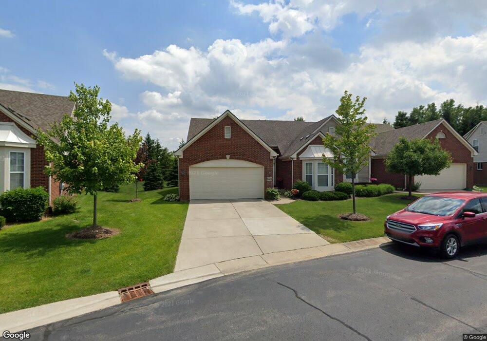
1228 Andover Cir Unit Bldg-Unit Commerce Township, MI 48390
Estimated Value: $378,801 - $428,000
2
Beds
3
Baths
1,557
Sq Ft
$257/Sq Ft
Est. Value
About This Home
This home is located at 1228 Andover Cir Unit Bldg-Unit, Commerce Township, MI 48390 and is currently estimated at $400,700, approximately $257 per square foot. 1228 Andover Cir Unit Bldg-Unit is a home located in Oakland County with nearby schools including Loon Lake Elementary School, Sarah G. Banks Middle School, and Walled Lake Central High School.
Ownership History
Date
Name
Owned For
Owner Type
Purchase Details
Closed on
Feb 22, 2018
Sold by
Burns Karen A
Bought by
Hensel Perpich Virginia Louise
Current Estimated Value
Home Financials for this Owner
Home Financials are based on the most recent Mortgage that was taken out on this home.
Original Mortgage
$90,000
Outstanding Balance
$76,526
Interest Rate
4.15%
Mortgage Type
New Conventional
Estimated Equity
$324,174
Purchase Details
Closed on
Nov 12, 2013
Sold by
Burns Raymond T and Burns Karen A
Bought by
Burns Raymond T and Burns Karen A
Purchase Details
Closed on
Mar 9, 2011
Sold by
Commerce Mb Llc
Bought by
Burns Raymond T and Burns Karen A
Home Financials for this Owner
Home Financials are based on the most recent Mortgage that was taken out on this home.
Original Mortgage
$165,615
Interest Rate
4.88%
Mortgage Type
VA
Create a Home Valuation Report for This Property
The Home Valuation Report is an in-depth analysis detailing your home's value as well as a comparison with similar homes in the area
Home Values in the Area
Average Home Value in this Area
Purchase History
| Date | Buyer | Sale Price | Title Company |
|---|---|---|---|
| Hensel Perpich Virginia Louise | $286,000 | Fidelity National Title | |
| Burns Raymond T | -- | None Available | |
| Burns Raymond T | $160,325 | Greco |
Source: Public Records
Mortgage History
| Date | Status | Borrower | Loan Amount |
|---|---|---|---|
| Open | Hensel Perpich Virginia Louise | $90,000 | |
| Previous Owner | Burns Raymond T | $165,615 |
Source: Public Records
Tax History Compared to Growth
Tax History
| Year | Tax Paid | Tax Assessment Tax Assessment Total Assessment is a certain percentage of the fair market value that is determined by local assessors to be the total taxable value of land and additions on the property. | Land | Improvement |
|---|---|---|---|---|
| 2024 | $3,199 | $179,490 | $0 | $0 |
| 2023 | $3,016 | $164,130 | $0 | $0 |
| 2022 | $4,625 | $158,370 | $0 | $0 |
| 2021 | $4,541 | $153,030 | $0 | $0 |
| 2020 | $2,980 | $143,580 | $0 | $0 |
| 2019 | $4,329 | $139,790 | $0 | $0 |
| 2018 | $194 | $126,681 | $0 | $0 |
| 2017 | $201 | $0 | $0 | $0 |
| 2016 | $191 | $0 | $0 | $0 |
| 2015 | -- | $0 | $0 | $0 |
| 2014 | -- | $92,000 | $0 | $0 |
| 2011 | -- | $43,750 | $0 | $0 |
Source: Public Records
Map
Nearby Homes
- 1338 Andover Cir
- 1128 Andover Cir Unit 88
- 1104 Andover Cir Unit 92
- 1179 Andover Cir Unit 48
- 1736 Pine Forest Dr
- 1500 Rustic Ln
- 1431 Lee Wood Ridge Rd
- 2000 Twin Sun Cir
- 1625 Mc Coy St
- 1860 Twin Sun Cir
- 1599 Chanticlair Cir
- 1561 Waters Edge Ct
- 1588 Ladd Rd
- 770 Brushwood Dr
- 27202 Chesapeake Cir Unit 320
- 24202 Chesapeake Cir Unit 287
- 853 Adelaide Dr
- 1442 Sunset Dr
- 420 Wellsboro St
- 688 Wolverine Dr
- 1388 Andover Cir Unit 122
- 1386 Gloucester Ct Unit 13
- 1549 Andover Cir
- 1074 Andover Cir Unit Bldg-Unit
- 1255 Andover Cir Unit 56
- 1288 Andover Cir Unit 71
- 1266 Andover Cir Unit 73
- 1304 Andover Cir Unit 69
- 1316 Andover Cir Unit 67
- 1329 Andover Cir Unit 60
- 1338 Andover Cir Unit 65
- 1354 Andover Cir Unit 63
- 1345 Andover Cir Unit 62
- 1341 Andover Cir Unit 61
- 1398 Gloucester Ct Unit 13
- 1645 Andover Cir Unit 26
- 1629 Andover Cir Unit 24
- 1641 Andover Cir Unit 25
- 1669 Andover Cir Unit 28
- 1672 Andover Cir Unit 4