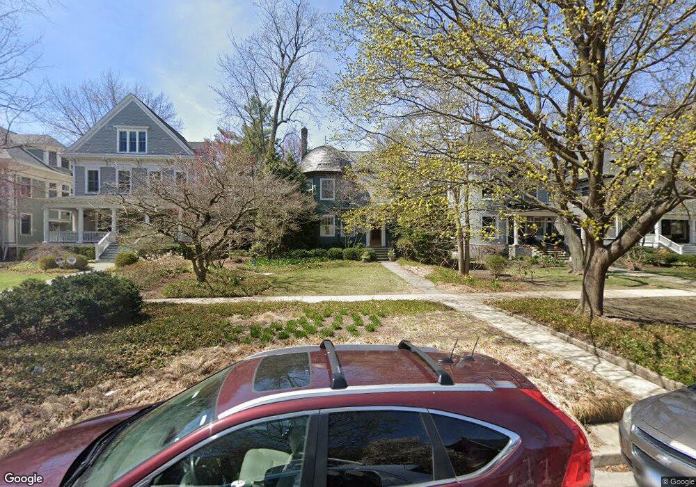
1228 Judson Ave Evanston, IL 60202
Southeast Evanston NeighborhoodEstimated Value: $1,295,000 - $1,523,000
4
Beds
3
Baths
3,098
Sq Ft
$449/Sq Ft
Est. Value
About This Home
This home is located at 1228 Judson Ave, Evanston, IL 60202 and is currently estimated at $1,392,294, approximately $449 per square foot. 1228 Judson Ave is a home located in Cook County with nearby schools including Dewey Elementary School, Washington Elementary School, and Nichols Middle School.
Ownership History
Date
Name
Owned For
Owner Type
Purchase Details
Closed on
Dec 11, 2003
Sold by
Otting Andrew J and Otting Laura
Bought by
Otting Laura A and Otting Andrew J
Current Estimated Value
Purchase Details
Closed on
Jan 13, 2003
Sold by
Hohnhold Laura
Bought by
Otting Andrew J and Hohnhold Laura
Home Financials for this Owner
Home Financials are based on the most recent Mortgage that was taken out on this home.
Original Mortgage
$375,000
Interest Rate
6.13%
Purchase Details
Closed on
Aug 31, 1995
Sold by
Otting Andrew J and Hohnhold Laura
Bought by
Hohnhold Laura
Purchase Details
Closed on
Mar 10, 1994
Sold by
Otting Andrew J and Honhold Laura
Bought by
Otting Andrew J and Hohnhold Laura
Create a Home Valuation Report for This Property
The Home Valuation Report is an in-depth analysis detailing your home's value as well as a comparison with similar homes in the area
Home Values in the Area
Average Home Value in this Area
Purchase History
| Date | Buyer | Sale Price | Title Company |
|---|---|---|---|
| Otting Laura A | -- | -- | |
| Otting Andrew J | -- | Cti | |
| Hohnhold Laura | -- | -- | |
| Otting Andrew J | -- | -- |
Source: Public Records
Mortgage History
| Date | Status | Borrower | Loan Amount |
|---|---|---|---|
| Closed | Otting Andrew J | $375,000 |
Source: Public Records
Tax History Compared to Growth
Tax History
| Year | Tax Paid | Tax Assessment Tax Assessment Total Assessment is a certain percentage of the fair market value that is determined by local assessors to be the total taxable value of land and additions on the property. | Land | Improvement |
|---|---|---|---|---|
| 2024 | $23,167 | $101,665 | $23,750 | $77,915 |
| 2023 | $22,185 | $101,665 | $23,750 | $77,915 |
| 2022 | $22,185 | $101,665 | $23,750 | $77,915 |
| 2021 | $17,326 | $71,284 | $17,100 | $54,184 |
| 2020 | $19,921 | $79,184 | $17,100 | $62,084 |
| 2019 | $21,488 | $95,139 | $17,100 | $78,039 |
| 2018 | $17,927 | $68,868 | $14,250 | $54,618 |
| 2017 | $19,335 | $75,838 | $14,250 | $61,588 |
| 2016 | $18,561 | $75,838 | $14,250 | $61,588 |
| 2015 | $13,560 | $53,194 | $12,112 | $41,082 |
| 2014 | $15,807 | $62,086 | $12,112 | $49,974 |
| 2013 | $15,427 | $62,086 | $12,112 | $49,974 |
Source: Public Records
Map
Nearby Homes
- 1229 Hinman Ave
- 524 Hamilton St
- 1120 Forest Ave
- 1210 Chicago Ave Unit C202
- 225 Hamilton St
- 1319 Forest Ave
- 1408 Hinman Ave Unit 2
- 1500 Hinman Ave Unit 302
- 1508 Hinman Ave Unit 8B
- 1508 Hinman Ave Unit 1A
- 525 Grove St Unit 4D
- 1516 Hinman Ave Unit 211
- 240 Lee St Unit G
- 937 Forest Ave Unit 3
- 909 Greenwood St Unit 1
- 1022 Elmwood Ave
- 1316 Maple Ave Unit D3
- 515 Main St Unit 709
- 900 Chicago Ave Unit 413
- 900 Chicago Ave Unit 510
- 1226 Judson Ave
- 1232 Judson Ave
- 1220 Judson Ave
- 1236 Judson Ave
- 1216 Judson Ave
- 1242 Judson Ave
- 1212 Judson Ave
- 1231 Hinman Ave
- 1225 Hinman Ave
- 1235 Hinman Ave
- 1221 Hinman Ave
- 1208 Judson Ave
- 1241 Hinman Ave
- 1217 Hinman Ave
- 416 Dempster St
- 1235 Judson Ave
- 418 Dempster St
- 1211 Hinman Ave
- 1239 Judson Ave
- 1229 Judson Ave