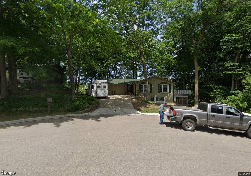
1228 Maple Ln Faribault, MN 55021
Estimated Value: $298,000 - $476,000
2
Beds
3
Baths
1,172
Sq Ft
$349/Sq Ft
Est. Value
About This Home
This home is located at 1228 Maple Ln, Faribault, MN 55021 and is currently estimated at $408,521, approximately $348 per square foot. 1228 Maple Ln is a home located in Rice County with nearby schools including Roosevelt Elementary School, Faribault Middle School, and Faribault Senior High School.
Ownership History
Date
Name
Owned For
Owner Type
Purchase Details
Closed on
Mar 16, 2022
Sold by
Crowl Earl J and Crowl Donna M
Bought by
Healy Michael R
Current Estimated Value
Home Financials for this Owner
Home Financials are based on the most recent Mortgage that was taken out on this home.
Original Mortgage
$195,000
Outstanding Balance
$182,049
Interest Rate
3.85%
Mortgage Type
New Conventional
Estimated Equity
$226,472
Create a Home Valuation Report for This Property
The Home Valuation Report is an in-depth analysis detailing your home's value as well as a comparison with similar homes in the area
Home Values in the Area
Average Home Value in this Area
Purchase History
| Date | Buyer | Sale Price | Title Company |
|---|---|---|---|
| Healy Michael R | $395,000 | North Star Title |
Source: Public Records
Mortgage History
| Date | Status | Borrower | Loan Amount |
|---|---|---|---|
| Open | Healy Michael R | $195,000 |
Source: Public Records
Tax History
| Year | Tax Paid | Tax Assessment Tax Assessment Total Assessment is a certain percentage of the fair market value that is determined by local assessors to be the total taxable value of land and additions on the property. | Land | Improvement |
|---|---|---|---|---|
| 2025 | $4,144 | $358,800 | $111,500 | $247,300 |
| 2024 | $4,144 | $338,000 | $104,600 | $233,400 |
| 2023 | $3,682 | $338,000 | $104,600 | $233,400 |
| 2022 | $3,304 | $309,700 | $99,900 | $209,800 |
| 2021 | $3,164 | $263,800 | $84,800 | $179,000 |
| 2020 | $2,974 | $252,500 | $98,900 | $153,600 |
| 2019 | $2,880 | $243,000 | $96,600 | $146,400 |
| 2018 | $2,808 | $233,300 | $96,100 | $137,200 |
| 2017 | $2,632 | $223,000 | $96,100 | $126,900 |
| 2016 | $2,594 | $204,800 | $96,100 | $108,700 |
| 2015 | $1,821 | $198,400 | $96,100 | $102,300 |
| 2014 | -- | $195,400 | $96,100 | $99,300 |
Source: Public Records
Map
Nearby Homes
- 905 Orchard Heights Ct
- 1107 Shumway Ct
- 2009 Goldenray Dr
- 2110 Goldenray Dr
- 2038 Legacy Dr
- 2140 Violet Ln
- 1195 Ivy Way
- 1322 1st Ave NE
- 210 6th Ave NE
- 210 5th Ave NE
- 14xx Division St E
- 15 14th St NE
- 227 3rd Ave NE
- 1102 1st Ave NW
- 1105 2nd St SE
- 710 1st Ave NW
- 1022 3rd Ave NW
- 501 Seabury Ln
- 416 8th St NW
- 15 1st St SE
Your Personal Tour Guide
Ask me questions while you tour the home.