Estimated Value: $115,061 - $136,000
3
Beds
2
Baths
980
Sq Ft
$128/Sq Ft
Est. Value
About This Home
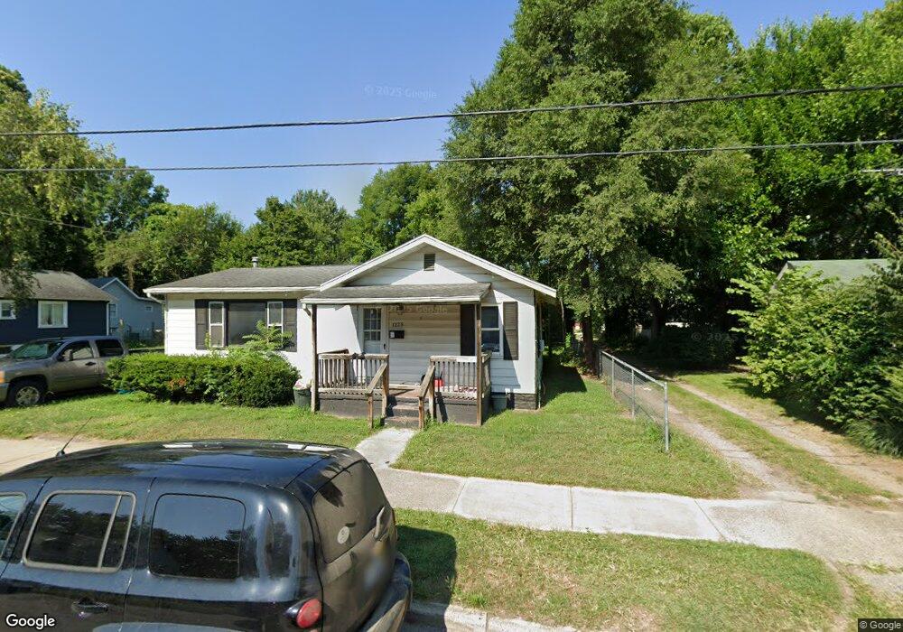
This home is located at 1228 N 10th St, Niles, MI 49120 and is currently estimated at $125,515, approximately $128 per square foot. 1228 N 10th St is a home located in Berrien County with nearby schools including James Ellis School, Howard-Ellis Elementary School, and Ring Lardner Middle School.
Ownership History
Date
Name
Owned For
Owner Type
Purchase Details
Closed on
Sep 8, 2011
Sold by
Jackson Jimmie M and Jackson James
Bought by
Robison William R and Robison Carol S
Current Estimated Value
Purchase Details
Closed on
Nov 15, 2008
Sold by
Robison William R and Robison Carol S
Bought by
Jackson Jimmie M
Purchase Details
Closed on
Mar 15, 2007
Sold by
Maccani Brett J
Bought by
Deutsche Bank National Trust Co and New Century Home Equity Loan Trust
Purchase Details
Closed on
Mar 22, 2002
Create a Home Valuation Report for This Property
The Home Valuation Report is an in-depth analysis detailing your home's value as well as a comparison with similar homes in the area
Home Values in the Area
Average Home Value in this Area
Purchase History
| Date | Buyer | Sale Price | Title Company |
|---|---|---|---|
| Robison William R | -- | None Available | |
| Jackson Jimmie M | -- | None Available | |
| Deutsche Bank National Trust Co | $46,392 | None Available | |
| -- | $27,000 | -- |
Source: Public Records
Tax History Compared to Growth
Tax History
| Year | Tax Paid | Tax Assessment Tax Assessment Total Assessment is a certain percentage of the fair market value that is determined by local assessors to be the total taxable value of land and additions on the property. | Land | Improvement |
|---|---|---|---|---|
| 2025 | $1,024 | $50,500 | $0 | $0 |
| 2024 | $532 | $49,100 | $0 | $0 |
| 2023 | $510 | $33,600 | $0 | $0 |
| 2022 | $486 | $21,400 | $0 | $0 |
| 2021 | $892 | $19,400 | $3,000 | $16,400 |
| 2020 | $882 | $18,000 | $0 | $0 |
| 2019 | $869 | $16,400 | $2,000 | $14,400 |
| 2018 | $838 | $16,400 | $0 | $0 |
| 2017 | $829 | $18,800 | $0 | $0 |
| 2016 | $815 | $14,400 | $0 | $0 |
| 2015 | $928 | $18,700 | $0 | $0 |
| 2014 | $484 | $16,200 | $0 | $0 |
Source: Public Records
Map
Nearby Homes
- 1603 N 5th St
- 1201 N 6th St
- 1610 N 5th St
- 2802 Primrose Ct
- 1630 Forest Trail
- 501 & 505 N Twelfth St
- 712 Wayne St
- 1405 Sheffield Ave
- 645 N 11th St
- 622 N 13th St
- 232 Pokagon St
- 1123 N 9th St
- 31829 Heritage Place
- 534 James St
- 1314 Ferry St
- 810 Ferry St
- 98 River St
- 211 N 8th St
- 709 Regent St
- 921 Cedar St