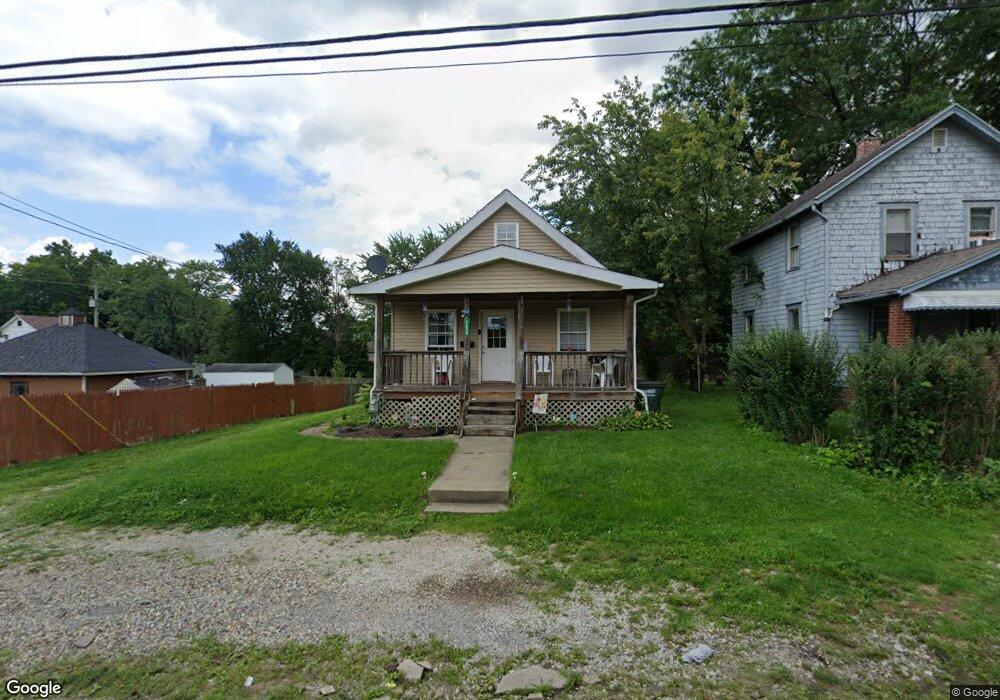
1228 S Morgan Ave Alliance, OH 44601
Estimated Value: $79,000 - $103,000
2
Beds
1
Bath
704
Sq Ft
$122/Sq Ft
Est. Value
About This Home
This home is located at 1228 S Morgan Ave, Alliance, OH 44601 and is currently estimated at $85,843, approximately $121 per square foot. 1228 S Morgan Ave is a home located in Stark County with nearby schools including Alliance Elementary School at Rockhill, Alliance Intermediate School at Northside, and Alliance Middle School.
Ownership History
Date
Name
Owned For
Owner Type
Purchase Details
Closed on
Jul 29, 2020
Sold by
Delp Jennifer and Delp Jeff
Bought by
T & L Casas Llc
Current Estimated Value
Purchase Details
Closed on
Feb 13, 2008
Sold by
Wells Fargo Bank Na
Bought by
Fdt Properties Llc
Purchase Details
Closed on
Jan 23, 2007
Sold by
Lancaster Eric S
Bought by
Wells Fargo Bank Na and Asset Backed Pass Through Certificates S
Purchase Details
Closed on
Jul 14, 2004
Sold by
Steed Roger H and Steed Elizabeth
Bought by
Lancaster Eric S
Purchase Details
Closed on
Nov 16, 2000
Sold by
Muntz Claudia Jeanne and Burns Alma M
Bought by
Lancaster Eric S and Steed Ii Roger H
Home Financials for this Owner
Home Financials are based on the most recent Mortgage that was taken out on this home.
Original Mortgage
$27,900
Interest Rate
7.87%
Mortgage Type
Purchase Money Mortgage
Create a Home Valuation Report for This Property
The Home Valuation Report is an in-depth analysis detailing your home's value as well as a comparison with similar homes in the area
Home Values in the Area
Average Home Value in this Area
Purchase History
| Date | Buyer | Sale Price | Title Company |
|---|---|---|---|
| T & L Casas Llc | $40,000 | Heritage Union Title Co Ltd | |
| Fdt Properties Llc | $13,500 | Chicago Title Insurance Co | |
| Wells Fargo Bank Na | $26,000 | None Available | |
| Lancaster Eric S | $16,000 | Colonial Title Agency | |
| Lancaster Eric S | $31,000 | -- |
Source: Public Records
Mortgage History
| Date | Status | Borrower | Loan Amount |
|---|---|---|---|
| Previous Owner | Lancaster Eric S | $27,900 |
Source: Public Records
Tax History Compared to Growth
Tax History
| Year | Tax Paid | Tax Assessment Tax Assessment Total Assessment is a certain percentage of the fair market value that is determined by local assessors to be the total taxable value of land and additions on the property. | Land | Improvement |
|---|---|---|---|---|
| 2025 | -- | $16,000 | $3,850 | $12,150 |
| 2024 | -- | $16,000 | $3,850 | $12,150 |
| 2023 | $617 | $14,990 | $3,960 | $11,030 |
| 2022 | $621 | $14,990 | $3,960 | $11,030 |
| 2021 | $623 | $14,990 | $3,960 | $11,030 |
| 2020 | $547 | $12,290 | $3,430 | $8,860 |
| 2019 | $539 | $12,290 | $3,430 | $8,860 |
| 2018 | $542 | $12,290 | $3,430 | $8,860 |
| 2017 | $484 | $10,790 | $2,910 | $7,880 |
| 2016 | $488 | $10,790 | $2,910 | $7,880 |
| 2015 | $493 | $10,790 | $2,910 | $7,880 |
| 2014 | $340 | $7,080 | $2,630 | $4,450 |
| 2013 | $169 | $7,080 | $2,630 | $4,450 |
Source: Public Records
Map
Nearby Homes
- 1233 Woodland Ave
- 1395 S Webb Ave
- 729 Waugh St
- 815 Grace St
- 1044 S Liberty Ave
- 814 Milner St
- 551 South St
- 831 Wade Ave
- 1175 S Freedom Ave
- 1005 S Freedom Ave
- 1437 S Linden Ave
- 390 E College St
- 452 E Summit St
- 1846 S Freedom Ave
- 1475 Chatauqua Ct
- 442 S Liberty Ave
- 112 E College St
- 317 E State St
- 432 S Linden Ave
- V/L S Fredeom Ave
- 1236 S Morgan Ave
- 903 South St
- 1344 S Morgan Ave
- 919 South St
- 945 South St
- 1355 S Morgan Ave
- 914 South St
- 914 South St
- 928 South St
- 1003 South St
- 936 South St
- 1373 S Morgan Ave
- 1344 S Webb Ave
- 1013 South St
- 1385 S Morgan Ave
- 1352 S Webb Ave
- 1392 S Morgan Ave
- 1141 Wade Ave
- 1395 S Morgan Ave
- 936 Waugh St