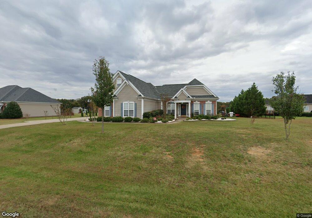
1228 Sam Cox Ln Wingate, NC 28174
Estimated Value: $337,000 - $410,000
3
Beds
3
Baths
1,753
Sq Ft
$208/Sq Ft
Est. Value
About This Home
This home is located at 1228 Sam Cox Ln, Wingate, NC 28174 and is currently estimated at $364,110, approximately $207 per square foot. 1228 Sam Cox Ln is a home located in Union County with nearby schools including Wingate Elementary School, East Union Middle School, and Forest Hills High School.
Ownership History
Date
Name
Owned For
Owner Type
Purchase Details
Closed on
Mar 17, 2005
Sold by
Vista Signature Homes Llc
Bought by
Leaks Lamont and Leaks Keisha J
Current Estimated Value
Home Financials for this Owner
Home Financials are based on the most recent Mortgage that was taken out on this home.
Original Mortgage
$152,255
Outstanding Balance
$76,985
Interest Rate
5.57%
Mortgage Type
FHA
Estimated Equity
$287,125
Purchase Details
Closed on
Mar 8, 2000
Sold by
Hough Jessie Mae C
Bought by
Infinity Land Sales Llc
Create a Home Valuation Report for This Property
The Home Valuation Report is an in-depth analysis detailing your home's value as well as a comparison with similar homes in the area
Home Values in the Area
Average Home Value in this Area
Purchase History
| Date | Buyer | Sale Price | Title Company |
|---|---|---|---|
| Leaks Lamont | $158,000 | -- | |
| Infinity Land Sales Llc | -- | -- |
Source: Public Records
Mortgage History
| Date | Status | Borrower | Loan Amount |
|---|---|---|---|
| Open | Leaks Lamont | $152,255 |
Source: Public Records
Tax History Compared to Growth
Tax History
| Year | Tax Paid | Tax Assessment Tax Assessment Total Assessment is a certain percentage of the fair market value that is determined by local assessors to be the total taxable value of land and additions on the property. | Land | Improvement |
|---|---|---|---|---|
| 2024 | $1,501 | $222,800 | $40,200 | $182,600 |
| 2023 | $1,459 | $222,800 | $40,200 | $182,600 |
| 2022 | $1,459 | $222,800 | $40,200 | $182,600 |
| 2021 | $1,458 | $222,800 | $40,200 | $182,600 |
| 2020 | $1,229 | $151,200 | $23,500 | $127,700 |
| 2019 | $1,205 | $151,200 | $23,500 | $127,700 |
| 2018 | $1,205 | $151,200 | $23,500 | $127,700 |
| 2017 | $1,281 | $151,200 | $23,500 | $127,700 |
| 2016 | $1,259 | $151,200 | $23,500 | $127,700 |
| 2015 | $1,274 | $151,200 | $23,500 | $127,700 |
| 2014 | $1,198 | $165,120 | $24,000 | $141,120 |
Source: Public Records
Map
Nearby Homes
- 5112 Monroe Ansonville Rd
- 1115 Deseo Dr Unit 2p
- 00 Mills Harris Rd
- 1509 Maurice Trull Rd
- 6014 Barbara Jean Ln
- 1216 Mills Harris Rd Unit 4
- 112 Aspire Cir
- TA3000 Plan at The Glenns - II
- Lenox Plan at The Glenns - II
- Montcrest Plan at The Glenns - II
- Wagner Plan at The Glenns - II
- TA4000 Plan at The Glenns - II
- TA2300 Plan at The Glenns - II
- Wakefield Plan at The Glenns - II
- Inverness Plan at The Glenns - II
- Aria Plan at The Glenns - II
- Shaw Plan at The Glenns - II
- Kipling Plan at The Glenns - II
- Declan Plan at The Glenns - II
- Eden Plan at The Glenns - II
- 1300 Sam Cox Ln
- 1229 Sam Cox Ln
- 1218 Sam Cox Ln
- 1301 Sam Cox Ln
- 1304 Sam Cox Ln
- 1225 Sam Cox Ln
- 5317 Monroe-Ansonville Rd
- 1305 Sam Cox Ln
- 1200 Sam Cox Ln
- 1205 Sam Cox Ln
- 1308 Sam Cox Ln
- 1221 Sam Cox Ln
- 1217 Sam Cox Ln
- 1213 Sam Cox Ln
- 1209 Sam Cox Ln
- 1309 Sam Cox Ln
- 1312 Sam Cox Ln
- 1201 Sam Cox Ln
- 1114 Eastwood Dr
- 1115 Eastwood Dr