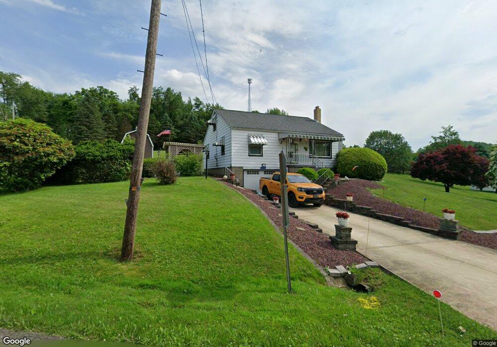
1228 Slate Point Rd Vandergrift, PA 15690
Parks Township NeighborhoodEstimated Value: $227,000 - $270,000
4
Beds
2
Baths
1,587
Sq Ft
$154/Sq Ft
Est. Value
About This Home
This home is located at 1228 Slate Point Rd, Vandergrift, PA 15690 and is currently estimated at $244,970, approximately $154 per square foot. 1228 Slate Point Rd is a home with nearby schools including Kiski Area High School.
Ownership History
Date
Name
Owned For
Owner Type
Purchase Details
Closed on
Dec 18, 2017
Sold by
Hasbargen Barbara J and Burkett Linda S
Bought by
Sforza Emilio V and Sforza Karen L
Current Estimated Value
Home Financials for this Owner
Home Financials are based on the most recent Mortgage that was taken out on this home.
Original Mortgage
$145,000
Outstanding Balance
$121,951
Interest Rate
3.9%
Mortgage Type
VA
Estimated Equity
$123,019
Purchase Details
Closed on
Oct 24, 2002
Bought by
Hasbargen Barbara J
Create a Home Valuation Report for This Property
The Home Valuation Report is an in-depth analysis detailing your home's value as well as a comparison with similar homes in the area
Home Values in the Area
Average Home Value in this Area
Purchase History
| Date | Buyer | Sale Price | Title Company |
|---|---|---|---|
| Sforza Emilio V | $145,000 | None Available | |
| Hasbargen Barbara J | -- | -- |
Source: Public Records
Mortgage History
| Date | Status | Borrower | Loan Amount |
|---|---|---|---|
| Open | Sforza Emilio V | $145,000 |
Source: Public Records
Tax History Compared to Growth
Tax History
| Year | Tax Paid | Tax Assessment Tax Assessment Total Assessment is a certain percentage of the fair market value that is determined by local assessors to be the total taxable value of land and additions on the property. | Land | Improvement |
|---|---|---|---|---|
| 2025 | $2,833 | $38,050 | $23,160 | $14,890 |
| 2024 | $2,617 | $38,050 | $23,160 | $14,890 |
| 2023 | $2,362 | $38,050 | $23,160 | $14,890 |
| 2022 | $2,362 | $38,050 | $23,160 | $14,890 |
| 2021 | $2,359 | $38,050 | $23,160 | $14,890 |
| 2020 | $2,389 | $38,050 | $23,160 | $14,890 |
| 2019 | $2,388 | $38,050 | $23,160 | $14,890 |
| 2018 | $2,341 | $0 | $0 | $0 |
| 2017 | $2,287 | $38,050 | $23,160 | $14,890 |
| 2016 | $2,221 | $38,050 | $23,160 | $14,890 |
| 2015 | $2,134 | $38,050 | $23,160 | $14,890 |
| 2014 | $2,134 | $38,050 | $23,160 | $14,890 |
Source: Public Records
Map
Nearby Homes
- 1149 Rosella Dr
- 214 and 214 1/2 Whittier St
- 2280 Garretts Run Rd
- 0 Lutheran Church Rd
- 1212 Gravel Bar Rd
- 139 Maple Dr
- 0000 Sr-2060
- 171 Hillview Manor Rd
- 0 Jack Rd
- 28 Clark Ave
- 1116 Grant St
- 369 Chestnut St
- 411 Center St
- 365 Chestnut St
- 405 5th Ave
- 1252 Jefferson St
- 137 Sherman Ave
- 133 Sherman Ave
- 247 Sherman Ave
- 153 Shuster Hollow Rd
- 1214 Slate Point Rd
- 1492 Ridge Rd
- 1515 Ridge Rd
- 1528 Ridge Rd
- 1170 Couslin Ln
- 1536 Ridge Rd
- 1170 Slate Point Rd
- 1140 Slate Point Rd
- 1122 Slate Point Rd
- 1328 Rearick Rd
- 1379 Ash Rd
- 1140 Eagles Nest Cir
- 1139 Eagles Nest Rd
- 1134 Eagles Nest Rd
- 1144 Birch Rd
- 1580 Weigand Rd
- 1122 Birch Rd
- 1131 Eagles Nest Rd
- Lot Eagles Nest
- 1128 Eagles Nest Cir