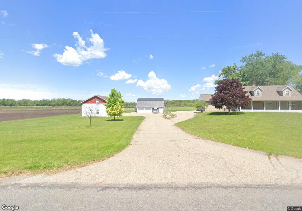
1229 92nd St SW Byron Center, MI 49315
Estimated Value: $569,000 - $941,000
--
Bed
--
Bath
3,427
Sq Ft
$219/Sq Ft
Est. Value
About This Home
This home is located at 1229 92nd St SW, Byron Center, MI 49315 and is currently estimated at $749,887, approximately $218 per square foot. 1229 92nd St SW is a home located in Kent County with nearby schools including Robert L. Nickels Intermediate School, Countryside Elementary School, and Byron Center West Middle School.
Ownership History
Date
Name
Owned For
Owner Type
Purchase Details
Closed on
Jun 21, 2006
Sold by
Vanderploeg Mark and Vanderploeg Cami
Bought by
Vanderploeg Mark and Vanderploeg Cami
Current Estimated Value
Home Financials for this Owner
Home Financials are based on the most recent Mortgage that was taken out on this home.
Original Mortgage
$80,000
Outstanding Balance
$47,453
Interest Rate
6.73%
Mortgage Type
Credit Line Revolving
Estimated Equity
$702,434
Purchase Details
Closed on
Jun 15, 2006
Sold by
Kash John and Kash Rachel
Bought by
Bb Partners Llc
Home Financials for this Owner
Home Financials are based on the most recent Mortgage that was taken out on this home.
Original Mortgage
$80,000
Outstanding Balance
$47,453
Interest Rate
6.73%
Mortgage Type
Credit Line Revolving
Estimated Equity
$702,434
Create a Home Valuation Report for This Property
The Home Valuation Report is an in-depth analysis detailing your home's value as well as a comparison with similar homes in the area
Home Values in the Area
Average Home Value in this Area
Purchase History
| Date | Buyer | Sale Price | Title Company |
|---|---|---|---|
| Vanderploeg Mark | -- | None Available | |
| Bb Partners Llc | -- | None Available |
Source: Public Records
Mortgage History
| Date | Status | Borrower | Loan Amount |
|---|---|---|---|
| Open | Vanderploeg Mark | $80,000 |
Source: Public Records
Tax History Compared to Growth
Tax History
| Year | Tax Paid | Tax Assessment Tax Assessment Total Assessment is a certain percentage of the fair market value that is determined by local assessors to be the total taxable value of land and additions on the property. | Land | Improvement |
|---|---|---|---|---|
| 2025 | $4,345 | $368,300 | $0 | $0 |
| 2024 | $4,345 | $340,700 | $0 | $0 |
| 2023 | $4,155 | $293,900 | $0 | $0 |
| 2022 | $5,707 | $241,100 | $0 | $0 |
| 2021 | $5,717 | $237,800 | $0 | $0 |
| 2020 | $3,904 | $229,600 | $0 | $0 |
| 2019 | $5,578 | $209,600 | $0 | $0 |
| 2018 | $5,458 | $202,300 | $51,500 | $150,800 |
| 2017 | $5,313 | $187,500 | $0 | $0 |
| 2016 | $5,127 | $180,400 | $0 | $0 |
| 2015 | $5,044 | $180,400 | $0 | $0 |
| 2013 | -- | $159,600 | $0 | $0 |
Source: Public Records
Map
Nearby Homes
- 784 Petoskey Stone Dr
- 8920 Pictured Rock Dr
- 8877 Pictured Rock Dr
- 760 Petoskey Stone SW
- 760 Petoskey Stone Dr
- 8733 Cobble Dr
- 769 Sun Stone Dr SW
- 1768 Hightree Dr SW
- 1941 Conifer Ridge Dr SW
- 903 S Center Park Dr SW Unit 14
- 884 S Center Park Dr SW Unit 7
- The Fitzgerald Plan at Walnut Ridge
- The Marley Plan at Walnut Ridge
- The Hearthside Plan at Walnut Ridge
- The Balsam Plan at Walnut Ridge
- The Rutherford Plan at Walnut Ridge
- The Stockton Plan at Walnut Ridge
- The Georgetown Plan at Walnut Ridge
- The Mayfair Plan at Walnut Ridge
- The Birkshire II Plan at Walnut Ridge
- 1216 92nd St SW
- 1130 92nd St SW
- 1065 92nd St SW
- 1120 92nd St SW
- 1250 92nd St SW
- 1020 92nd St SW
- 1417 92nd St SW
- 1416 92nd St SW
- 1001 92nd St SW
- 1420 92nd St SW
- 1165 92nd St SW
- 945 92nd St SW
- 1000 92nd St SW
- 925 92nd St SW
- 920 92nd St SW
- 870 92nd St SW
- 851 92nd St SW
- 885 92nd St SW
- 1555 92nd St SW
- 9001 Clyde Park Ave SW