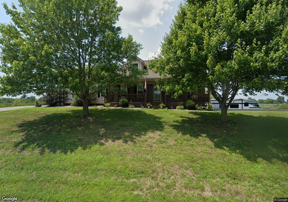
1229 Central Pike Harrodsburg, KY 40330
Estimated Value: $435,000 - $553,000
5
Beds
3
Baths
2,960
Sq Ft
$164/Sq Ft
Est. Value
About This Home
This home is located at 1229 Central Pike, Harrodsburg, KY 40330 and is currently estimated at $486,301, approximately $164 per square foot. 1229 Central Pike is a home located in Mercer County with nearby schools including Mercer County Elementary School, Mercer County Intermediate School, and King Middle School.
Ownership History
Date
Name
Owned For
Owner Type
Purchase Details
Closed on
Jul 16, 2020
Sold by
Dean Dallas Keith and Dean Shannon G
Bought by
Knisley Mark F and Knisley Chevelle L
Current Estimated Value
Home Financials for this Owner
Home Financials are based on the most recent Mortgage that was taken out on this home.
Original Mortgage
$248,000
Outstanding Balance
$219,910
Interest Rate
3.1%
Mortgage Type
New Conventional
Estimated Equity
$266,391
Purchase Details
Closed on
Jun 12, 2020
Sold by
Tallgrass Farm Foundation Inc
Bought by
Dean Dalls Keith and Dean Shannon G
Home Financials for this Owner
Home Financials are based on the most recent Mortgage that was taken out on this home.
Original Mortgage
$248,000
Outstanding Balance
$219,910
Interest Rate
3.1%
Mortgage Type
New Conventional
Estimated Equity
$266,391
Purchase Details
Closed on
Mar 12, 2015
Sold by
Tallgrass Farm Foundation Inc
Bought by
Dean Dallas Keith and Dean Shannon
Create a Home Valuation Report for This Property
The Home Valuation Report is an in-depth analysis detailing your home's value as well as a comparison with similar homes in the area
Home Values in the Area
Average Home Value in this Area
Purchase History
| Date | Buyer | Sale Price | Title Company |
|---|---|---|---|
| Knisley Mark F | $310,000 | Bluegrass Land Title | |
| Dean Dalls Keith | -- | None Available | |
| Dean Dallas Keith | -- | None Available |
Source: Public Records
Mortgage History
| Date | Status | Borrower | Loan Amount |
|---|---|---|---|
| Open | Knisley Mark F | $248,000 |
Source: Public Records
Tax History Compared to Growth
Tax History
| Year | Tax Paid | Tax Assessment Tax Assessment Total Assessment is a certain percentage of the fair market value that is determined by local assessors to be the total taxable value of land and additions on the property. | Land | Improvement |
|---|---|---|---|---|
| 2024 | $4,326 | $362,000 | $37,000 | $325,000 |
| 2023 | $4,366 | $362,000 | $0 | $0 |
| 2022 | $4,276 | $362,000 | $0 | $0 |
| 2021 | $3,686 | $310,000 | $0 | $0 |
| 2020 | $2,717 | $229,456 | $27,000 | $202,456 |
| 2019 | $2,758 | $229,456 | $27,000 | $202,456 |
| 2018 | $2,696 | $229,456 | $0 | $0 |
| 2017 | $2,604 | $229,456 | $0 | $0 |
| 2016 | $2,556 | $229,456 | $0 | $0 |
| 2015 | $2,332 | $229,456 | $27,000 | $202,456 |
| 2014 | $2,332 | $215,360 | $0 | $0 |
| 2010 | -- | $242,910 | $40,000 | $202,910 |
Source: Public Records
Map
Nearby Homes
- 161 Central Pike
- 860 Central Pike
- 346 Parsons Ln
- 306 Parsons Ln
- 651 Fairview Rd
- 380 Parsons Ln
- 651 Fairview #4 Rd
- 5980 Bohon Rd
- 935 Keenon Rd
- 420 Cole Ln
- 196 Hopewell Rd
- 1256 Jackson Pike
- 1047 Jackson Pike
- Tract 3 Cole Rd
- Tract 3a Cole Rd
- 1111 Jackson Pike
- 9999 Alford Rd
- 750 Bardstown Rd
- 155 Man-O-war Dr
- 151 Man-O-war Dr
- 1229 Central Pike
- 1190 Central Pike
- 1155 Central Pike
- 1276 Central Pike
- 1117 Central Pike
- 1015 Central Pike
- 1078 Central Pike
- 975 Central Pike
- 1301 Central Pike
- 0 Central Pike Unit TRACT 1 25008755
- 0 Central Pike
- 0 TRACT 2 Central Pike
- 800 Central Pike Unit 6
- 609 Central Pike Unit 2
- 1410 Central Pike
- 945 Central Pike
- 935 Central Pike
- 910 Central Pike
- 1054 Central Pike
- 938 Central Pike