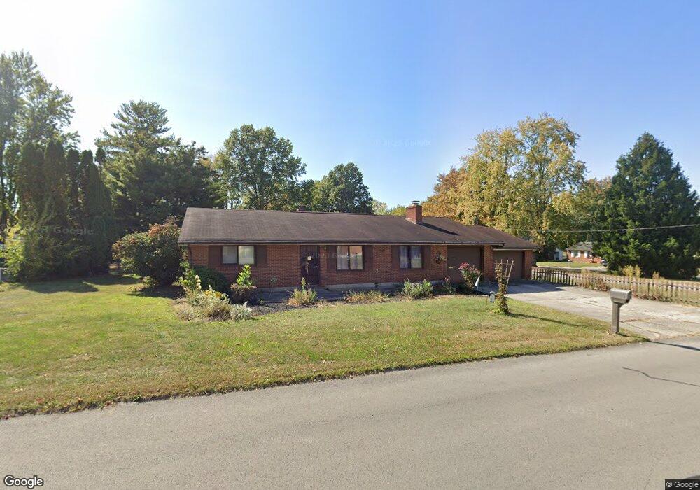
1229 Colonial Ave Marion, OH 43302
Estimated Value: $173,282 - $226,000
3
Beds
2
Baths
1,440
Sq Ft
$139/Sq Ft
Est. Value
About This Home
This home is located at 1229 Colonial Ave, Marion, OH 43302 and is currently estimated at $200,321, approximately $139 per square foot. 1229 Colonial Ave is a home located in Marion County with nearby schools including William McKinley Elementary School, Ulysses S. Grant Middle School, and Harding High School.
Ownership History
Date
Name
Owned For
Owner Type
Purchase Details
Closed on
Jun 25, 2024
Sold by
Howard Russell S and Howard Diane K
Bought by
Homeward Bound Homes Llc
Current Estimated Value
Purchase Details
Closed on
Sep 7, 2018
Sold by
Willis Evelyn L
Bought by
Howard Diane K and Howard Russell S
Home Financials for this Owner
Home Financials are based on the most recent Mortgage that was taken out on this home.
Original Mortgage
$54,400
Interest Rate
4.5%
Mortgage Type
New Conventional
Purchase Details
Closed on
Mar 19, 1998
Bought by
Willis Evelyn L
Create a Home Valuation Report for This Property
The Home Valuation Report is an in-depth analysis detailing your home's value as well as a comparison with similar homes in the area
Home Values in the Area
Average Home Value in this Area
Purchase History
| Date | Buyer | Sale Price | Title Company |
|---|---|---|---|
| Homeward Bound Homes Llc | -- | None Listed On Document | |
| Howard Diane K | $64,000 | None Available | |
| Willis Evelyn L | -- | -- |
Source: Public Records
Mortgage History
| Date | Status | Borrower | Loan Amount |
|---|---|---|---|
| Previous Owner | Howard Diane K | $54,400 |
Source: Public Records
Tax History Compared to Growth
Tax History
| Year | Tax Paid | Tax Assessment Tax Assessment Total Assessment is a certain percentage of the fair market value that is determined by local assessors to be the total taxable value of land and additions on the property. | Land | Improvement |
|---|---|---|---|---|
| 2024 | $1,630 | $41,610 | $8,010 | $33,600 |
| 2023 | $1,630 | $41,610 | $8,010 | $33,600 |
| 2022 | $1,482 | $41,610 | $8,010 | $33,600 |
| 2021 | $1,365 | $34,510 | $6,970 | $27,540 |
| 2020 | $1,368 | $34,510 | $6,970 | $27,540 |
| 2019 | $1,331 | $34,510 | $6,970 | $27,540 |
| 2018 | $867 | $31,250 | $7,020 | $24,230 |
| 2017 | $879 | $31,250 | $7,020 | $24,230 |
| 2016 | $873 | $31,250 | $7,020 | $24,230 |
| 2015 | $862 | $30,470 | $6,690 | $23,780 |
| 2014 | $863 | $30,470 | $6,690 | $23,780 |
| 2012 | $962 | $32,790 | $8,010 | $24,780 |
Source: Public Records
Map
Nearby Homes
- 1133 Amherst Dr
- 1406 Plantation Dr
- 786 Sheridan Rd
- 927 Bellefontaine Ave
- 772 Sheridan Rd
- 0 Bellefontaine Ave
- 950 Oak Grove Ave
- 889 Oak Grove Ave
- 757 Merkle Ave
- 796 Woodrow Ave
- 989 Davids St
- 981 Davids St
- 720 Woodrow Ave
- 625 Rochelle Dr
- 1178 Cheney Ave
- 668 Uncapher Ave
- 472 Clinton St
- 645 Henry St
- 681 Davids St
- 579 Henry St
- 1497 Plantation Ct
- 1247 Colonial Ave
- 1496 Bellefontaine Ave
- 0 Plantation Ct
- 1507 Plantation Ct
- 1234 Colonial Ave
- 1471 Plantation Dr
- 1470 Bellefontaine Ave
- 1506 Bellefontaine Ave
- 1203 Colonial Ave
- 1498 Plantation Ct
- 1519 Plantation Ct
- 1470 Plantation Dr
- 1460 Bellefontaine Ave
- 1516 Bellefontaine Ave
- 1508 Plantation Ct
- 1461 Plantation Dr
- 1198 Colonial Ave
- 1189 Colonial Ave