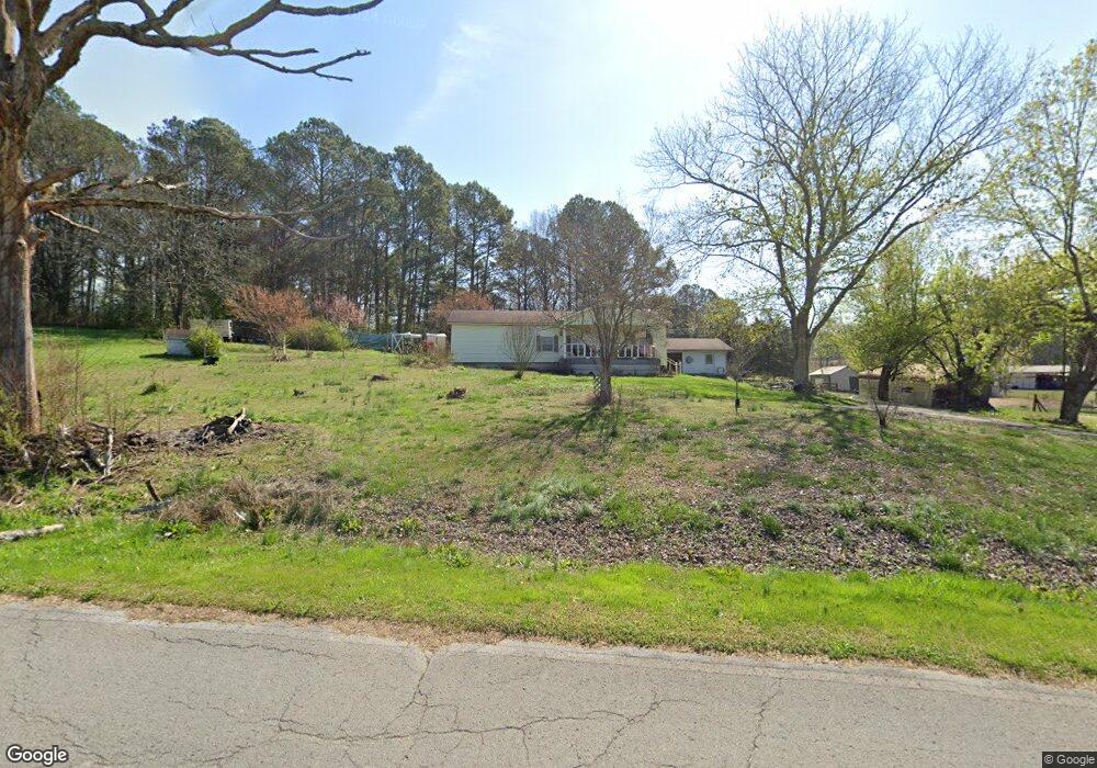
1229 Huffman Rd La Fayette, GA 30728
Estimated Value: $192,359 - $305,000
3
Beds
1
Bath
1,308
Sq Ft
$188/Sq Ft
Est. Value
About This Home
This home is located at 1229 Huffman Rd, La Fayette, GA 30728 and is currently estimated at $245,340, approximately $187 per square foot. 1229 Huffman Rd is a home located in Walker County with nearby schools including Rock Spring Elementary School, Lafayette High School, and Alice M Daley Adventist School.
Ownership History
Date
Name
Owned For
Owner Type
Purchase Details
Closed on
May 18, 2015
Sold by
Smith Roland
Bought by
Scott Patricia
Current Estimated Value
Purchase Details
Closed on
Aug 31, 2001
Sold by
Coulter Martha F and Teresa Ann
Bought by
Smith Roland
Purchase Details
Closed on
Jul 31, 2001
Sold by
Davis Clarence W and Davis Gertrude
Bought by
Coulter Martha F and Teresa Ann
Purchase Details
Closed on
Oct 6, 1978
Bought by
Davis Clarence W and Davis Gertrude
Create a Home Valuation Report for This Property
The Home Valuation Report is an in-depth analysis detailing your home's value as well as a comparison with similar homes in the area
Home Values in the Area
Average Home Value in this Area
Purchase History
| Date | Buyer | Sale Price | Title Company |
|---|---|---|---|
| Scott Patricia | -- | -- | |
| Smith Roland | $46,900 | -- | |
| Coulter Martha F | -- | -- | |
| Davis Clarence W | -- | -- |
Source: Public Records
Tax History Compared to Growth
Tax History
| Year | Tax Paid | Tax Assessment Tax Assessment Total Assessment is a certain percentage of the fair market value that is determined by local assessors to be the total taxable value of land and additions on the property. | Land | Improvement |
|---|---|---|---|---|
| 2024 | $202 | $50,920 | $7,152 | $43,768 |
| 2023 | $204 | $47,252 | $5,676 | $41,576 |
| 2022 | $156 | $38,323 | $2,317 | $36,006 |
| 2021 | $638 | $27,765 | $2,317 | $25,448 |
| 2020 | $554 | $23,765 | $2,317 | $21,448 |
| 2019 | $565 | $23,765 | $2,317 | $21,448 |
| 2018 | $629 | $23,765 | $2,317 | $21,448 |
| 2017 | $637 | $23,765 | $2,317 | $21,448 |
| 2016 | $663 | $23,765 | $2,317 | $21,448 |
| 2015 | $771 | $26,606 | $5,296 | $21,310 |
| 2014 | $686 | $26,606 | $5,296 | $21,310 |
| 2013 | -- | $26,605 | $5,296 | $21,309 |
Source: Public Records
Map
Nearby Homes
- 1052 Huffman Rd
- 7606 Highway 95
- 201 Van Dell Dr
- 533 Van Dell Dr
- 3255 Colbert Hollow Rd
- 0 Alabama Hwy Unit 1520958
- 0 Alabama Hwy Unit 21222630
- 0 Alabama Hwy Unit TRACT 3 10244950
- 134 Farm View Cir
- 0 Colbert Hollow Rd Unit 1513202
- Old Alabama Hwy Ga-151
- 200 Cattail Dr
- 176 Turkey Ridge Rd
- 72 Brutis Dr
- 0 Clyde Byrd Rd
- 0 Temperance Hall Rd Unit 10506446
- 0 Temperance Hall Rd Unit 1510568
- 450 Arnold Ln
- 1934 Round Pond Rd
- 121 Stock Dog Ln
- 40 Desda Ln
- 40 Desda Ln
- 1237 Huffman Rd
- 1239 Huffman Rd
- 94 Desda Ln
- 94 Desda Ln
- 1274 Huffman Rd
- 1160 Huffman Rd
- 122 Desda Ln
- 1327 Huffman Rd
- 1387 Huffman Rd
- 984 Huffman Rd
- 1038 Huffman Rd
- 998 Huffman Rd
- 1952 Huffman Rd
- 889 Huffman Rd
- 1242 Huffman Rd
- 791 Huffman Rd
- 791 Huffman Rd
- 1052 Huffman Rd Unit 7