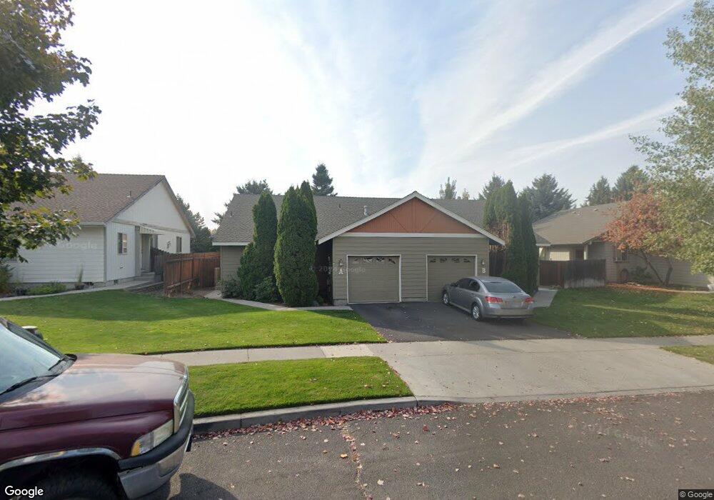
1229 NE Dawson Dr Bend, OR 97701
Mountain View NeighborhoodEstimated Value: $644,115 - $702,000
4
Beds
4
Baths
2,232
Sq Ft
$301/Sq Ft
Est. Value
About This Home
This home is located at 1229 NE Dawson Dr, Bend, OR 97701 and is currently estimated at $672,529, approximately $301 per square foot. 1229 NE Dawson Dr is a home located in Deschutes County with nearby schools including Buckingham Elementary School, Pilot Butte Middle School, and Mountain View Senior High School.
Ownership History
Date
Name
Owned For
Owner Type
Purchase Details
Closed on
Dec 13, 2021
Sold by
Sinatra Annie Chang and Sinatra Family Joint Rlt
Bought by
Sinatra Annie
Current Estimated Value
Home Financials for this Owner
Home Financials are based on the most recent Mortgage that was taken out on this home.
Original Mortgage
$189,000
Outstanding Balance
$146,888
Interest Rate
2.37%
Mortgage Type
New Conventional
Estimated Equity
$525,641
Purchase Details
Closed on
Aug 1, 2012
Sold by
Sinatra Annie
Bought by
Sinatra Annie Chang and Sinatra Family Joint Revocable Living Tr
Home Financials for this Owner
Home Financials are based on the most recent Mortgage that was taken out on this home.
Original Mortgage
$151,800
Interest Rate
3.62%
Mortgage Type
New Conventional
Create a Home Valuation Report for This Property
The Home Valuation Report is an in-depth analysis detailing your home's value as well as a comparison with similar homes in the area
Home Values in the Area
Average Home Value in this Area
Purchase History
| Date | Buyer | Sale Price | Title Company |
|---|---|---|---|
| Sinatra Annie | -- | First American Title | |
| Sinatra Annie Chang | -- | Accommodation | |
| Sinatra Annie | -- | Accommodation |
Source: Public Records
Mortgage History
| Date | Status | Borrower | Loan Amount |
|---|---|---|---|
| Open | Sinatra Annie | $189,000 | |
| Closed | Sinatra Annie | $151,800 |
Source: Public Records
Tax History Compared to Growth
Tax History
| Year | Tax Paid | Tax Assessment Tax Assessment Total Assessment is a certain percentage of the fair market value that is determined by local assessors to be the total taxable value of land and additions on the property. | Land | Improvement |
|---|---|---|---|---|
| 2025 | $4,247 | $251,370 | -- | -- |
| 2024 | $4,086 | $244,050 | -- | -- |
| 2023 | $3,788 | $236,950 | $0 | $0 |
| 2022 | $3,534 | $223,350 | $0 | $0 |
| 2021 | $3,540 | $216,850 | $0 | $0 |
| 2020 | $3,358 | $216,850 | $0 | $0 |
| 2019 | $3,265 | $210,540 | $0 | $0 |
| 2018 | $3,172 | $204,410 | $0 | $0 |
| 2017 | $3,079 | $198,460 | $0 | $0 |
| 2016 | $2,937 | $192,680 | $0 | $0 |
| 2015 | $2,855 | $187,070 | $0 | $0 |
| 2014 | $2,755 | $181,630 | $0 | $0 |
Source: Public Records
Map
Nearby Homes
- 1297 NE Dawson Dr Unit A&B
- 1188 NE 27th St Unit 71
- 1188 NE 27th St Unit 82
- 3151 NE Barrington Ct
- 2876 NE Forum Dr
- 2741 NE Laramie Way
- 3318 NE Hoona Dr
- 3325 NE Mendenhall Dr
- 3336 NE Hoona Dr
- 62453 Eagle Rd
- 3362 NE Collier Ct
- 940 NE Paula Dr Unit 21
- 1938 NE Curtis Dr
- 940 NE Purcell Blvd
- 62085 Wolcott Place
- 62466 Eagle Rd
- 21323 Oconnor Way
- 21489 Oconnor Way Unit 17
- 21493 Oconnor Way Unit 15
- 21491 Oconnor Way Unit 16
- 1225 NE Dawson Dr
- 1239 NE Dawson Dr
- 1239 NE Dawson Dr Unit A&B
- 1249 NE Dawson Dr
- 1249 NE Dawson Dr Unit A & B
- 1215 NE Dawson Dr
- 1220 NE Dawson Dr
- 1234 NE Dawson Dr
- 1244 NE Dawson Dr
- 1211 NE Dawson Dr
- 1259 NE Dawson Dr
- 1254 NE Dawson Dr
- 1207 NE Dawson Dr
- 1204 NE Dawson Dr
- 3017 NE Raleigh Ct
- 2987 NE Stanton Ave
- 1286 NE Dawson Dr
- 3014 NE Royal Ct
- 3018 NE Raleigh Ct
- 2975 NE Stanton Ave