Estimated Value: $160,000 - $175,000
3
Beds
2
Baths
1,056
Sq Ft
$159/Sq Ft
Est. Value
About This Home
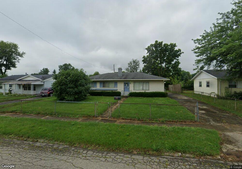
This home is located at 1229 Reid Ave, Xenia, OH 45385 and is currently estimated at $167,734, approximately $158 per square foot. 1229 Reid Ave is a home located in Greene County with nearby schools including Xenia High School, Summit Academy Community School for Alternative Learners - Xenia, and Legacy Christian Academy.
Ownership History
Date
Name
Owned For
Owner Type
Purchase Details
Closed on
Sep 2, 2003
Sold by
Baughn Donald R and Baughn Wanda L
Bought by
Baughn Donald R and Baughn Wanda L
Current Estimated Value
Purchase Details
Closed on
Sep 1, 1998
Sold by
Hud
Bought by
Baughn Donald R and Baughn Wanda L
Purchase Details
Closed on
Jun 10, 1998
Sold by
Bullen Rodney A and Doe Jane
Bought by
Hud
Purchase Details
Closed on
Mar 27, 1998
Sold by
Bullen Rodney A
Bought by
Hud
Purchase Details
Closed on
Dec 1, 1994
Sold by
Mickle Roger
Bought by
Bullen Rodney A
Home Financials for this Owner
Home Financials are based on the most recent Mortgage that was taken out on this home.
Original Mortgage
$60,787
Interest Rate
8.91%
Mortgage Type
FHA
Create a Home Valuation Report for This Property
The Home Valuation Report is an in-depth analysis detailing your home's value as well as a comparison with similar homes in the area
Home Values in the Area
Average Home Value in this Area
Purchase History
| Date | Buyer | Sale Price | Title Company |
|---|---|---|---|
| Baughn Donald R | -- | -- | |
| Baughn Donald R | -- | Lawyers Title Ins Corp | |
| Hud | $50,000 | -- | |
| Hud | $50,000 | -- | |
| Bullen Rodney A | $60,900 | -- |
Source: Public Records
Mortgage History
| Date | Status | Borrower | Loan Amount |
|---|---|---|---|
| Previous Owner | Bullen Rodney A | $60,787 |
Source: Public Records
Tax History Compared to Growth
Tax History
| Year | Tax Paid | Tax Assessment Tax Assessment Total Assessment is a certain percentage of the fair market value that is determined by local assessors to be the total taxable value of land and additions on the property. | Land | Improvement |
|---|---|---|---|---|
| 2024 | $1,775 | $41,490 | $10,050 | $31,440 |
| 2023 | $1,775 | $41,490 | $10,050 | $31,440 |
| 2022 | $1,472 | $29,340 | $7,180 | $22,160 |
| 2021 | $1,492 | $29,340 | $7,180 | $22,160 |
| 2020 | $1,429 | $29,340 | $7,180 | $22,160 |
| 2019 | $1,157 | $22,360 | $4,870 | $17,490 |
| 2018 | $1,162 | $22,360 | $4,870 | $17,490 |
| 2017 | $1,099 | $22,360 | $4,870 | $17,490 |
| 2016 | $1,099 | $20,760 | $4,870 | $15,890 |
| 2015 | $1,102 | $20,760 | $4,870 | $15,890 |
| 2014 | $1,055 | $20,760 | $4,870 | $15,890 |
Source: Public Records
Map
Nearby Homes
- 1223 June Dr
- 1233 June Dr
- 1283 June Dr
- 1391 June Dr
- 1342 Kylemore Dr
- 343 Sheelin Rd
- 1351 Omard Dr
- 883 Omard Dr
- 912 Omard Dr
- 509 Antrim Rd
- 1144 Rockwell Dr
- 121 S Progress Dr
- 305-325 Bellbrook Ave
- 1568 Cheyenne Dr
- 1208 Bellbrook Ave
- 453 Walnut St
- 1272 Bellbrook Ave
- 1618 Navajo Dr
- 613 N West St
- 0 W Church St