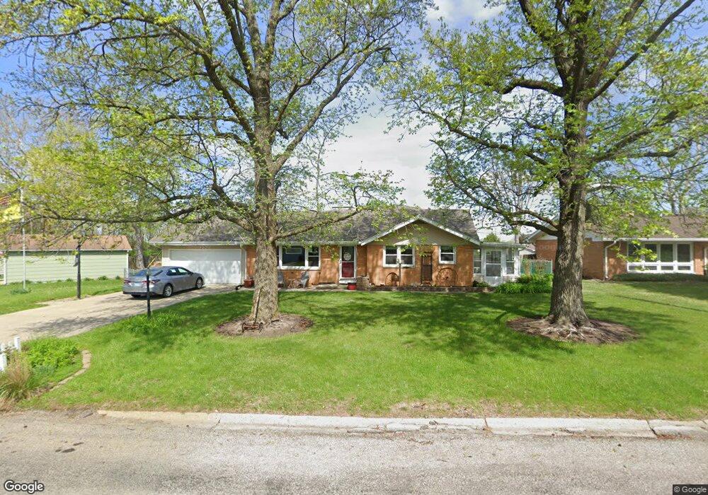
1229 Rutledge Dr Lincoln, IL 62656
Estimated Value: $198,000 - $327,000
6
Beds
--
Bath
2,094
Sq Ft
$128/Sq Ft
Est. Value
About This Home
This home is located at 1229 Rutledge Dr, Lincoln, IL 62656 and is currently estimated at $268,342, approximately $128 per square foot. 1229 Rutledge Dr is a home located in Logan County with nearby schools including Adams Elementary School, Central Elementary School, and Lincoln Junior High School.
Ownership History
Date
Name
Owned For
Owner Type
Purchase Details
Closed on
Aug 23, 2011
Sold by
Leininger Brett J
Bought by
Meador Michael C and Meador Diane
Current Estimated Value
Home Financials for this Owner
Home Financials are based on the most recent Mortgage that was taken out on this home.
Original Mortgage
$140,000
Interest Rate
4%
Mortgage Type
Future Advance Clause Open End Mortgage
Create a Home Valuation Report for This Property
The Home Valuation Report is an in-depth analysis detailing your home's value as well as a comparison with similar homes in the area
Home Values in the Area
Average Home Value in this Area
Purchase History
| Date | Buyer | Sale Price | Title Company |
|---|---|---|---|
| Meador Michael C | $175,000 | -- |
Source: Public Records
Mortgage History
| Date | Status | Borrower | Loan Amount |
|---|---|---|---|
| Closed | Meador Michael C | $140,000 |
Source: Public Records
Tax History Compared to Growth
Tax History
| Year | Tax Paid | Tax Assessment Tax Assessment Total Assessment is a certain percentage of the fair market value that is determined by local assessors to be the total taxable value of land and additions on the property. | Land | Improvement |
|---|---|---|---|---|
| 2024 | $5,883 | $70,170 | $10,390 | $59,780 |
| 2023 | $5,577 | $64,970 | $9,620 | $55,350 |
| 2022 | $5,400 | $60,720 | $8,990 | $51,730 |
| 2021 | $5,177 | $58,290 | $8,630 | $49,660 |
| 2020 | $5,102 | $57,430 | $8,500 | $48,930 |
| 2019 | $4,982 | $56,300 | $8,330 | $47,970 |
| 2018 | $4,933 | $55,200 | $8,170 | $47,030 |
| 2017 | $4,904 | $55,200 | $8,170 | $47,030 |
| 2016 | $4,776 | $55,140 | $8,160 | $46,980 |
| 2015 | $4,603 | $53,290 | $7,880 | $45,410 |
| 2014 | $4,603 | $53,290 | $7,880 | $45,410 |
| 2013 | $4,603 | $50,580 | $7,480 | $43,100 |
| 2012 | $4,603 | $51,490 | $7,610 | $43,880 |
Source: Public Records
Map
Nearby Homes
- 1204 N Ottawa St
- 1431 N Ottawa St
- 1208 N Kankakee St
- 1107 N Kankakee St
- 1503 N Kankakee St
- 6 Meadow Ln
- 311 Davenport St
- 1019 N Mclean St
- 330 Water St
- 180 Regent St
- 403 Grand Ave
- 530 Grand Ave
- 104 Tremont St
- 620 Tremont St
- 417 N Union St
- 915 Peoria St
- 515 Oglesby Ave
- 703 Grand Ave
- 306 Woodlawn Rd
- 145 Half Moon St
- 1301 Rutledge Dr
- 1206 Nicholson Rd
- 1309 Rutledge Dr
- 1216 Nicholson Rd
- 1300 Rutledge Dr
- 1230 Rutledge Dr
- 1228 Rutledge Dr
- 1226 Nicholson Rd
- 1224 Rutledge Dr
- 1236 Nicholson Rd
- 1235 Richland Ave
- 1241 Richland Ave
- 1199 N Ottawa St
- 1318 Rutledge Dr
- 1227 N Ottawa St
- 1219 N Ottawa St
- 1246 Nicholson Rd
- 1217 N Ottawa St
- 1307 N Ottawa St
- 1326 Rutledge Dr