Estimated Value: $420,000 - $505,000
4
Beds
2
Baths
2,716
Sq Ft
$171/Sq Ft
Est. Value
About This Home
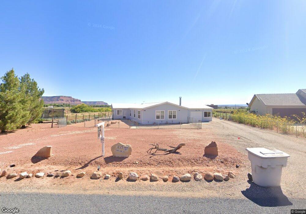
This home is located at 1229 S Kane Dr Unit 1009, Kanab, UT 84741 and is currently estimated at $465,566, approximately $171 per square foot. 1229 S Kane Dr Unit 1009 is a home located in Kane County with nearby schools including Kanab Elementary School, Kanab Middle School, and Kanab High School.
Ownership History
Date
Name
Owned For
Owner Type
Purchase Details
Closed on
Oct 21, 2024
Sold by
Dean Paul G
Bought by
Sorrels Frank and Sorrels Dawn
Current Estimated Value
Purchase Details
Closed on
Mar 14, 2011
Sold by
Dean Paul G
Bought by
Dean Paul G and Paul G Dean Revocable Trust
Purchase Details
Closed on
Jun 25, 2010
Sold by
Federal National Mortgage Association
Bought by
Dean Paul G
Purchase Details
Closed on
Apr 16, 2010
Sold by
Etitle Insurance Agency
Bought by
Federal National Mortgage Association
Purchase Details
Closed on
Nov 16, 2009
Sold by
Wells Fargo Bank Na
Bought by
Etitle Insurance Agency
Purchase Details
Closed on
Oct 10, 2007
Sold by
Gibson William
Bought by
Gibson Joan
Home Financials for this Owner
Home Financials are based on the most recent Mortgage that was taken out on this home.
Original Mortgage
$108,000
Interest Rate
6.4%
Create a Home Valuation Report for This Property
The Home Valuation Report is an in-depth analysis detailing your home's value as well as a comparison with similar homes in the area
Home Values in the Area
Average Home Value in this Area
Purchase History
| Date | Buyer | Sale Price | Title Company |
|---|---|---|---|
| Sorrels Frank | -- | -- | |
| Dean Paul G | -- | -- | |
| Dean Paul G | -- | -- | |
| Federal National Mortgage Association | -- | -- | |
| Etitle Insurance Agency | -- | -- | |
| Gibson Joan | -- | -- |
Source: Public Records
Mortgage History
| Date | Status | Borrower | Loan Amount |
|---|---|---|---|
| Previous Owner | Gibson Joan | $108,000 |
Source: Public Records
Tax History Compared to Growth
Tax History
| Year | Tax Paid | Tax Assessment Tax Assessment Total Assessment is a certain percentage of the fair market value that is determined by local assessors to be the total taxable value of land and additions on the property. | Land | Improvement |
|---|---|---|---|---|
| 2025 | $1,800 | $293,712 | $54,450 | $239,262 |
| 2024 | $1,800 | $209,189 | $55,297 | $153,892 |
| 2023 | $1,507 | $179,445 | $51,201 | $128,244 |
| 2022 | $1,287 | $151,777 | $33,033 | $118,744 |
| 2021 | $1,275 | $225,524 | $46,200 | $179,324 |
| 2020 | $1,121 | $192,495 | $53,818 | $138,677 |
| 2019 | $1,056 | $176,707 | $46,799 | $129,908 |
| 2018 | $1,018 | $168,907 | $38,999 | $129,908 |
| 2017 | $924 | $146,392 | $33,912 | $112,480 |
| 2016 | $915 | $140,740 | $28,260 | $112,480 |
| 2015 | $879 | $137,143 | $27,896 | $109,247 |
| 2014 | $879 | $134,439 | $39,852 | $94,587 |
| 2013 | -- | $73,942 | $0 | $0 |
Source: Public Records
Map
Nearby Homes
- 307 W Pipe Springs Dr
- Lot 2 Sedona Valley Rd
- 1603 S Escalante Dr
- 425 S Moki Dr Unit 117
- 425 S Moki Dr Unit I-1
- 26 E Sedona Valley Rd
- 1681 W Creekside Dr
- 0 1681 So East Creekside
- 690 W Chamberlain Dr
- 1369 S Stewart Dr W Unit 250
- 1459 S Stewart Dr
- 725 W Aspen Dr
- 422 Piute Dr
- 859 W Chamberlain Dr
- 530 W Powell Dr
- 1389 S Heaton Dr
- 1475 S Lee Dr
- 325 E Waipiti
- 400 S Moki Dr Unit H-2
- 400 S Moki Dr Unit Bldg H-2
- 1229 S Kane Dr
- 333 W Kane Dr
- 1215 S Kane Dr
- 341 W Kane Dr
- 1199 SE Kane Dr
- 332 W Johnson Dr
- 352 Kane
- 1222 SE Kane Dr
- 1206 SE Kane Dr
- 355 W Kane Dr
- 334 W Johnson Dr
- 1183 SE Kane Dr
- 1190 S Kane Dr
- 373 W Kane Dr
- 1167 SE Kane Dr
- 323 W Johnson Dr
- 380 W Kane Dr
- 1172 S Kane Dr
- 1223 S Hamblin Dr
- 338 W Johnson Dr