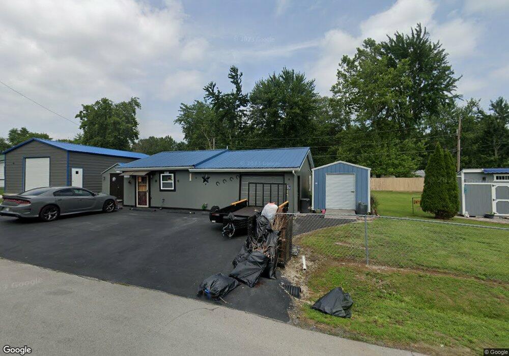
1229 W Dehart Dr Austin, IN 47102
Estimated Value: $103,000 - $131,739
2
Beds
1
Bath
908
Sq Ft
$133/Sq Ft
Est. Value
About This Home
This home is located at 1229 W Dehart Dr, Austin, IN 47102 and is currently estimated at $120,935, approximately $133 per square foot. 1229 W Dehart Dr is a home with nearby schools including Austin Elementary School, Austin Middle School, and Austin High School.
Ownership History
Date
Name
Owned For
Owner Type
Purchase Details
Closed on
Jan 17, 2018
Sold by
Gwin David D and Gwin April M
Bought by
Campbell Larry H and Spellman Reva Joyce
Current Estimated Value
Purchase Details
Closed on
Jul 9, 2010
Sold by
Rudder Kelley J
Bought by
Gwin David D and Gwin April M
Home Financials for this Owner
Home Financials are based on the most recent Mortgage that was taken out on this home.
Original Mortgage
$15,750
Interest Rate
4.74%
Mortgage Type
New Conventional
Create a Home Valuation Report for This Property
The Home Valuation Report is an in-depth analysis detailing your home's value as well as a comparison with similar homes in the area
Home Values in the Area
Average Home Value in this Area
Purchase History
| Date | Buyer | Sale Price | Title Company |
|---|---|---|---|
| Campbell Larry H | -- | None Available | |
| Gwin David D | -- | None Available |
Source: Public Records
Mortgage History
| Date | Status | Borrower | Loan Amount |
|---|---|---|---|
| Previous Owner | Gwin David D | $15,750 |
Source: Public Records
Tax History Compared to Growth
Tax History
| Year | Tax Paid | Tax Assessment Tax Assessment Total Assessment is a certain percentage of the fair market value that is determined by local assessors to be the total taxable value of land and additions on the property. | Land | Improvement |
|---|---|---|---|---|
| 2024 | $817 | $48,500 | $13,500 | $35,000 |
| 2023 | $868 | $51,500 | $13,500 | $38,000 |
| 2022 | $728 | $35,700 | $13,500 | $22,200 |
| 2021 | $642 | $33,900 | $13,500 | $20,400 |
| 2020 | $628 | $33,900 | $13,500 | $20,400 |
| 2019 | $628 | $33,900 | $13,500 | $20,400 |
| 2018 | $726 | $37,200 | $13,500 | $23,700 |
| 2017 | $726 | $37,200 | $13,500 | $23,700 |
Source: Public Records
Map
Nearby Homes
- 1237 W de Hart Dr
- 1237 Dehart Dr
- 1226 N 3rd St
- 1232 W de Hart Dr
- 1245 W de Hart Dr
- 1236 N 3rd St
- 1242 W de Hart Dr
- 1242 N 3rd St
- 1247 W de Hart Dr
- 120 Bank St
- 1248 W de Hart Dr
- 241 N de Hart Dr
- 253 Dehart Dr
- 253 S de Hart Dr
- 1235 N 3rd St
- 1221 N 3rd St
- 1239 N 3rd St
- 255 S de Hart Dr
- 1245 N 3rd St
- 244 Dehart Dr