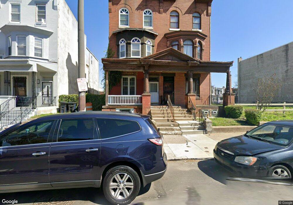
1229 W Lehigh Ave Philadelphia, PA 19133
Hartranft NeighborhoodEstimated Value: $151,000 - $167,000
--
Bed
--
Bath
2,904
Sq Ft
$55/Sq Ft
Est. Value
About This Home
This home is located at 1229 W Lehigh Ave, Philadelphia, PA 19133 and is currently estimated at $159,000, approximately $54 per square foot. 1229 W Lehigh Ave is a home located in Philadelphia County with nearby schools including Clymer Elementary School, Kipp North Philadelphia Academy, and Laboratory Charter School.
Ownership History
Date
Name
Owned For
Owner Type
Purchase Details
Closed on
Nov 2, 2016
Sold by
Johnson Orie and City Of Philadelphia
Bought by
Under Agreement Llc
Current Estimated Value
Purchase Details
Closed on
Nov 9, 2009
Sold by
Tomlin Robert and Us Bank Na
Bought by
1229 Leithgow St Llc
Purchase Details
Closed on
May 15, 1999
Sold by
Mccollum Ernestine and Will Of Harry Foy
Bought by
Johnson Orie
Purchase Details
Closed on
Oct 18, 1995
Sold by
Mccollum Ernestine and Foy Harry
Bought by
Mccollum Ernestine
Create a Home Valuation Report for This Property
The Home Valuation Report is an in-depth analysis detailing your home's value as well as a comparison with similar homes in the area
Home Values in the Area
Average Home Value in this Area
Purchase History
| Date | Buyer | Sale Price | Title Company |
|---|---|---|---|
| Under Agreement Llc | $7,000 | None Available | |
| 1229 Leithgow St Llc | $13,100 | None Available | |
| Johnson Orie | -- | -- | |
| Mccollum Ernestine | -- | -- |
Source: Public Records
Tax History Compared to Growth
Tax History
| Year | Tax Paid | Tax Assessment Tax Assessment Total Assessment is a certain percentage of the fair market value that is determined by local assessors to be the total taxable value of land and additions on the property. | Land | Improvement |
|---|---|---|---|---|
| 2026 | $455 | $52,200 | $10,440 | $41,760 |
| 2025 | $455 | $52,200 | $10,440 | $41,760 |
| 2024 | $455 | $52,200 | $10,440 | $41,760 |
| 2023 | $455 | $32,500 | $6,500 | $26,000 |
| 2022 | $235 | $32,500 | $6,500 | $26,000 |
| 2021 | $235 | $0 | $0 | $0 |
| 2020 | $235 | $0 | $0 | $0 |
| 2019 | $258 | $0 | $0 | $0 |
| 2018 | $782 | $0 | $0 | $0 |
| 2017 | $782 | $0 | $0 | $0 |
| 2016 | $363 | $0 | $0 | $0 |
| 2015 | $347 | $0 | $0 | $0 |
| 2014 | -- | $55,900 | $6,581 | $49,319 |
| 2012 | -- | $1,920 | $619 | $1,301 |
Source: Public Records
Map
Nearby Homes
- 2716 N 12th St
- 1216 W Somerset St
- 1232 W Tucker St
- 1309 W Seltzer St
- 2716 N Marvine St
- 1229 W Somerset St
- 1332 W Silver St
- 2725 N Park Ave
- 1232 W Harold St
- 2640 N Jessup St
- 2846 N 12th St
- 2740 N 12th St
- 1220 W Rush St
- 2615 N 12th St
- 2626 N Jessup St
- 1114 W Somerset St
- 2609 N 12th St
- 1346 W Seltzer St
- 1322 W Rush St
- 1305 W Rush St
- 1225 W Lehigh Ave
- 1227 W Lehigh Ave
- 1233 W Lehigh Ave
- 1223 W Lehigh Ave Unit 3
- 1223 W Lehigh Ave Unit 2
- 1223 W Lehigh Ave Unit 1
- 1223 W Lehigh Ave
- 1235 W Lehigh Ave Unit PHO011
- 1235 W Lehigh Ave
- 1221 W Lehigh Ave Unit 3
- 1221 W Lehigh Ave Unit 2
- 1221 W Lehigh Ave Unit 1
- 1221 W Lehigh Ave
- 1237 W Lehigh Ave
- 1239 W Lehigh Ave
- 1217 W Lehigh Ave
- 1224 W Silver St Unit 2
- 1224 W Silver St Unit 3
- 1224 W Silver St Unit 1
- 1222 W Silver St Unit 2