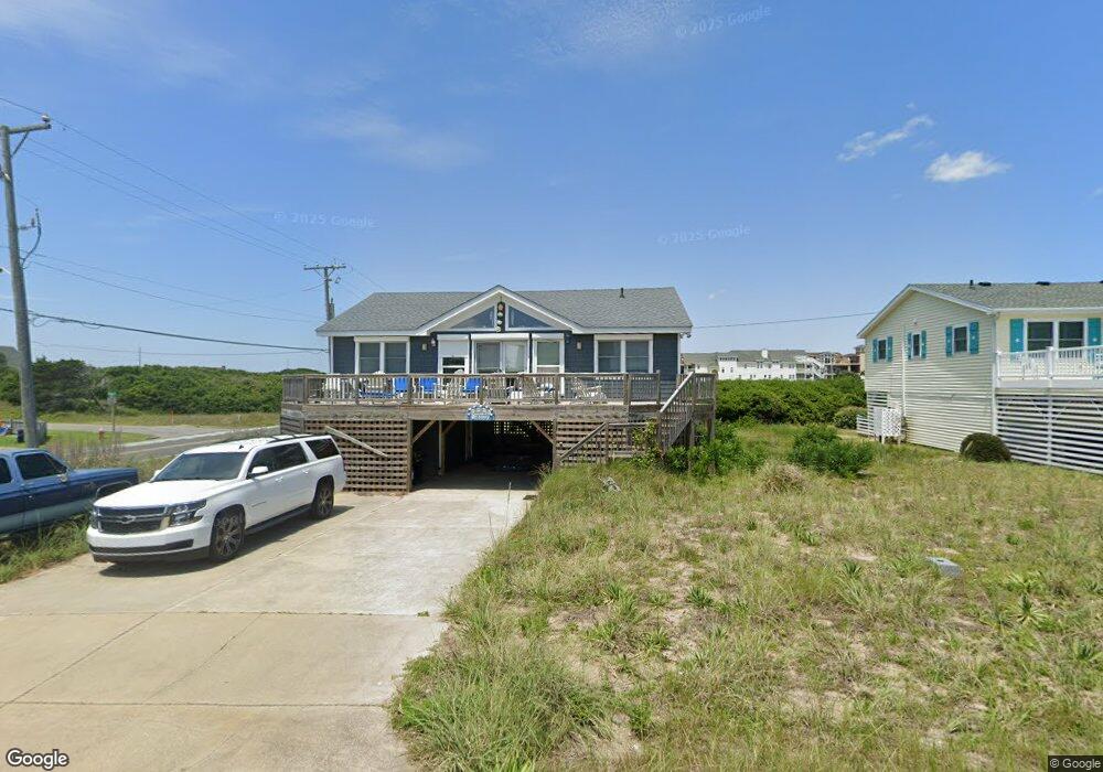
1229 Windsong Way Unit 1 Kill Devil Hills, NC 27948
Estimated Value: $827,000 - $2,601,000
4
Beds
3
Baths
1,590
Sq Ft
$815/Sq Ft
Est. Value
About This Home
This home is located at 1229 Windsong Way Unit 1, Kill Devil Hills, NC 27948 and is currently estimated at $1,295,522, approximately $814 per square foot. 1229 Windsong Way Unit 1 is a home located in Dare County with nearby schools including Nags Head Elementary School, First Flight Middle School, and First Flight High School.
Ownership History
Date
Name
Owned For
Owner Type
Purchase Details
Closed on
May 30, 2012
Sold by
King Todd White and Sanders William Charles
Bought by
King Todd White
Current Estimated Value
Purchase Details
Closed on
May 21, 2010
Sold by
Braxton Land Co Llc
Bought by
King Todd White and Sanders William Charles
Home Financials for this Owner
Home Financials are based on the most recent Mortgage that was taken out on this home.
Original Mortgage
$332,000
Outstanding Balance
$223,614
Interest Rate
5.15%
Mortgage Type
New Conventional
Estimated Equity
$1,071,908
Create a Home Valuation Report for This Property
The Home Valuation Report is an in-depth analysis detailing your home's value as well as a comparison with similar homes in the area
Home Values in the Area
Average Home Value in this Area
Purchase History
| Date | Buyer | Sale Price | Title Company |
|---|---|---|---|
| King Todd White | -- | None Available | |
| King Todd White | $415,000 | None Available |
Source: Public Records
Mortgage History
| Date | Status | Borrower | Loan Amount |
|---|---|---|---|
| Open | King Todd White | $332,000 |
Source: Public Records
Tax History
| Year | Tax Paid | Tax Assessment Tax Assessment Total Assessment is a certain percentage of the fair market value that is determined by local assessors to be the total taxable value of land and additions on the property. | Land | Improvement |
|---|---|---|---|---|
| 2025 | $4,738 | $872,200 | $569,600 | $302,600 |
| 2024 | $3,595 | $468,100 | $274,500 | $193,600 |
| 2023 | $3,595 | $475,844 | $274,500 | $201,344 |
| 2022 | $3,428 | $475,844 | $274,500 | $201,344 |
| 2021 | $3,428 | $475,844 | $274,500 | $201,344 |
| 2020 | $3,391 | $502,884 | $274,500 | $228,384 |
| 2019 | $3,391 | $383,100 | $250,500 | $132,600 |
| 2018 | $0 | $383,100 | $250,500 | $132,600 |
| 2017 | $3,316 | $383,100 | $250,500 | $132,600 |
| 2016 | $4,446 | $383,100 | $250,500 | $132,600 |
| 2014 | $3,043 | $383,100 | $250,500 | $132,600 |
Source: Public Records
Map
Nearby Homes
- 1315 N Virginia Dare Trail
- 1319 N Virginia Dare Trail Unit 4F
- 1319 N Virginia Dare Trail Unit 3S
- 1319 N Virginia Dare Trail Unit 2K
- 1319 N Virginia Dare Trail Unit 2R
- 1319 N Virginia Dare Trail Unit 3O
- 1319 N Virginia Dare Trail Unit 3Q
- 108 Lowell Ave Unit Lot 8/pt7
- 102 Cove Ct Unit 28
- 1505 N Virginia Dare Trail Unit Lot 19
- 102 E Landing Dr Unit Lot 2
- 107 Porthole Ct Unit Lot 33
- 907 N Virginia Dare Trail Unit Lot 4
- 1541 N Virginia Dare Trail Unit L-3
- 110 Baker Ave Unit Lot:7 & PT 6
- 1633 N Virginia Dare Trail Unit 3-A
- 1633 N Virginia Dare Trail Unit C2
- 1701 N Virginia Dare Trail Unit C3
- 1711 Bobby Lee Trail
- 113 E Aviation Ave
- 1227 Windsong Way
- 1225 Windsong Way
- 1205 Windsong Way Unit 13
- 1205 Windsong Way
- 1207 Windsong Way Unit 12
- 1207 Windsong Way
- 1206 N Virginia Dare Trail
- 1204 N Virginia Dare Trail
- 1209 Windsong Way
- 1300 N Virginia Dare Trail
- 1223 Windsong Way
- 1202 N Virginia Dare Trail
- 1303 N Virginia Dare Trail
- 1211 Windsong Way
- 1203 N Virginia Dare Trail
- 123 Tanya Dr
- 1219 Windsong Way
- 124 Tanya Dr Unit 2
- 124 Tanya Dr
- 1305 N Virginia Dare Trail
Your Personal Tour Guide
Ask me questions while you tour the home.