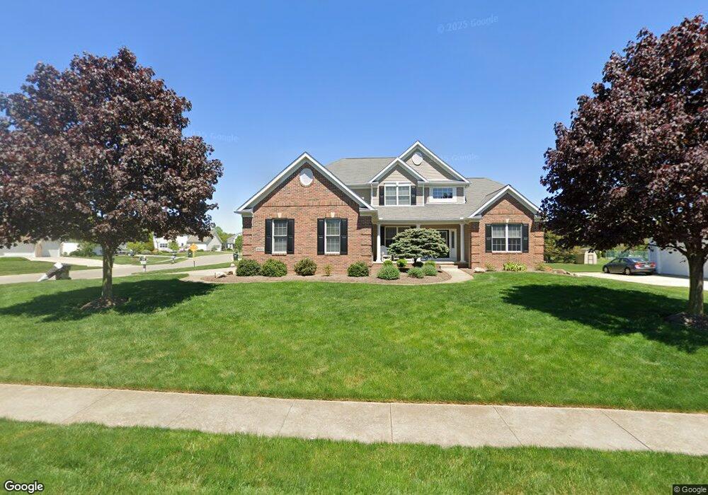
12290 Cantburg Ave NW Uniontown, OH 44685
Estimated Value: $453,211 - $523,000
4
Beds
3
Baths
2,354
Sq Ft
$208/Sq Ft
Est. Value
About This Home
This home is located at 12290 Cantburg Ave NW, Uniontown, OH 44685 and is currently estimated at $489,053, approximately $207 per square foot. 12290 Cantburg Ave NW is a home located in Stark County with nearby schools including Lake Middle/High School and Lake Center Christian School.
Ownership History
Date
Name
Owned For
Owner Type
Purchase Details
Closed on
Jan 31, 2005
Sold by
Mgk Ltd
Bought by
W S Homes Inc
Current Estimated Value
Home Financials for this Owner
Home Financials are based on the most recent Mortgage that was taken out on this home.
Original Mortgage
$3,000,000
Interest Rate
4.75%
Mortgage Type
Seller Take Back
Create a Home Valuation Report for This Property
The Home Valuation Report is an in-depth analysis detailing your home's value as well as a comparison with similar homes in the area
Home Values in the Area
Average Home Value in this Area
Purchase History
| Date | Buyer | Sale Price | Title Company |
|---|---|---|---|
| W S Homes Inc | $500,000 | -- |
Source: Public Records
Mortgage History
| Date | Status | Borrower | Loan Amount |
|---|---|---|---|
| Closed | W S Homes Inc | $3,000,000 |
Source: Public Records
Tax History Compared to Growth
Tax History
| Year | Tax Paid | Tax Assessment Tax Assessment Total Assessment is a certain percentage of the fair market value that is determined by local assessors to be the total taxable value of land and additions on the property. | Land | Improvement |
|---|---|---|---|---|
| 2025 | -- | $141,060 | $34,760 | $106,300 |
| 2024 | $3,158 | $141,060 | $34,760 | $106,300 |
| 2023 | $6,166 | $117,540 | $28,460 | $89,080 |
| 2022 | $6,036 | $117,540 | $28,460 | $89,080 |
| 2021 | $6,100 | $117,540 | $28,460 | $89,080 |
| 2020 | $5,996 | $103,220 | $24,540 | $78,680 |
| 2019 | $5,948 | $103,220 | $24,540 | $78,680 |
| 2018 | $5,954 | $103,220 | $24,540 | $78,680 |
| 2017 | $6,093 | $97,760 | $24,470 | $73,290 |
| 2016 | $6,105 | $97,760 | $24,470 | $73,290 |
| 2015 | $6,104 | $97,760 | $24,470 | $73,290 |
| 2014 | $1,043 | $82,960 | $20,760 | $62,200 |
| 2013 | $2,545 | $82,960 | $20,760 | $62,200 |
Source: Public Records
Map
Nearby Homes
- 12235 Cantburg Ave NW
- 843 Brodie Ct
- 835 Brodie Ct
- 12494 Bridgemont Ave NW
- 2693 Ledgestone Dr NW
- 2335 Ledgestone Dr NW
- 2273 Ledgestone Dr NW
- 2319 Ledgestone Dr NW
- 2255 Ledgestone Dr NW
- 2334 Ledgestone Dr NW
- 2244 Ledgestone Dr NW
- 2316 Ledgestone Dr NW
- 2490 Ledgestone Dr NW
- 2601 Lake Center St NW
- 12855 Redwood Ave NW
- 0 Pine St NW
- 3648 Mulberry St NW
- 13025 Sunset Cir NW
- 3771 Edison St NW
- 12374 Springwater Ave NW
- 2933 Carriage Stone St NW
- 12316 Cantburg Ave NW
- 2911 Carriage Stone St NW
- 2922 (S/L 74) Londonbury St NW
- 2922 Londonbury St NW
- 12316 (S/L 75) Cantburg Ave NW
- 12317 (S/L 53) Cantburg Ave NW
- 2893 Carriage Stone St NW
- 2892 Londonbury St NW
- 2906 Londonbury St NW
- 2906 Londonbury St NW
- 2892 Londonbury St NW
- 12273 Cantburg Ave NW
- 12273-(SL 51) Cantburg
- 12317 Cantburg Ave NW
- 12291 S/L 52 Cantburg Ave NW
- 2968 Londonbury St NW
- 12291 Cantburg Ave NW
- 2917 (S/L 66) Londonbury St NW
- 2863 Carriage Stone St NW