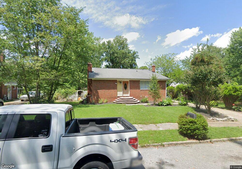
123 2nd St Annapolis, MD 21401
Estimated Value: $485,000 - $721,000
Studio
2
Baths
2,170
Sq Ft
$269/Sq Ft
Est. Value
About This Home
This home is located at 123 2nd St, Annapolis, MD 21401 and is currently estimated at $584,008, approximately $269 per square foot. 123 2nd St is a home located in Anne Arundel County with nearby schools including Rolling Knolls Elementary School, Wiley H. Bates Middle School, and Annapolis High School.
Ownership History
Date
Name
Owned For
Owner Type
Purchase Details
Closed on
Jul 21, 2023
Sold by
Cruz Saviel
Bought by
Benjamin Angelica
Current Estimated Value
Purchase Details
Closed on
Oct 3, 2001
Sold by
Taylor Richard W
Bought by
Cruz Saviel
Create a Home Valuation Report for This Property
The Home Valuation Report is an in-depth analysis detailing your home's value as well as a comparison with similar homes in the area
Home Values in the Area
Average Home Value in this Area
Purchase History
| Date | Buyer | Sale Price | Title Company |
|---|---|---|---|
| Benjamin Angelica | $338,400 | Home First Title Group | |
| Benjamin Angelica | $338,400 | Home First Title Group | |
| Cruz Saviel | $178,000 | -- |
Source: Public Records
Mortgage History
| Date | Status | Borrower | Loan Amount |
|---|---|---|---|
| Closed | Cruz Saviel | -- |
Source: Public Records
Tax History
| Year | Tax Paid | Tax Assessment Tax Assessment Total Assessment is a certain percentage of the fair market value that is determined by local assessors to be the total taxable value of land and additions on the property. | Land | Improvement |
|---|---|---|---|---|
| 2025 | $4,589 | $408,067 | -- | -- |
| 2024 | $4,589 | $373,233 | $0 | $0 |
Source: Public Records
Map
Nearby Homes
- 810 Midship Ct
- 92 Clifford Blvd
- 807 Eastern Point Rd
- 1909 Eleanor Ct
- 2510 Painter Ct
- 926 Perry Landing Ct
- 1943 Marconi Cir
- 2568 Forest Knoll
- 1907 Mackiebeth Ct
- 1955 Marconi Cir
- 1984 Marconi Cir
- 2731 Yeomans Lantern Ct
- 1010 Mastline Dr
- 516 Kansala Dr
- 905 Scupper Ct
- 930 Astern Way Unit 512
- 930 Astern Way Unit 405
- 940 Astern Way Unit 309
- 2568 Glen Cove
- 2729 Poplar Ln
- 121 2nd St
- 1802 Labrott Ln
- 105 Yellowtwig Ln
- 105 Yellow Twig Ln
- 107 Yellowtwig Ln
- 103 Yellowtwig Ln
- 1800 Labrott Ln
- 120 2nd St
- 101 Yellowtwig Ln
- 109 Yellowtwig Ln
- 118 2nd St
- 167 2nd St
- 1801 Labrott Ln
- 116 2nd St
- 1803 Labrott Ln
- 100 Yellowtwig Ln
- 102 Yellowtwig Ln
- 104 Yellowtwig Ln
- 106 Yellowtwig Ln
- 108 Yellowtwig Ln
Your Personal Tour Guide
Ask me questions while you tour the home.