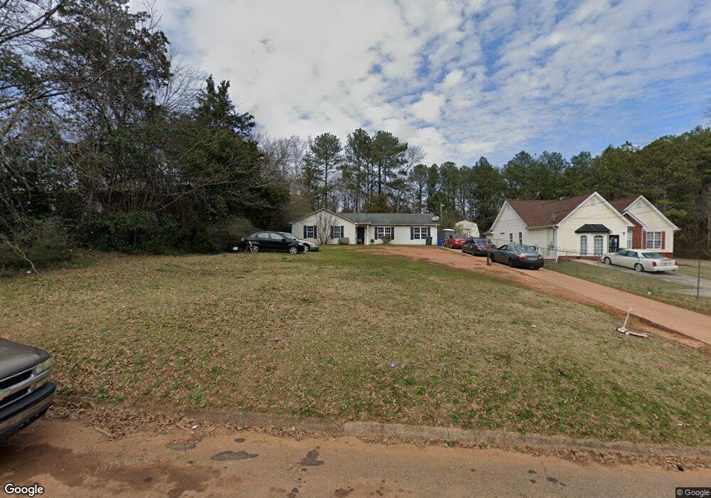
123 Armstead Cir Griffin, GA 30223
Spalding County NeighborhoodEstimated Value: $188,000 - $207,437
4
Beds
2
Baths
1,488
Sq Ft
$131/Sq Ft
Est. Value
About This Home
This home is located at 123 Armstead Cir, Griffin, GA 30223 and is currently estimated at $194,359, approximately $130 per square foot. 123 Armstead Cir is a home located in Spalding County with nearby schools including Atkinson Elementary School, Cowan Road Middle School, and Spalding High School.
Ownership History
Date
Name
Owned For
Owner Type
Purchase Details
Closed on
Mar 22, 2004
Sold by
Golden Bobby D
Bought by
Golden William D
Current Estimated Value
Home Financials for this Owner
Home Financials are based on the most recent Mortgage that was taken out on this home.
Original Mortgage
$71,200
Outstanding Balance
$33,159
Interest Rate
5.62%
Mortgage Type
New Conventional
Estimated Equity
$161,200
Purchase Details
Closed on
Jul 10, 1991
Sold by
Touchstone Emmett
Bought by
Touchstone Euvalyn F Etal
Purchase Details
Closed on
Dec 16, 1980
Sold by
Touchstone Emmett and Charlie Mcdowell
Bought by
Touchstone Emmett
Purchase Details
Closed on
Apr 28, 1978
Sold by
North Star Investment Corp
Bought by
Touchstone Emmett and Charlie Mcdowel
Purchase Details
Closed on
Jan 27, 1972
Sold by
Patton James M
Bought by
North Star Investment Corp
Purchase Details
Closed on
Feb 1, 1956
Bought by
Patton James M
Create a Home Valuation Report for This Property
The Home Valuation Report is an in-depth analysis detailing your home's value as well as a comparison with similar homes in the area
Home Values in the Area
Average Home Value in this Area
Purchase History
| Date | Buyer | Sale Price | Title Company |
|---|---|---|---|
| Golden William D | -- | -- | |
| Touchstone Euvalyn F Etal | -- | -- | |
| Touchstone Emmett | -- | -- | |
| Touchstone Emmett | $58,300 | -- | |
| North Star Investment Corp | $51,500 | -- | |
| Patton James M | -- | -- |
Source: Public Records
Mortgage History
| Date | Status | Borrower | Loan Amount |
|---|---|---|---|
| Open | Golden William D | $71,200 |
Source: Public Records
Tax History Compared to Growth
Tax History
| Year | Tax Paid | Tax Assessment Tax Assessment Total Assessment is a certain percentage of the fair market value that is determined by local assessors to be the total taxable value of land and additions on the property. | Land | Improvement |
|---|---|---|---|---|
| 2024 | $2,291 | $64,051 | $8,740 | $55,311 |
| 2023 | $2,291 | $65,308 | $8,740 | $56,568 |
| 2022 | $1,913 | $52,620 | $7,600 | $45,020 |
| 2021 | $1,656 | $45,543 | $7,600 | $37,943 |
| 2020 | $1,431 | $39,219 | $7,600 | $31,619 |
| 2019 | $1,460 | $39,219 | $7,600 | $31,619 |
| 2018 | $1,369 | $35,823 | $7,600 | $28,223 |
| 2017 | $1,332 | $35,823 | $7,600 | $28,223 |
| 2016 | $1,356 | $35,823 | $7,600 | $28,223 |
| 2015 | $1,469 | $37,704 | $7,600 | $30,104 |
| 2014 | $1,499 | $37,704 | $7,600 | $30,104 |
Source: Public Records
Map
Nearby Homes
- 1621 N Hill St
- 0 Short St Unit 10555372
- 0 Short St Unit 7572526
- 126 Callie Rd
- 1307 Wildwood Dr
- 1416 Spellman Ave
- 607 Lakewood Dr
- 1324 Spellman Ave
- 418 E Northwoods Dr
- 1406 Canterbury Rd
- 32 UNIT MUTLIPL Multiple
- 204 Derek Ct
- 1406 N 9th St
- 1315 Greenbriar Dr
- 0 Jackson Rd Unit 10545729
- 221 Bleachery St
- 204 Custer Cir
- 436 Lakeview St
- 101 Behan Place
- 125 W Lexington Ave
- 127 Armstead Cir
- 119 Armstead Cir
- 129 Armstead Cir
- 117 Armstead Cir
- 131 Armstead Cir
- 133 Armstead Cir
- 135 Armstead Cir
- 137 Armstead Cir
- 1642 N Hill St
- 117 Mcintosh Cir
- 115 Mcintosh Cir
- 113 Mcintosh Cir
- 132 Armstead Cir
- 106 Armstead Cir
- 111 Mcintosh Cir
- 209 Armstead Cir
- 109 Mcintosh Cir
- 134 Armstead Cir
- 139 Armstead Cir
- 104 Mcintosh Cir