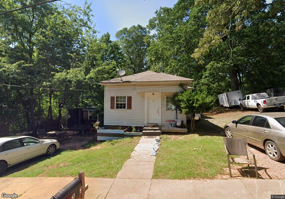
123 Avenue A Carrollton, GA 30117
Estimated Value: $116,000 - $126,655
2
Beds
1
Bath
1,010
Sq Ft
$121/Sq Ft
Est. Value
About This Home
This home is located at 123 Avenue A, Carrollton, GA 30117 and is currently estimated at $122,664, approximately $121 per square foot. 123 Avenue A is a home located in Carroll County with nearby schools including Carrollton Elementary School, Carrollton Upper Elementary School, and Carrollton Middle School.
Ownership History
Date
Name
Owned For
Owner Type
Purchase Details
Closed on
Dec 31, 2008
Sold by
Federal National Mortgage Association
Bought by
Accurate Appraisal Associates
Current Estimated Value
Purchase Details
Closed on
Jul 1, 2008
Sold by
Not Provided
Bought by
Accurate Appraisal Associates
Purchase Details
Closed on
Jun 14, 2005
Sold by
Criswell Timothy J
Bought by
Goldin Robert L
Home Financials for this Owner
Home Financials are based on the most recent Mortgage that was taken out on this home.
Original Mortgage
$59,750
Interest Rate
5.66%
Mortgage Type
New Conventional
Purchase Details
Closed on
Apr 1, 1988
Bought by
Chriswell
Create a Home Valuation Report for This Property
The Home Valuation Report is an in-depth analysis detailing your home's value as well as a comparison with similar homes in the area
Home Values in the Area
Average Home Value in this Area
Purchase History
| Date | Buyer | Sale Price | Title Company |
|---|---|---|---|
| Accurate Appraisal Associates | $21,500 | -- | |
| Accurate Appraisal Associates | $72,001 | -- | |
| Accurate Appraisal Associates | $72,001 | -- | |
| Goldin Robert L | $43,750 | -- | |
| Chriswell | -- | -- |
Source: Public Records
Mortgage History
| Date | Status | Borrower | Loan Amount |
|---|---|---|---|
| Previous Owner | Goldin Robert L | $59,750 |
Source: Public Records
Tax History Compared to Growth
Tax History
| Year | Tax Paid | Tax Assessment Tax Assessment Total Assessment is a certain percentage of the fair market value that is determined by local assessors to be the total taxable value of land and additions on the property. | Land | Improvement |
|---|---|---|---|---|
| 2025 | $711 | $26,865 | $6,641 | $20,224 |
| 2024 | $734 | $26,865 | $6,641 | $20,224 |
| 2023 | $734 | $25,067 | $6,641 | $18,426 |
| 2022 | $562 | $19,254 | $4,438 | $14,816 |
| 2021 | $471 | $16,120 | $3,288 | $12,832 |
| 2020 | $437 | $14,954 | $3,288 | $11,666 |
| 2019 | $411 | $13,944 | $3,288 | $10,656 |
| 2018 | $391 | $13,071 | $3,288 | $9,783 |
| 2017 | $393 | $13,071 | $3,288 | $9,783 |
| 2016 | $395 | $13,071 | $3,288 | $9,783 |
| 2015 | $317 | $10,262 | $3,288 | $6,975 |
| 2014 | $318 | $10,263 | $3,288 | $6,975 |
Source: Public Records
Map
Nearby Homes
- 219 Broad St
- 109 7th St
- 106 Summerfield Place Dr
- 166 Maple St
- 223 Riversong Rd Unit 55
- 223 Riversong Rd
- 109 Chalfont Cir
- 141 Bowen St
- 142 Griffin Dr
- 149 River Dr
- 149 River Dr Unit 42
- 105 Haygood Place
- 160 Watson St
- 516 Longview St
- 250 Riversong Rd
- 250 Riversong Rd Unit 55
- 223 Sunset Blvd
- 654 King St
- 109 S Park St