Estimated Value: $229,000 - $279,000
About This Home
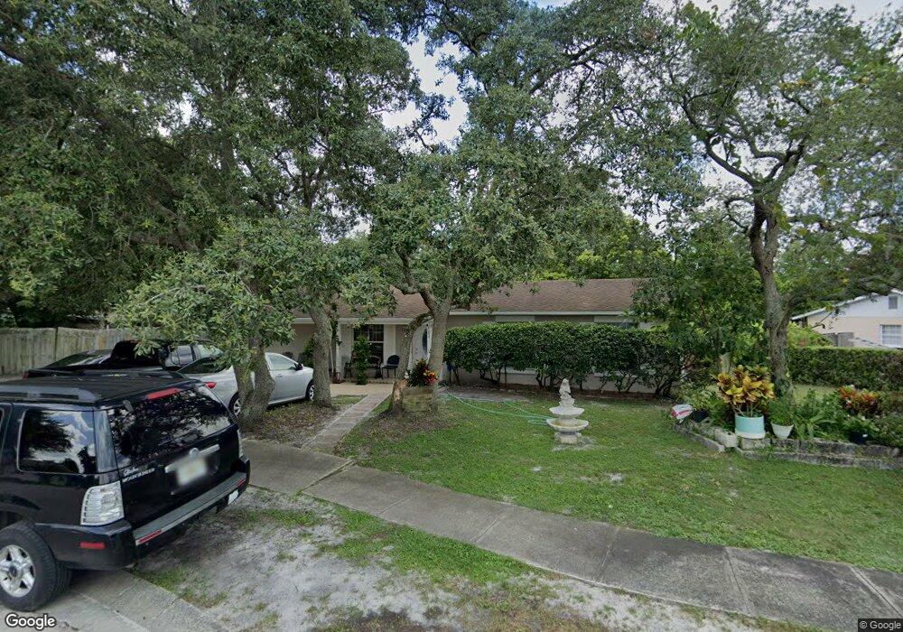
This home is located at 123 Burnt Tree Ct, Ocoee, FL 34761 and is currently estimated at $256,307, approximately $256 per square foot. 123 Burnt Tree Ct is a home located in Orange County with nearby schools including Ocoee Elementary School, Ocoee Middle School, and Ocoee High School.
Ownership History
We collect this data history from publicly available records. To have your information removed, we recommend requesting removal directly through your county’s website.
Purchase Details
Home Financials for this Owner
Home Financials are based on the most recent Mortgage that was taken out on this home.Home Values in the Area
Average Home Value in this Area
Purchase History
We collect this data history from publicly available records. To have your information removed, we recommend requesting removal directly through your county’s website.
| Date | Buyer | Sale Price | Title Company |
|---|---|---|---|
| $68,800 | -- |
Mortgage History
We collect this data history from publicly available records. To have your information removed, we recommend requesting removal directly through your county’s website.
| Date | Status | Borrower | Loan Amount |
|---|---|---|---|
| Open | $71,000 | ||
| Closed | $68,712 |
Tax History
We collect this data history from publicly available records. To have your information removed, we recommend requesting removal directly through your county’s website.
| Year | Tax Paid | Tax Assessment Tax Assessment Total Assessment is a certain percentage of the fair market value that is determined by local assessors to be the total taxable value of land and additions on the property. | Land | Improvement |
|---|---|---|---|---|
| 2025 | $1,141 | $64,449 | -- | -- |
| 2024 | $963 | $62,755 | -- | -- |
| 2023 | $963 | $59,210 | $0 | $0 |
| 2022 | $934 | $57,485 | $0 | $0 |
| 2021 | $931 | $55,811 | $0 | $0 |
| 2020 | $892 | $55,040 | $0 | $0 |
| 2019 | $927 | $53,803 | $0 | $0 |
| 2018 | $919 | $52,800 | $0 | $0 |
| 2017 | $920 | $76,340 | $18,000 | $58,340 |
| 2016 | $926 | $63,671 | $7,000 | $56,671 |
| 2015 | $936 | $62,232 | $7,000 | $55,232 |
| 2014 | $931 | $51,645 | $7,000 | $44,645 |
Map
- 28 Rewis St
- 600 Hill Ave
- 143 Laurel Ridge Ave
- 450 E Silver Star Rd
- 417 Little Spring Hill Dr
- 20 Rewis St
- 327 Little Rock Ct
- 333 Little Rock St
- 322 Little Rock Ct
- 472 Little Rock St
- 473 Wurst Rd
- 12 Lee St
- 470 Wurst Rd
- 893 Kimball Dr
- 503 Spring Creek Dr
- 1500 Adair St
- 900 Jamela Dr
- 907 Hyland Springs Dr
- 906 Sabrina Dr
- 324 Fort Collins Ct
- 126 Burnt Tree Ct
- 120 Burnt Tree Ct
- 125 Burnt Tree Ct
- 118 Burnt Tree Ct
- 164 Mobile Ln
- 160 Mobile Ln
- 158 Mobile Ln
- 1003 Caballero Ct
- 116 Burnt Tree Ct
- 121 Burnt Tree Ct
- 1005 Caballero Ct
- 150 Mobile Ln
- 439 Basking Ridge Ct
- 1001 Caballero Ct
- 148 Mobile Ln
- 165 Mobile Ln
- 163 Mobile Ln
- 161 Mobile Ln
- 157 Mobile Ln
- 114 Burnt Tree Ct
Ask me questions while you tour the home.