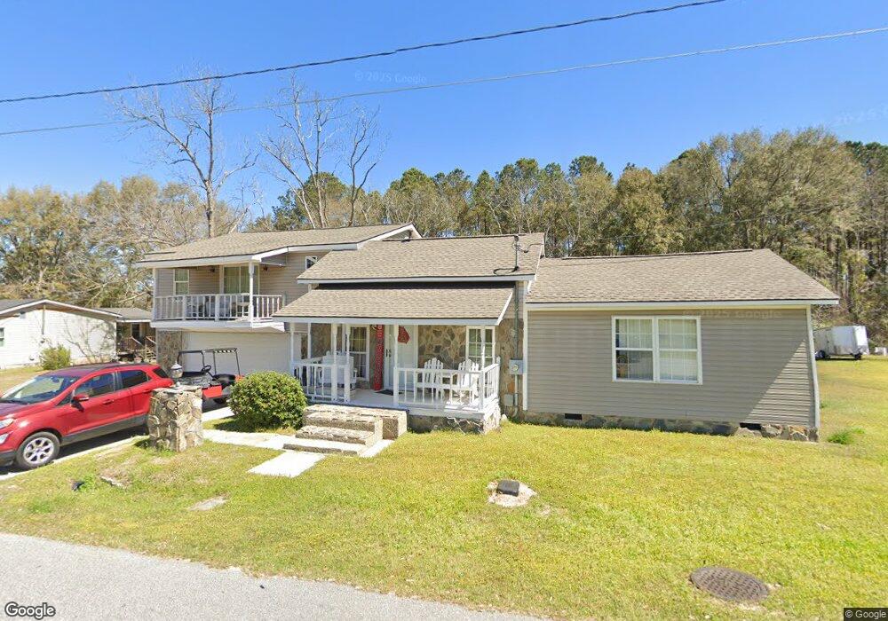
123 Davis Rd Twin City, GA 30471
Estimated Value: $170,057 - $222,000
4
Beds
2
Baths
2,740
Sq Ft
$74/Sq Ft
Est. Value
About This Home
This home is located at 123 Davis Rd, Twin City, GA 30471 and is currently estimated at $203,014, approximately $74 per square foot. 123 Davis Rd is a home located in Emanuel County with nearby schools including Twin City Elementary School.
Ownership History
Date
Name
Owned For
Owner Type
Purchase Details
Closed on
Oct 2, 2012
Sold by
Stanford Nora T
Bought by
Stanford Christopher Anthony
Current Estimated Value
Purchase Details
Closed on
Dec 16, 1991
Bought by
Sanford Nora T
Create a Home Valuation Report for This Property
The Home Valuation Report is an in-depth analysis detailing your home's value as well as a comparison with similar homes in the area
Home Values in the Area
Average Home Value in this Area
Purchase History
| Date | Buyer | Sale Price | Title Company |
|---|---|---|---|
| Stanford Christopher Anthony | $4,400 | -- | |
| Sanford Nora T | $4,400 | -- |
Source: Public Records
Tax History Compared to Growth
Tax History
| Year | Tax Paid | Tax Assessment Tax Assessment Total Assessment is a certain percentage of the fair market value that is determined by local assessors to be the total taxable value of land and additions on the property. | Land | Improvement |
|---|---|---|---|---|
| 2024 | $1,953 | $57,360 | $1,846 | $55,514 |
| 2023 | $1,462 | $54,443 | $1,846 | $52,597 |
| 2022 | $1,325 | $49,809 | $1,846 | $47,963 |
| 2021 | $1,265 | $46,650 | $1,605 | $45,045 |
| 2020 | $971 | $33,657 | $2,400 | $31,257 |
| 2019 | $965 | $33,657 | $2,400 | $31,257 |
| 2018 | $923 | $33,657 | $2,400 | $31,257 |
| 2017 | $926 | $33,657 | $2,400 | $31,257 |
| 2016 | $923 | $33,550 | $2,400 | $31,150 |
| 2015 | -- | $33,486 | $2,336 | $31,150 |
| 2014 | -- | $31,624 | $1,947 | $29,677 |
| 2013 | -- | $31,460 | $1,946 | $29,513 |
Source: Public Records
Map
Nearby Homes
- 912 5th Ave
- 317 5th Ave
- 304 5th Ave
- 211 6th Ave
- 164 5th Ave
- 1120 5th Ave
- 0 Scarboro Church Rd Unit 25066343
- 889 Ga Highway 192 N
- 501 S Old Reidsville Rd
- S S Old Reidsville Rd
- 184 Eagle Pass
- 56 Rock Creek Rd
- 3770 Hill Rd
- 0 Forest Creek Dr
- 13995 Ollifftown Rd
- 75 Scuffletown Rd
- 000 Scuffletown Rd
- LOT 5 Hendricks Rd
- 410 L B Hall Rd
- 760 Memphis Rd
- 123 Davis Rd
- 118 Davis Rd
- 135 Davis Rd
- 113 Maple St
- 137 Davis Rd
- 121 Maple St
- 316 Old Statesboro Rd
- 111 Maple St
- 203 Maple St
- 619 N Railroad Ave
- 112 Maple St
- 209 Maple St
- 402 Old Statesboro Rd
- 217 Maple St
- N N Railroad Ave
- 216 Old Statesboro Rd
- 410 Old Statesboro Rd
- 412 Old Statesboro Rd
- 111 Paradise Rd
- 723 N Railroad Ave