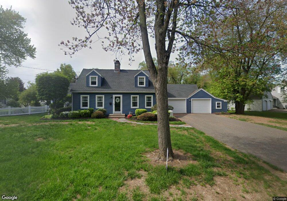
123 Falmouth Rd West Springfield, MA 01089
Estimated Value: $406,000 - $506,000
3
Beds
2
Baths
1,440
Sq Ft
$304/Sq Ft
Est. Value
About This Home
This home is located at 123 Falmouth Rd, West Springfield, MA 01089 and is currently estimated at $437,548, approximately $303 per square foot. 123 Falmouth Rd is a home located in Hampden County with nearby schools including Hampden Charter School of Science West and St Thomas The Apostle School.
Ownership History
Date
Name
Owned For
Owner Type
Purchase Details
Closed on
Apr 30, 2010
Sold by
Thornton Arthur J and Thornton Emily S
Bought by
Potorski Tracy M
Current Estimated Value
Home Financials for this Owner
Home Financials are based on the most recent Mortgage that was taken out on this home.
Original Mortgage
$248,417
Outstanding Balance
$170,130
Interest Rate
5.5%
Mortgage Type
FHA
Estimated Equity
$267,418
Purchase Details
Closed on
Mar 7, 2007
Sold by
Nestor Michael W and Nestor Paula J
Bought by
Thornton Arthur J
Home Financials for this Owner
Home Financials are based on the most recent Mortgage that was taken out on this home.
Original Mortgage
$245,160
Interest Rate
6.3%
Mortgage Type
VA
Purchase Details
Closed on
Mar 1, 1991
Sold by
Brannkarr Tage G A and Brannkarr Joyce A
Bought by
Nestor Michael W and Nestor Paula J
Home Financials for this Owner
Home Financials are based on the most recent Mortgage that was taken out on this home.
Original Mortgage
$141,700
Interest Rate
9.69%
Mortgage Type
Purchase Money Mortgage
Create a Home Valuation Report for This Property
The Home Valuation Report is an in-depth analysis detailing your home's value as well as a comparison with similar homes in the area
Home Values in the Area
Average Home Value in this Area
Purchase History
| Date | Buyer | Sale Price | Title Company |
|---|---|---|---|
| Potorski Tracy M | $253,000 | -- | |
| Thornton Arthur J | $240,000 | -- | |
| Nestor Michael W | $149,200 | -- |
Source: Public Records
Mortgage History
| Date | Status | Borrower | Loan Amount |
|---|---|---|---|
| Open | Potorski Tracy M | $248,417 | |
| Previous Owner | Thornton Arthur J | $245,160 | |
| Previous Owner | Nestor Michael W | $142,800 | |
| Previous Owner | Nestor Michael W | $137,700 | |
| Previous Owner | Nestor Michael W | $141,700 | |
| Previous Owner | Nestor Michael W | $20,000 |
Source: Public Records
Tax History Compared to Growth
Tax History
| Year | Tax Paid | Tax Assessment Tax Assessment Total Assessment is a certain percentage of the fair market value that is determined by local assessors to be the total taxable value of land and additions on the property. | Land | Improvement |
|---|---|---|---|---|
| 2025 | $5,254 | $353,300 | $131,500 | $221,800 |
| 2024 | $5,198 | $351,000 | $131,500 | $219,500 |
| 2023 | $4,942 | $318,000 | $138,200 | $179,800 |
| 2022 | $4,525 | $287,100 | $125,400 | $161,700 |
| 2021 | $4,375 | $258,900 | $117,000 | $141,900 |
| 2020 | $4,356 | $256,400 | $117,000 | $139,400 |
| 2019 | $4,349 | $256,400 | $117,000 | $139,400 |
| 2018 | $4,372 | $256,400 | $117,000 | $139,400 |
| 2017 | $4,372 | $256,400 | $117,000 | $139,400 |
| 2016 | $4,326 | $254,600 | $112,500 | $142,100 |
| 2015 | $4,244 | $249,800 | $110,300 | $139,500 |
| 2014 | $1,031 | $249,800 | $110,300 | $139,500 |
Source: Public Records
Map
Nearby Homes
- 32 Lotus Ave
- 139 Upper Beverly Hills
- 180 Wolcott Ave
- 260 Wolcott Ave
- 148 Craiwell Ave
- 514 Dewey St
- 16 North St
- 31 Stone Path Ln
- 43 Houston Rd
- 283 Forest Glen
- 258 Poplar Ave
- 65 Verdugo St
- 43 Wishing Well Way
- 142 Morton St
- 416 Hillcrest Ave
- 19 Cora St
- 42 Janet St
- 61 Clarence St
- 34 High Meadow Dr
- 74 Maple Terrace
- 141 Falmouth Rd
- 218 Ohio Ave
- 120 Falmouth Rd
- 236 Ohio Ave
- 151 Falmouth Rd
- 140 Falmouth Rd
- 202 Ohio Ave
- 244 Ohio Ave
- 163 Falmouth Rd
- 148 Falmouth Rd
- 85 Falmouth Rd
- 190 Ohio Ave
- 258 Ohio Ave
- 223 Greystone Ave
- 171 Falmouth Rd
- 235 Ohio Ave
- 217 Greystone Ave
- 231 Greystone Ave
- 197 Ohio Ave
- 168 Falmouth Rd